Development Odds Dwindling in the Atlantic
Inhospitable conditions settle in over the Atlantic for the second part of October
It’s been a week since Milton raced out to sea after devastating parts of west-central Florida and setting off a deadly outbreak of tornadoes – Florida’s biggest tornado outbreak on record.
Since Milton’s demise, we’ve seen no active tropical systems anywhere in the Atlantic, the longest stretch of inactivity in a month and before the historic run of late-season activity that included 6 named storms, of which 5 became hurricanes and 3 of those Category 3 or stronger, capped off by Category 5 Milton, the most intense hurricane in nearly two decades.
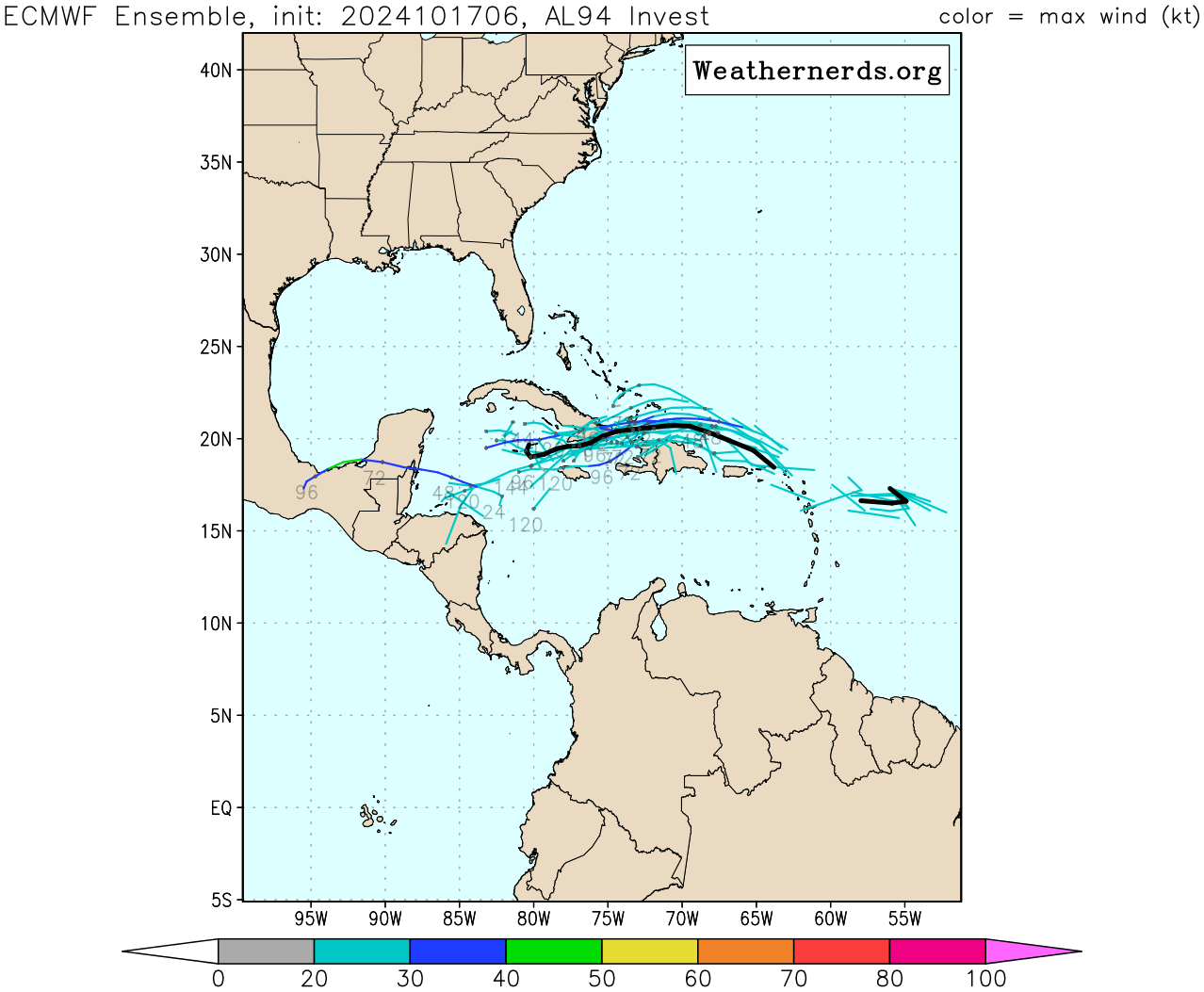
While we have two candidates that could break the streak this week in the Atlantic – including Invest 94L moving through the central Atlantic – the window for either to do so is quickly closing as development odds dwindle.
Invest 94L to move north of Puerto Rico and the U.S. Virgin Islands tomorrow
The disturbance we’ve been following this week through the central Atlantic – designated Invest 94L – continues to struggle. Dry, sinking air has plagued its organization and the lack of persistent thunderstorms is keeping its circulation broad and messy.
Models have largely backed down on development and NHC again today lowered development odds. The window for development will quickly close by late weekend as the disturbance gets shredded by a firehose of wind shear as it nears eastern Cuba.

Nevertheless, the disturbance will enhance the threat for heavy rainfall across parts of the Greater Antilles – including Puerto Rico, the U.S. Virgin Islands, Haiti, and the Dominican Republic – through the weekend.
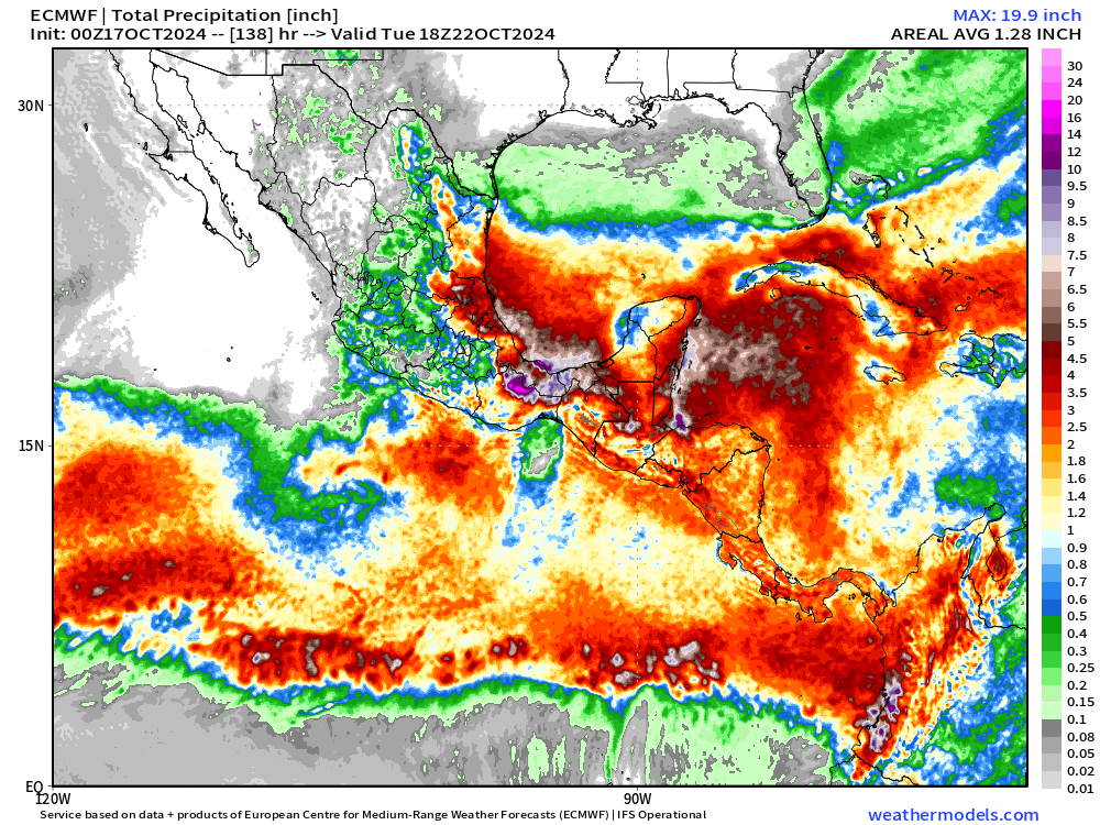
Western Caribbean disturbance moves inland this weekend
A broad area of low pressure over the western Caribbean is forecast to pivot inland across Central America on Saturday. As we’ve discussed in the newsletter this week, odds for development are low since the system is quite broad, but the upshot regardless will be heavy rainfall and the threat of widespread flooding from northern Honduras to Belize and Guatemala to parts of southern Mexico into the next week.

MJO puts the Atlantic to bed for the next week or two
As we discussed in Monday’s newsletter, the large see-saw pattern of upper-level winds that we track around the globe known as the Madden-Julian Oscillation or MJO is now in the suppressed phase over the Atlantic. The yin and yang configuration of the MJO often means a busy period – as we saw for the first few weeks of October – is quickly followed up by a quiet period which we’ve entered now.
According to our best MJO trackers (the MJO is difficult to “see” by the models so certain tracking algorithms are more useful than others), the suppressed phase should persist over the Atlantic for the next 10 days or so.

As the calendar turns from October to November, another active pulse will push into the Caribbean and Atlantic. We’re probably a little late in the game to expect much in the way of significant activity, but that should be the last hurrah for the Atlantic before the season really shuts down.
About 90% of typical hurricane season activity is complete by the end of October. Hurricane season officially runs through November 30th.


Thankful that both of those are unlikely to be a problem after all but I do feel sorry for those who are going to get dumped on with all that rain. I don't think they need anywhere near what they are likely to get..