Debby Forecast to Strike Florida's Big Bend as a Hurricane Tomorrow, Historic Flood Threat Ahead
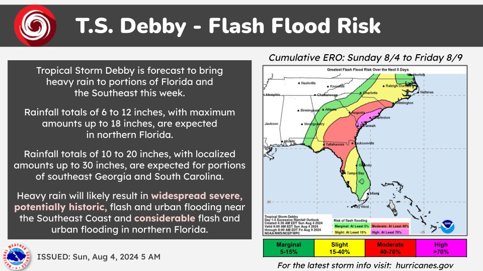
Debby to bring “widespread severe, potentially historic, flash and urban flooding” to the southeast coast this week, according to the National Weather Service
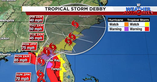
Tropical Storm Debby, which formed Saturday afternoon, continues to strengthen this morning and is expected to become a hurricane before making landfall in Florida’s Big Bend tomorrow. Conditions will quickly deteriorate today along Florida’s Gulf Coast, with up to 10 feet of storm surge flooding possible into many of the same areas affected by Hurricane Idalia last August.
Once Debby moves inland, it’s expected to slow to a crawl, which could bring “widespread severe, potentially historic, flash and urban flooding” to parts of the southeast coast, according to the National Weather Service, with up to 30 inches of rainfall forecast for parts of southeast Georgia and South Carolina through Friday.
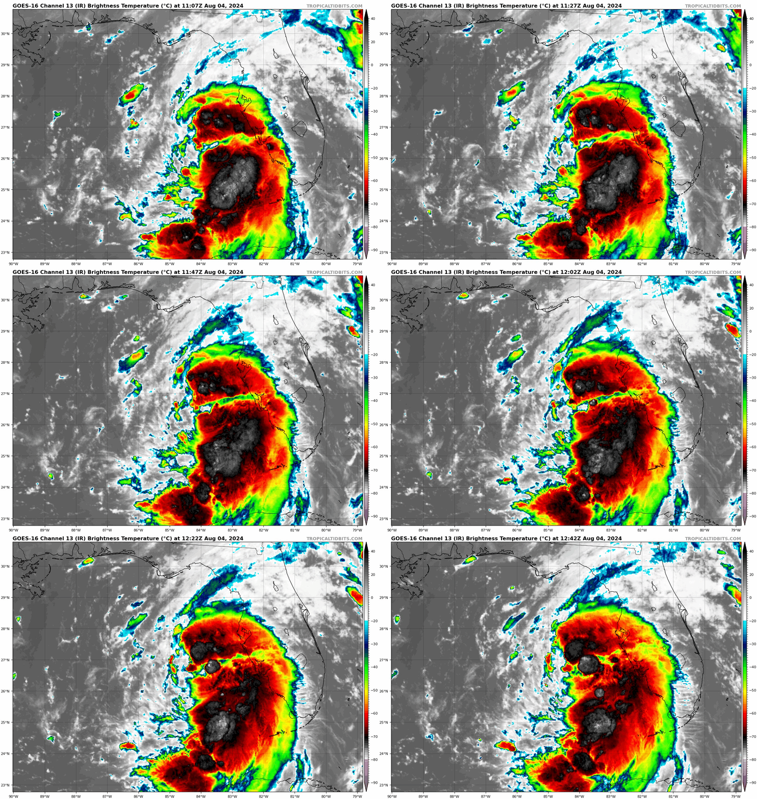
Debby right now
Although Debby continues to steadily strengthen, it’s so far been held back by light to moderate wind shear, a positive and surprising development in the face of forecasts that indicated negligible wind shear this morning. These stronger upper-level winds from the west have also slightly displaced the worst weather slightly east of the center, with bands of strong storms and gusty winds spreading northward into the Tampa Bay area Sunday morning.

That said, Debby will be over the record warm waters of the northeastern Gulf of Mexico for another 24 hours and just a small nudge in upper-levels could favor a quicker strengthening through landfall. Our intensity guidance are advertising about a 1 in 3 chance of rapid strengthening (at least a 35 mph increase in maximum winds in 24 hours) before landfall and the Hurricane Center explicitly calls rapid strengthening to a hurricane by the time Debby moves ashore between Cedar Key and Apalachicola, Florida, sometime tomorrow.
Our reliable forecast models are in very good agreement with a hurricane landfall scenario in the Big Bend or north Florida.

Another big storm surge possible less than a year after Idalia
Hurricane Hunters Sunday morning are finding Debby’s maximum winds a remarkable 90 miles northeast of its center, which makes it a very large storm. Big storms are notorious for big problems along the coast, as wide winds can sweep up a bigger storm surge. NHC is forecasting up to 10 feet of life-threatening storm surge into Florida’s Big Bend as this ring of strongest winds nears the coast late Sunday into early Monday.
For context, Hurricane Idalia – a Category 3 hurricane but much smaller storm – produced an 8-to-12 foot storm surge last August in many of the same areas targeted by Debby.
Those at the coast being asked to evacuate by local officials should do so without delay.
Historic flooding possible this week with reminders of Joaquin
The National Weather Service is forecasting extreme rainfall totals as Debby slows down this week due to collapsing steering, a worrisome scenario we detailed in newsletters last week.
For now, the highest amounts forecast this week are centered over coastal South Carolina and southeast Georgia, where widespread rainfall of 10 to 20 inches is expected, with localized amounts approaching 30 inches by week’s end.
This could rival the state rainfall record in South Carolina for not just tropical systems, but for any type of storm system.
Back in early October 2015, South Carolina was devastated by a firehose of heavy rainfall from a combination of rich tropical air ahead of Hurricane Joaquin in the open Atlantic and a wintertime coastal low near the southeast U.S. Rainfall totals reached over 25 inches during the multi-day flood, a 1-in-1,000-year flood event centered on Charleston and Columbia that caused nearly 20 deaths.
No slowdown in the Atlantic behind Debby
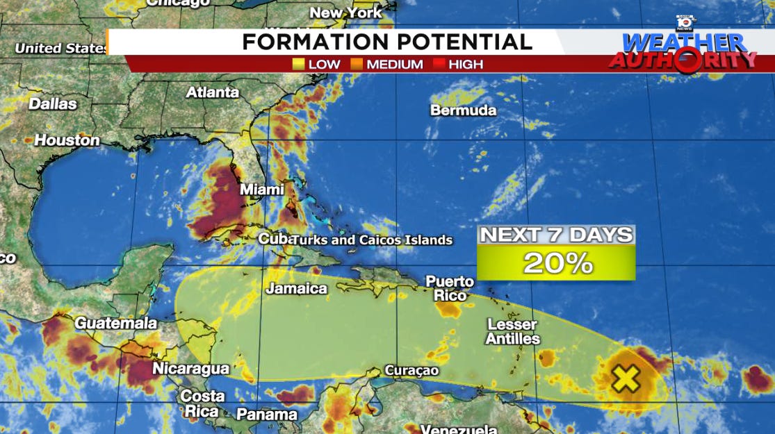
We began previewing a more active period for early August in newsletters back in middle July. We’re square in the window now and models suggest more storms brewing behind Debby.
A robust and fast-moving tropical wave from the Atlantic will move westward through the Caribbean this week and could develop as it slows down in the western Caribbean or southern Gulf by next weekend. We’ll have some time to follow this, but any development shouldn’t come until its deeper into the Caribbean later this week.


We've long judged hurricanes' potential for damage by their projected wind speeds at landfall. I think we're slowly coming to the realization that hurricanes are primarily hydrological events. Even discounting wind-driven storms surge, much of the hurricane damage is flooding. They are in essence a rotating atmospheric river. I've long thought we ought to grade atmospheric rivers by their precipitable water potential.
Is Texas being considered the most likely landfall area?