When It Comes to June Hurricanes, Two States Stand Out
Texas and Florida are the states to watch for June tropical strikes
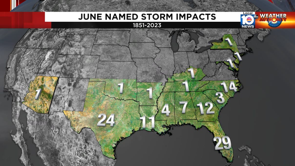
You don’t hear us talk about June hurricanes very often. And for good reason. The last hurricane to form anywhere in the Atlantic in June was back in 2012 (Hurricane Chris). That’s a long time!
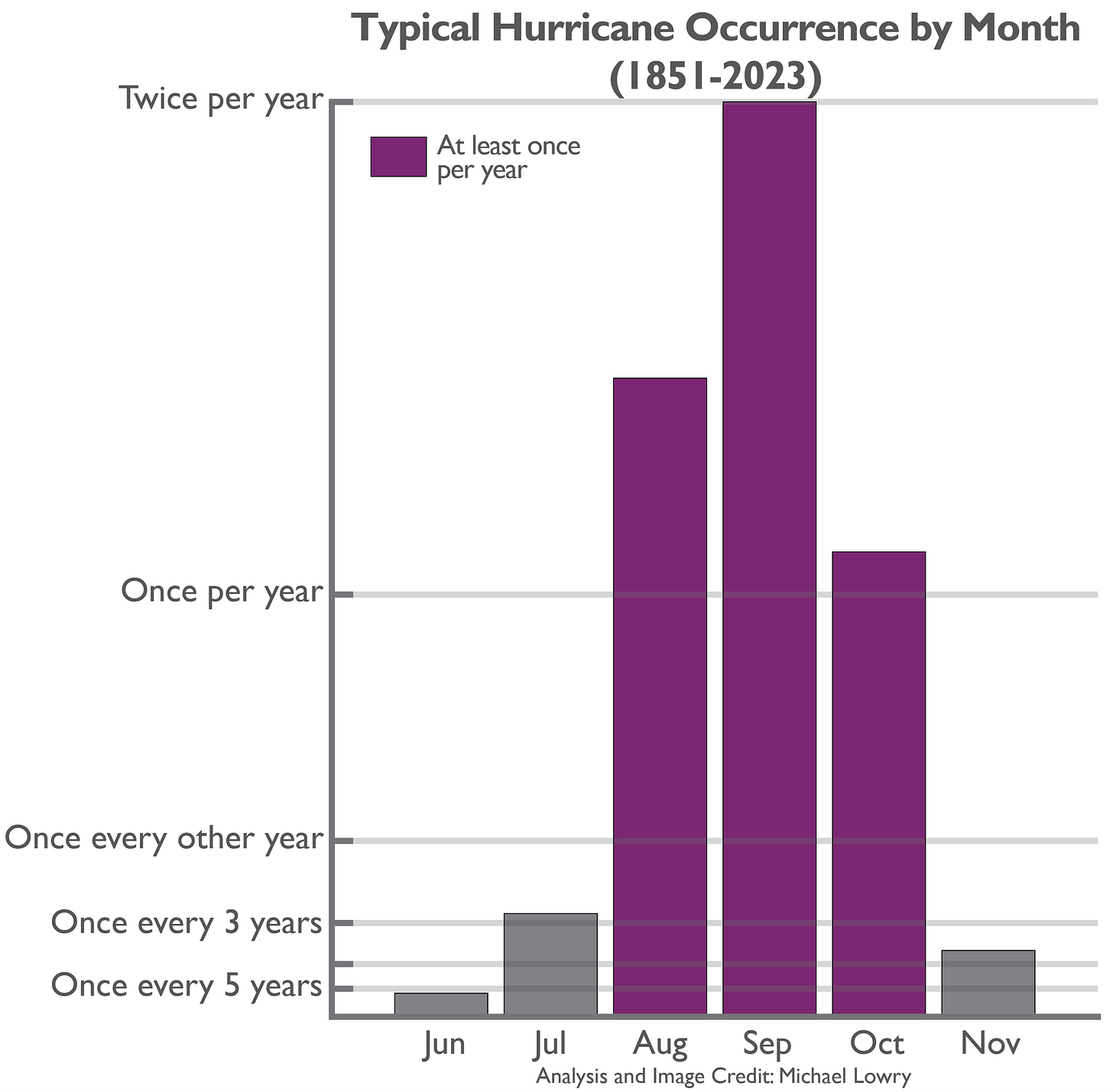
June hurricanes on average form only about once every five years. In fact, of all months of hurricane season, June historically has the lowest odds of seeing a hurricane – even lower than November.
That’s of course not to suggest we don’t (or won’t) see impactful tropical storms and even hurricanes in June. Audrey in 1957 was one of the deadliest hurricanes on record, killing over 400 people, and Hurricane Agnes just 15 years later killed some 128 people, mainly from widespread inland flooding across the mid-Atlantic. Even the names of June storms that never became hurricanes – like Tropical Storm Allison that inundated parts of Texas in June 2001 – have been retired because devastation was so widespread.
Although tropical storms and hurricanes can impact any state along the Gulf Coast or southeast U.S. in June, two states especially stand out. Texas and Florida – the bookends of the Gulf with expansive coastlines – have both recorded about twice as many named storm impacts in June as any other state in the mainland U.S.
Texas in particular is at greatest risk for early season hurricanes, besting even Florida, with nearly twice as many June hurricane impacts as the Sunshine State since records began in 1851.
As we discussed in Monday’s newsletter, 8 in 10 June tropical cyclones form in the western Caribbean or Gulf of Mexico. If you include storms that form off Florida’s east coast, that number rises to 9 in 10 June storms, so it’s no wonder Florida and Texas see the lion’s share of impacts early in the hurricane season.
Rainier days next week but tropical development not expected
In yesterday’s newsletter, we discussed the slug of saturated tropical air that will be drug out of the Caribbean and into Florida for next week. Models differ on the exact placement of the richest tropical air – with some directing the deepest moisture over South Florida and others over north Florida – but regardless rainfall chances will be on the uptick for South Florida. The National Weather Service is forecasting as much as 4 to 7 inches of widespread rainfall over South Florida through next Friday, June 14th, which would be more rainfall in a week than many areas of South Florida have received in the past three months.
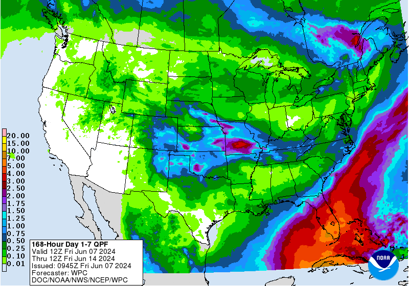
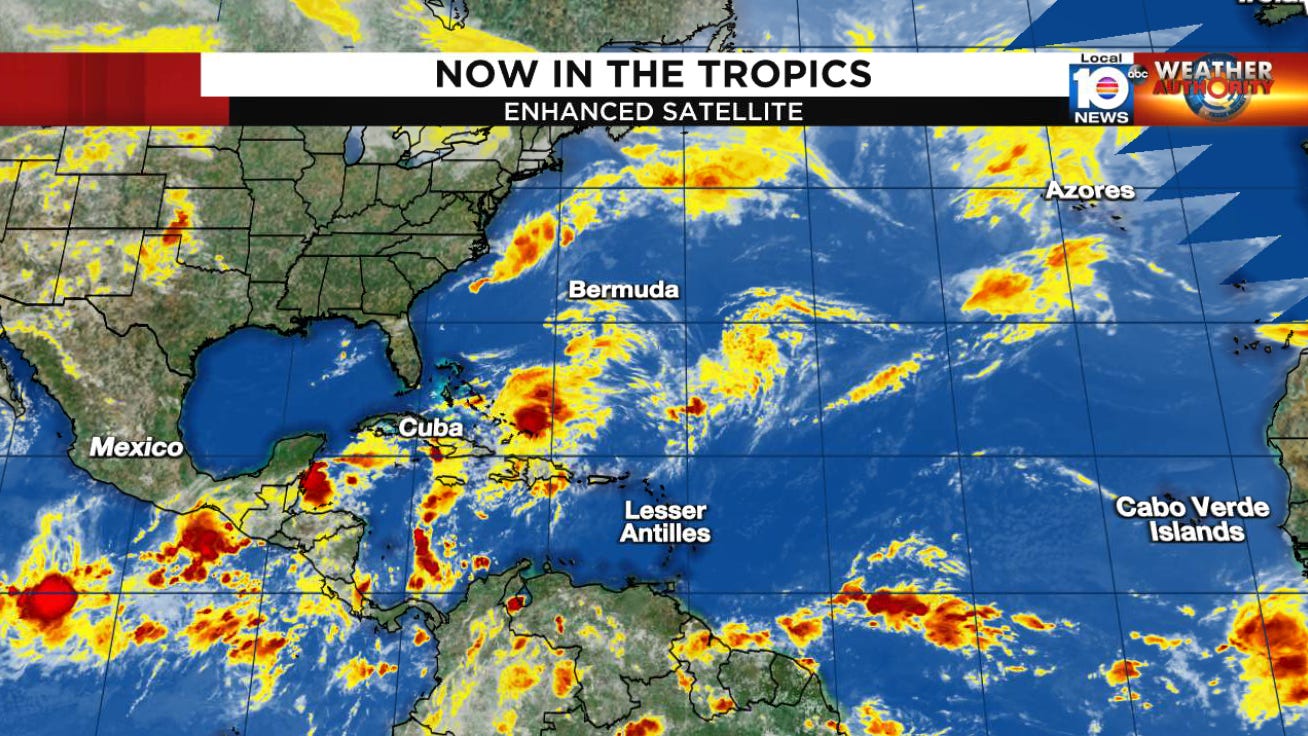
None of the unsettled weather next week is expected to organize into anything tropically, and NHC keeps tropical development odds at nil for the next 7 days.
As we discussed in previous newsletters this week, the upper-air pattern will be changing for mid-June (week after next), which could support some tropical mischief in the southern Gulf. We’ll have more to say on this deeper into next week as the forecast gets a little clearer.


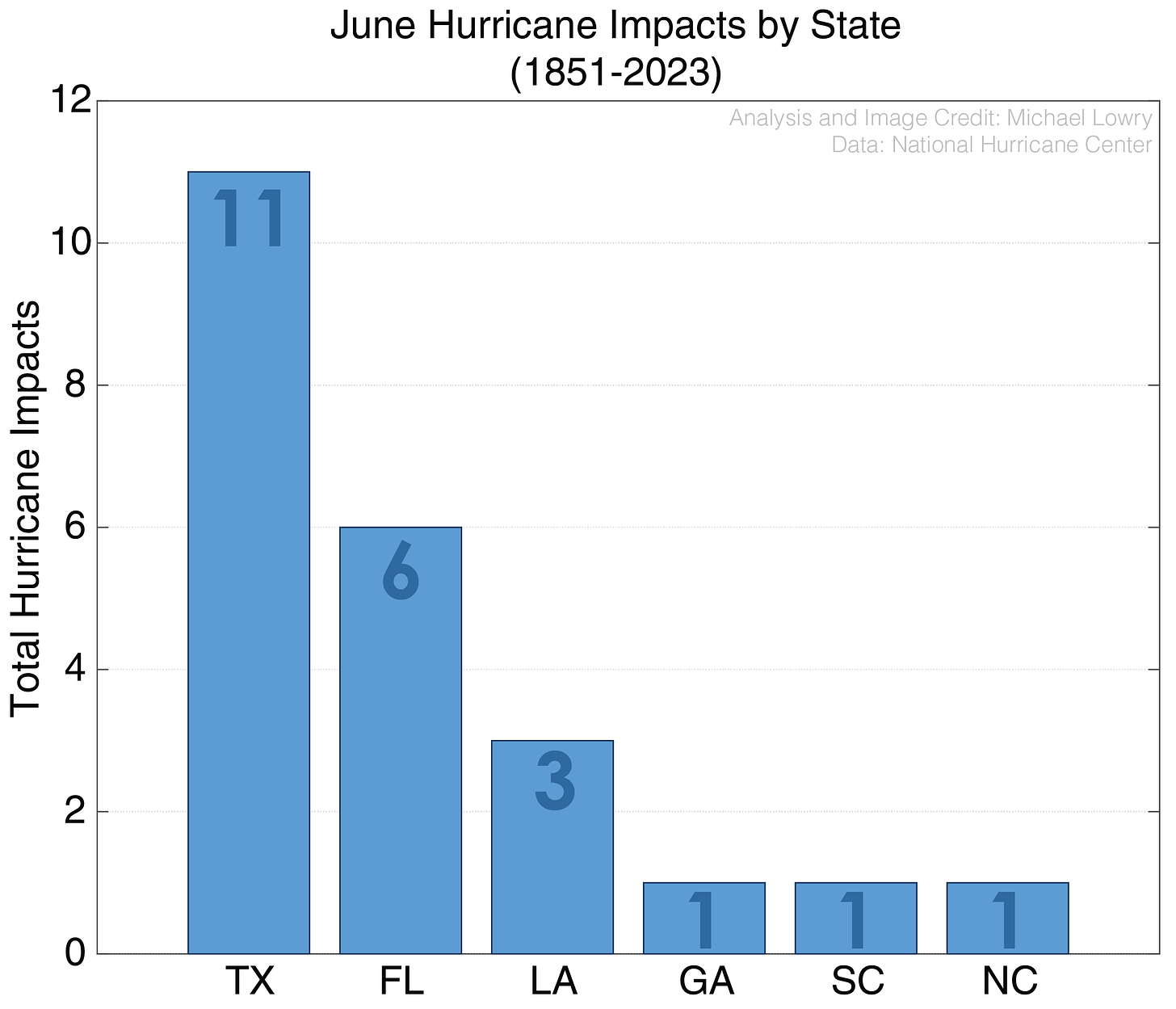
June storms have had dramatic impact in Texas due to extreme rainfall. An unnamed storm in 1889, Alice, 1954, Amelia 1978, Allison 1989 and Allison, 2001 all produced over 25" of rain and caused major flooding.
Once again thank you. We look forward to each of your emails!