Stormier Days Ahead for South Florida
The tropical spigot will turn on by mid next week, but organized tropical development is unlikely for now
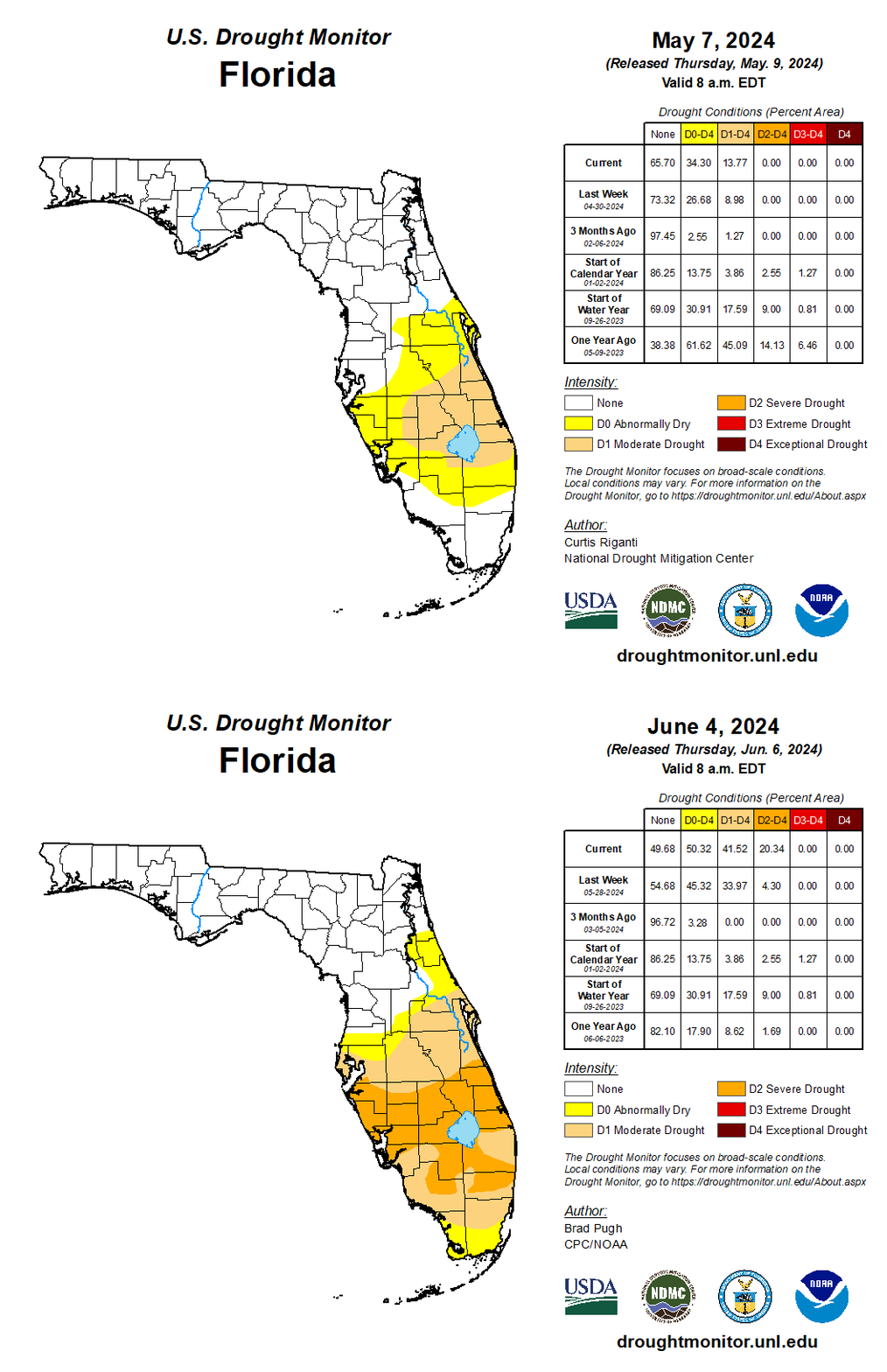
It’s been a rather dry start to the rainy season for South Florida. Though it’s only been three weeks since the official start of the rainy season, over the past month a good portion of South Florida has only seen a quarter to a tenth (or less) of the rainfall we’d typically expect this time of year.
The rainfall deficit is a holdover from the dry conditions this spring and in their latest report released this morning, the U.S. Drought Monitor shows areas of severe drought quickly spreading across South Florida and down into parts of Broward County. Moderate drought conditions are now being observed in parts of Miami-Dade County. Some areas of South Florida have seen rainfall deficits of up to 8 inches since February.
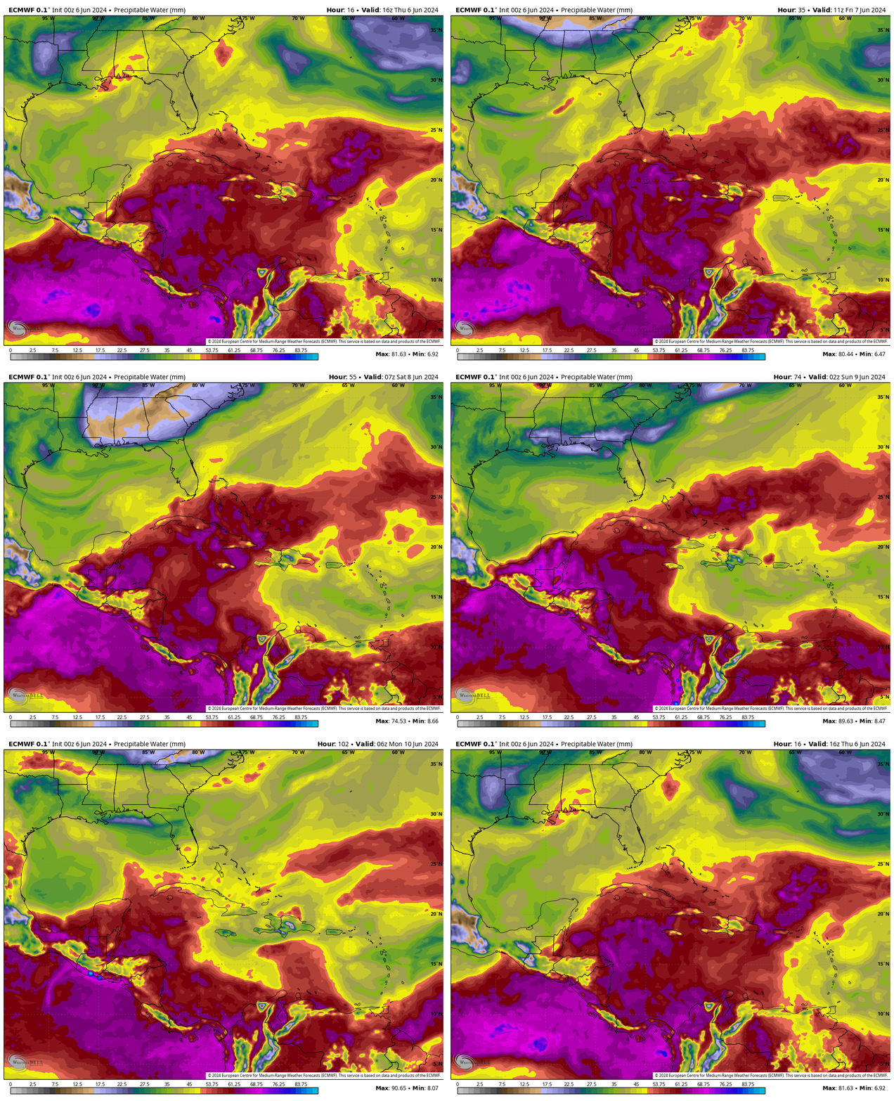
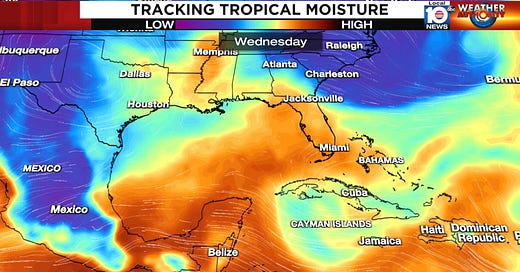
Needless to say, we could use the rain and we may get more of it starting the middle of next week, as saturated tropical air spreads northward into the peninsula from the Caribbean, bringing with it a noticeable uptick in storminess.

For now at least, any organization to the wet weather is unlikely. The American GFS model – notorious for ginning up “boguscanes” in the western Caribbean and southern Gulf at long lead times – has unsurprisingly backed off earlier forecasts advertising a more organized tropical system near Florida next week. As we noted in Wednesday’s newsletter, these forecasts from the GFS should be discounted until we find evidence from other reliable models.
Overall the upper-levels aren’t conducive to storm organization just yet, but as we discussed on Monday that may change after next week (more below). For now, the increased rainfall next week looks to be more of the beneficial than threatening variety, but we’re still a week out, so we’ll want to follow the trends for any changes.
Looking ahead to mid June
On Monday, we touched on changes to the jet stream winds that could open the door to tropical mischief by mid month. Our model ensembles – the various iterations of individual models that better account for uncertainty in the future – are beginning to sniff out possible suspect areas down in the southern Gulf or western Caribbean in about a week and a half.

It’s still very early, but it’s a fairly robust signal this far out, so it’s something to keep an eye on. This also aligns more broadly with the timing of the arrival of the more active branch of the Madden Julian Oscillation or MJO, an upper-level feature we track that can promote tropical development as it moves around the globe every 30 to 60 days.

We’ll have more on this in future newsletters as forecast details become clearer.


Good stuff, Mr. Lowry ⚘
Once again, thank you. I appreciate the way you are giving us information. You are teaching us more everyday and I think that is very helpful understanding our hurricane season.