Tropical Déjà Vu? Another Week, Another Area to Watch in the Gulf
Although another system could form in the same area as Helene, models for now suggest it remains weak and messy

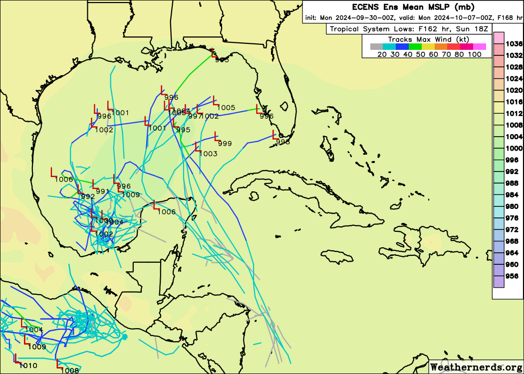
Another tropical system could form later this week over the northwestern Caribbean or Gulf of Mexico – in the vicinity of where Helene formed last week – and move toward the Gulf Coast for next weekend or early next week.

Although the system will have similar origins to Helene, unlike Helene, several obstacles to organization lie ahead and computer models for now indicate development isn’t a slam dunk. The NHC slightly decreased 7-day development odds early Monday morning.
The consensus suggests a tropical depression or weak tropical storm could gradually take shape by late week into next weekend and move toward the northern Gulf Coast or Florida’s Gulf Coast, but it’s most likely the system stays broad and messy.

Nevertheless, it could impact the ongoing recovery efforts in Florida, so folks will want to monitor its progress and check back on the forecast trends this week.
An active Central American Gyre
Back in August, we discussed the possibility of a backloaded hurricane season and late-season mischief due to the Central American Gyre or CAG – a broad area of storminess and spin extending from the eastern Pacific into the Caribbean that can be a breeding ground for tropical systems on the hurricane season’s shoulders.
Helene was spawned from the CAG and the system this week again appears to come about from the interaction between a westward-moving tropical wave and the Central American Gyre. The tropical wave helps to energize the CAG and lift it northward so that spin and storminess gets focused in the western Caribbean and southern Gulf of Mexico.
Forecast models show two areas of spin within the broader CAG – one east of Mexico’s Yucatan Peninsula and another to its west – by mid to late week.
The areas of spin may merge over the Gulf by the weekend and get whisked toward the U.S. Gulf Coast.
Unlike with Helene, upper-level winds will be brisk and should impart a non-trivial amount of wind shear atop the system while in the Gulf. Because of this, models for now show it staying weak, messy, and lopsided – primarily a rainmaker for Florida or parts of the northeastern Gulf into early next week.
Any potential U.S. impacts are still some days away so as always, we’ll continue to monitor the forecast trends.
Hurricane season making up for lost time
After a very unusual lull into what is traditionally the busiest part of the hurricane season in late August and September, the Atlantic is now firing on all cylinders. We discussed in detail back at the turn of the month why we shouldn’t bet against the back part of the season, which we’re now seeing play out.
Thankfully, at least for the time being, the storms over the Atlantic are poised to stay over the Atlantic.
Over the weekend, Isaac peaked as a 105 mph Category 2 hurricane over the open waters of the central Atlantic. It’s quickly getting entangled in a much larger frontal system over the far north Atlantic and will lose its tropical moniker today.
Meanwhile, Joyce plateaued over the weekend as a mid-grade tropical storm. Wind shear is raining down over the system, tearing most of its thunderstorms away and Joyce is expected to be relegated to a swirl of low-level clouds over the next day or two over the open Atlantic.
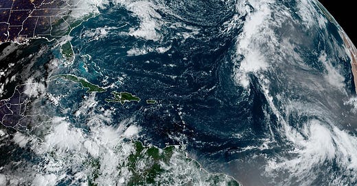
The big story in the Atlantic this week will be newly-minted Tropical Storm Kirk, located between Africa and the Caribbean Islands. Kirk is forecast to steadily strengthen into a large and powerful major hurricane by the middle to latter part of next week.
The good news with Kirk is it will be turning into the open Atlantic, and while its wide swell could reach U.S. shorelines by early next week, it should stay mainly a threat to shipping interests.
Cabo Verde Season extended into October
The height of Cabo Verde Season – the part of the season where deep Atlantic storms form near the Cabo Verde Islands off Africa and grow into hurricanes before reaching the Caribbean Islands – is headed into overtime this year.
Typically Cabo Verde season shuts down by October but with peak activity shifted later this year, we’re seeing yet another Cabo-Verde-style hurricane in the pipeline. The tropical wave situated near the coast of Africa today is forecast by computer models to organize into another powerful hurricane into next week.
We have plenty of time to watch and for now it poses no immediate threats to land.


Please don't form and if you do, stay weak and could you kindly give us a miss this time? Helene did a real number on the east and central eastern states. We can't handle anymore right now.