Signs the Hurricane Season Could be Backloaded
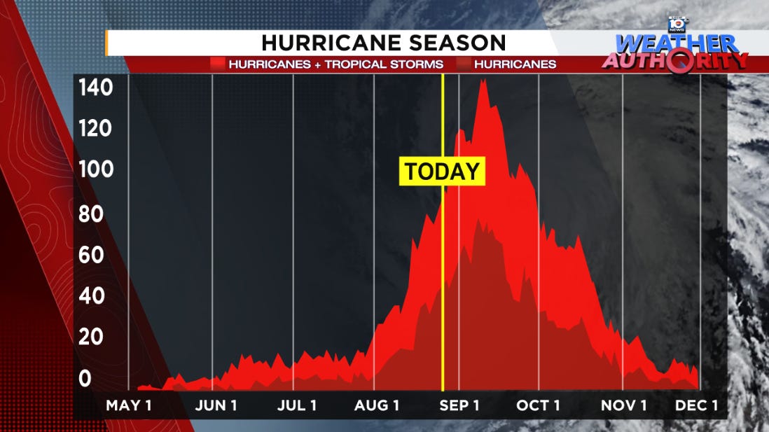
September 11th is typically the inflection point of hurricane season activity, but some signals point to a busier-than-average second half
We hit the ground running this hurricane season earlier than usual – with the earliest Category 5 hurricane on record and already two U.S. hurricane landfalls and one direct hurricane strike on Bermuda. Even if no other tropical systems form in the Atlantic for the next 2 weeks, we’ll still be running ahead of schedule for the year.
Years like this, however, are also at heightened risk for a busier than average back part of the season. The same factors giving us a late August lull could contribute to more activity later in September, October, and November.
The wind shear conundrum
As we mentioned in Tuesday’s newsletter, wind shear has been high, especially in the eastern part of the Atlantic Main Development Region or MDR the past few weeks.
The higher-than-average wind shear is from winds tearing at would-be storms from the east, rather than from the west which is most typical during the hurricane season. The typical west-to-east upper-wind configuration that’s normally one of the biggest factors working against tropical development flipped so much in the other direction, it’s actually remained a deterrent. This is pretty unusual for the Atlantic.
One of the contributors to this unusual east-to-west wind shear in the eastern Atlantic has been a northward displacement of southwesterly (winds from the southwest) surface winds over parts of northern Africa known as the West African Monsoon or WAM. Typically, the northward displacement of the WAM would favor more robust disturbances, but it’s been so far north that it’s actually enhancing the easterly shear due to stronger winds from the west at the surface.
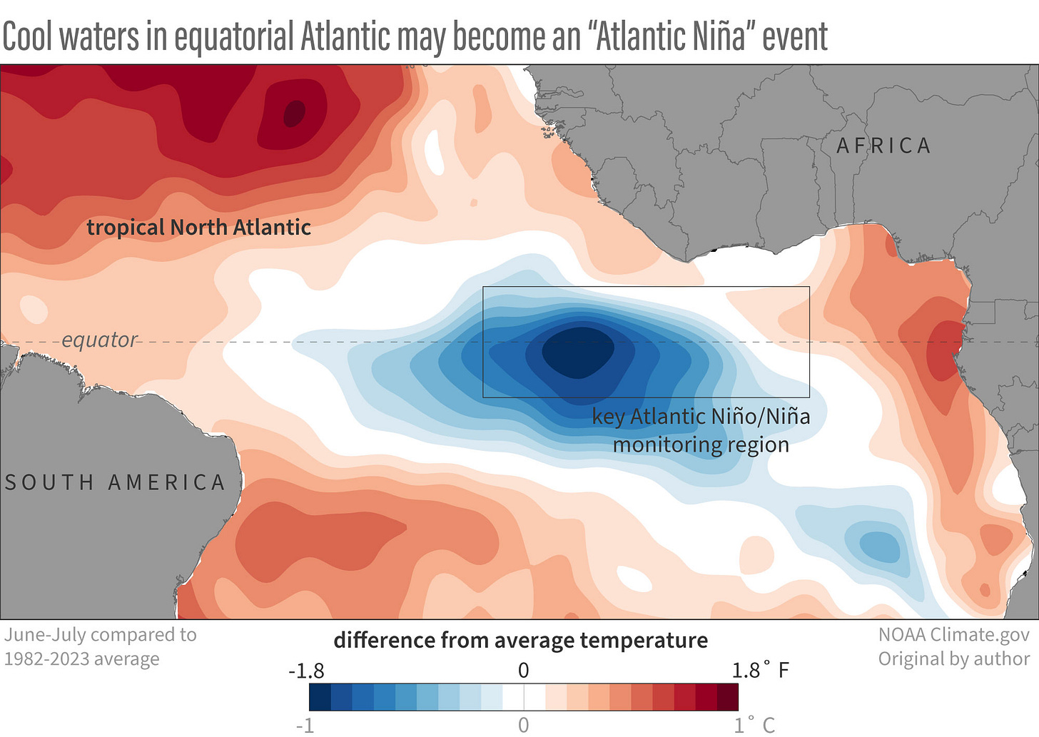
One of the causes of the WAM’s northward displacement is the so-called Atlantic Niña, a cooling of the waters around the equator in the eastern Atlantic just south of Africa.

Though we haven’t technically met the criteria for an Atlantic Niña, the quick transition to cooler than average waters increases the temperature difference between the warm Sahara and cooler, wetter conditions to the south. This in part drives the West African Monsoon farther north.
The Caribbean hot spot
While wind shear has been much higher than average over the eastern tropical Atlantic, it’s been generally much lower-than-average across the Caribbean, a sign of a budding La Niña in the eastern Pacific.
La Niña should officially emerge over the next month or two, according to government forecasters. Studies have shown that during La Niña years, there tends to be more tropical activity in the later months, and the lower wind shear in the Caribbean, a hot spot for October hurricanes, would also suggest it.
The Central American Gyre – a large sprawling area of low pressure that extends from the Pacific into the Caribbean and southern Gulf – tends to make a return in September and October and could be a source for later season mischief closer to the U.S.

What role could an Atlantic Niña play?
Research has shown very little statistically significant correlation with cooler-than-average water temperatures that define the Atlantic Niña in the eastern equatorial Atlantic and seasonal hurricane activity.

While we can’t rule out some affect, it’s unlikely the little cooling so far will have any major influence on overall activity.
Extra warm waters up the late-season risk
The budding La Niña, much lower-than-average Caribbean shear, and return of the Central American Gyre will be accompanied by deep and plentiful ocean fuel to tap into come September and October. The Caribbean is the warmest on record to this point in the hurricane season, so as the formation zones shift back toward the western Atlantic in September, and especially by October, we could certainly see more robust activity toward the back part of the season.
Quiet stretch extends into next week
For now, the Atlantic will stay quiet into next week.
As we mentioned earlier this week, Florida residents should take advantage of the next 2-week disaster preparedness sales tax holiday, which begins tomorrow, to replenish any supplies and save on taxes before activity picks back up in the Atlantic.


Very useful information. Thank you!
This is really good work.