Tropical Atlantic Lies Dormant into Next Week
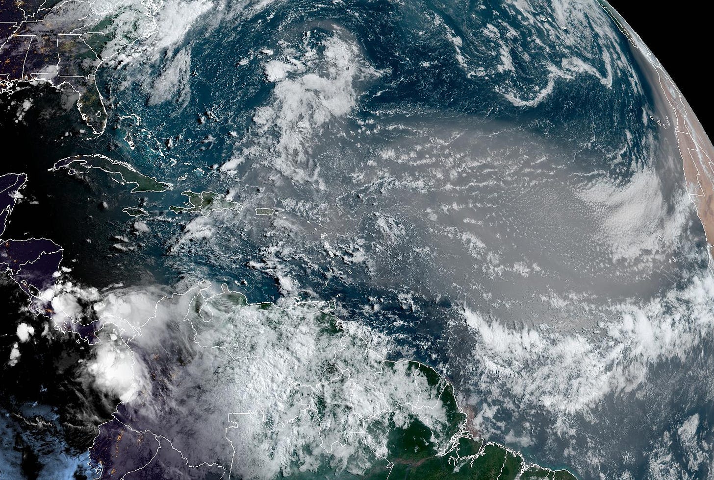
Saharan dust at its annual peak across the Atlantic

It’s been 9 days since the last active tropical system in the Atlantic and 18 days since the last named storm – Tropical Storm Chris – formed. Of course, by the first week of July, the Atlantic managed to notch its most active start to a hurricane season on record – courtesy of long-lived, Category 5 Hurricane Beryl – and activity through July 18th is more like what we’d expect through the end of August.
Since we’re running a full 6 weeks ahead of schedule, the lull of the last week is welcome news, especially for those in places recently affected by Hurricane Beryl.
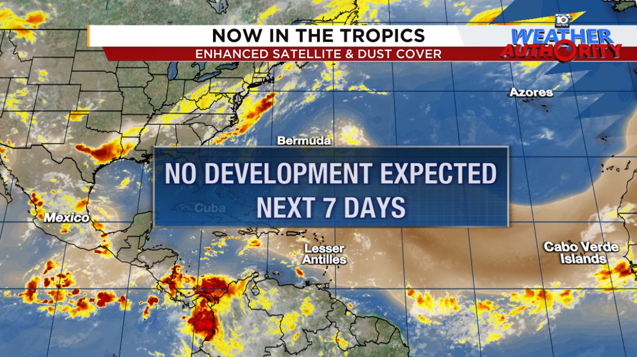
A continent-sized plume of Saharan dust continues to surge through the Atlantic today while the atmosphere remains in a stable configuration, with dry, sinking air stymieing organized development. This dust plume is expected to reach the shores of South Florida by the weekend, limiting otherwise widespread shower activity. The dust concentrations in the air over Florida hit its highest levels of the year last Tuesday and Wednesday.
Saharan dust is likely at its annual peak this week over the tropical Atlantic and should taper down quickly into August.
For now, models show no signs of life in the Atlantic through next week so enjoy the continued tropical slumber.


I have absolutely no evidence other than a hunch that the Saharan dust plume is going to be more prolonged this year than usual..perhaps setting some records. That may keep things quiet longer than usual. Just a guess..
This year in cyclone blogging is already a success in that the state of the SAL has entered the mainstream of discussion. But for the dust plume to set records would require a relapse in the changes to high level wind patterns? My understanding is that these were long-term changes.
Meanwhile, perhaps the Atlantic lull is an opportunity to discuss other topics For one, I am curious why the IKE (Integrated Kinetic Energy) rating of storms has not seemed to catch on? Too new? It fixes the obvious issue with ACE in that the latter does not account for the size of storms. I haven't been able to find any IKE calculations for Beryl, and I'm very interested to see them as it was relatively small.
Finally, we would be remiss to point out that the terms "incredible" "unprecedented" et al apply equally to the Eastern Pacific season -- except in the opposite direction: super quiet. E..g. July 4 is the latest first-named-storm ever. It seems intuitive to suggest that high-energy in the Atlantic is in equilibrium to low-energy in the EP?