Beryl Tops the Scale as the Earliest Category 5 Hurricane on Record
Hurricane warning in effect for Jamaica as Beryl could threaten as a major hurricane by Wednesday

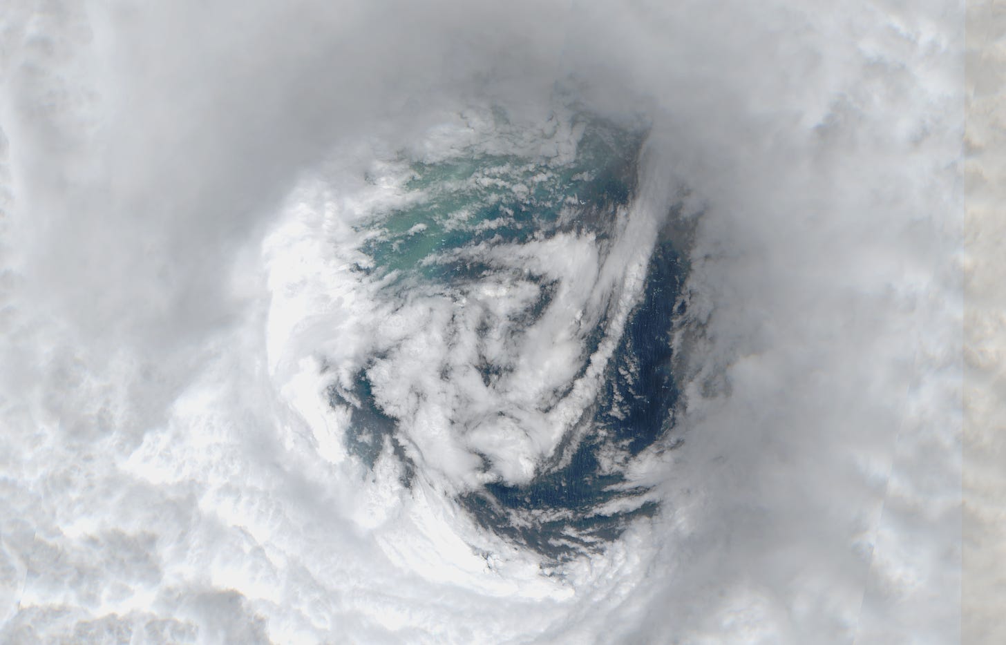
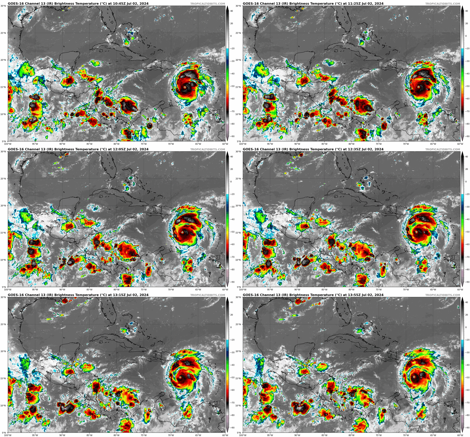
After striking the small island of Carriacou at the entrance of the eastern Caribbean as a 150 mph Category 4 hurricane on Monday, Beryl continued to intensify through the overnight hours, becoming a 165 mph Category 5 hurricane by early Tuesday.

Hurricane Beryl is the 41st Category 5 hurricane on record in the Atlantic and easily the earliest Category 5 hurricane since records began in 1851, forming an astounding 15 days ahead of the previous earliest Category 5 recordholder, Hurricane Emily, which became a Category 5 on July 17th, 2005. Beryl and Emily are the only two Category 5 hurricanes to be observed before the month of August in the Atlantic. Beryl is also now the strongest July hurricane on record.
The Category 5 designation was confirmed by multiple Hurricane Hunter aircraft that have been flying the intense hurricane since late Monday night.
What’s ahead for Beryl
Beryl – now located several hundred miles south of Puerto Rico and Hispaniola in the eastern Caribbean – appears to have finally leveled off in intensity. As we previewed in Monday’s newsletter, a gradual weakening should commence for the remainder of the week as Beryl encounters increasing wind shear deeper into the Caribbean.
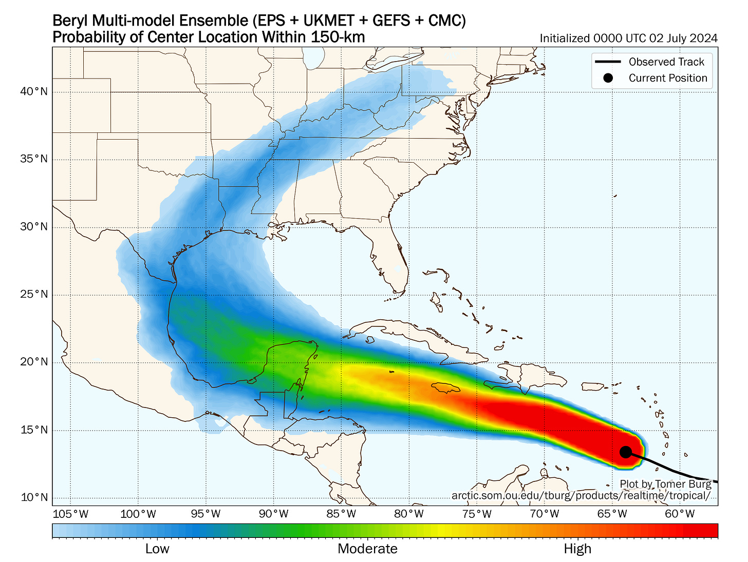
The hurricane will gain some latitude as it encounters a small weakness in the subtropical ridge to the north which is steering it westward. This will take the center of the hurricane near or over Jamaica by Wednesday, perhaps as a still-major Category 3 hurricane.
The ridge will quickly rebuild, bending Beryl back to the west on a track toward the Yucatan Peninsula and Gulf of Mexico for the weekend.
Beryl is not a threat to Florida.
What happens to Beryl beyond the weekend?
By late weekend – as it makes its way into the southwestern Gulf of Mexico – Beryl will begin to round the western periphery of the high pressure steering to its north. This will curl the system toward Mexico or the Texas coastline for early next week.

Beryl’s strength at the time will affect its eventual track, with a stronger system moving farther north and a weaker system continuing farther west.
Intensity guidance remains tepid on Beryl’s strength at this time, in general keeping it a tropical storm next week as it encounters increasing wind shear and drier continental air. That said, a borderline hurricane threat to the Texas coast can’t be ruled out, so interests in the western Gulf should continue to follow the forecasts.
Development odds on the decline for 96L
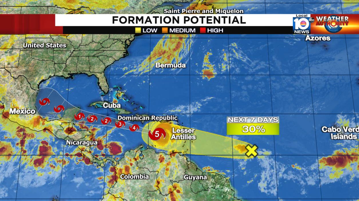
The disturbance we’ve been tracking in the open tropical Atlantic about 1,000 miles east of the easternmost Caribbean hasn’t become any better organized today. As we discussed in Monday’s newsletter, conditions ahead are only marginally favorable for development.
On Tuesday, the National Hurricane Center dropped its development odds to low over the next week. However, those areas affected by Beryl will want to monitor its progress as it will bring additional heavy rains to the Windward Islands on Wednesday regardless of development.


Its eye looks like a triskelion.