Torrential Tropical Rains Headed to Texas with Area to Watch off the Southeast
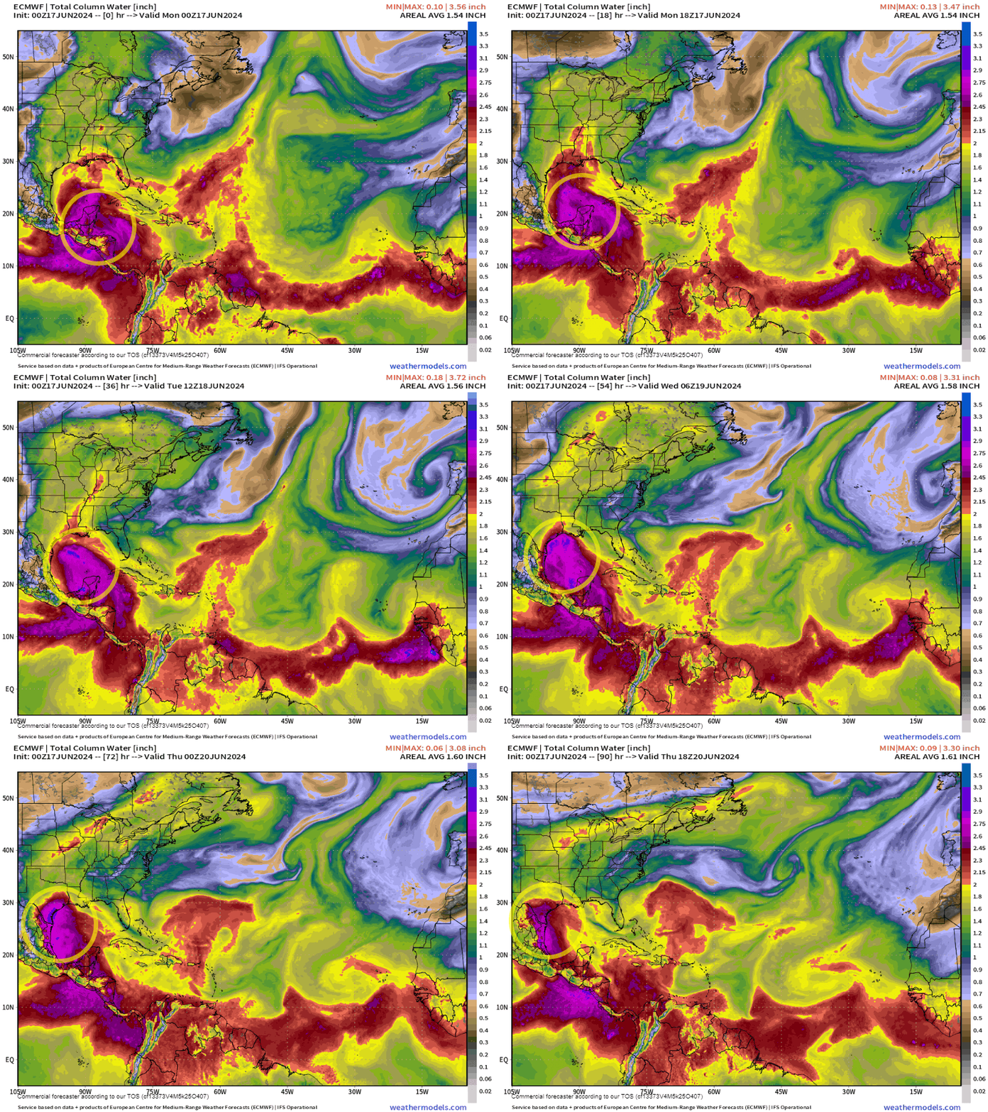
A major surge of tropical moisture from a developing system will bring a multi-day flood threat to South Texas starting on Tuesday
It’s a scenario South Floridians know all-too-well. A major surge of saturated tropical air from the Caribbean will bring rounds of heavy rainfall and a prolonged, multi-day flood threat – but this week on the other side of the Gulf to parts of northern Mexico and much of South Texas.

And this time, the culprit won’t be a stalled front and jet stream energy, but a developing tropical system pinwheeling in from the southern Gulf.
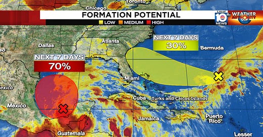
As of 8 AM ET Monday, the National Hurricane Center gives this area a high chance of becoming a tropical depression or tropical storm over the next few days. Whether or not it becomes Alberto, the first named storm of the 2024 hurricane season, is inconsequential, as the impacts will be boatloads of rain to a state that’s water-logged on one side and water-starved on the other.
For parts of South Texas, the Lower Rio Grande Valley, areas of the Hill Country, and Big Bend, reservoirs are needing replenishing rains. Falcon Reservoir on the Rio Grande is less than 10% full – some of the lowest levels in 20 years – while Medina Lake in the Texas Hill Country, an important source for local irrigation, dropped to less than 3% capacity.
On the other side of the ledger, the Houston-Galveston area has been plagued by heavy rains and floods this spring and spots just to the north – like The Woodlands and Huntsville – saw as much as 600% of their normal May rainfall. The last thing many of these places need is another big rain event.

Leading rains today will set the stage for the main event tomorrow through Thursday, with the potential for heaviest rains late Tuesday into Wednesday. The National Weather Service is forecasting up to 6 to 10 inches of total rainfall, with isolated higher amounts through Thursday, with the heaviest totals closer to coastal areas of South Texas.

The Weather Prediction Center also has a moderate risk of excessive rainfall for these areas from tomorrow morning through early Thursday, indicating numerous flash floods are likely.
Because of the large, sprawling nature of the low-pressure system, strong winds along a long stretch of coastline will also produce dangerous seas, strong rip currents, and a risk of significant coastal flooding for Gulf-facing beaches from Padre Island to the Bolivar Peninsula.
Watching the waters off the southeast this week
As we previewed in a special edition of the newsletter on Sunday, a low-pressure system – a spinoff from a dying cold front – is expected to form northeast of the Bahamas by mid-week. The National Hurricane Center indicates the possibility of slow development as it moves westward toward the southeast U.S. by later in the week.
The good news for flood-weary South Florida is forecast models have continued to trend to our north, and NHC has adjusted its potential area for development farther away from the waters off South Florida.
There also hasn’t been any appreciable change in the forecasts since yesterday which mainly keep the system small and weak as it approaches the U.S. on Thursday or Friday.

We won’t have a better handle on everything until the low-pressure area becomes better defined in a day or two, but for now residents from east-central Florida to the Carolinas will want to monitor the forecasts in the coming days.
Regardless, the sharp difference in pressure between the low-pressure system and high-pressure to the north will create windy conditions along area beaches, especially to the north of the system, for late in the week.


We thank you everyday!