New System Could Bring Tropical Threat to Florida this Week
Models latching on to new system and taking it toward the southeast U.S. by mid- to late week
Author’s note: This is a special Sunday edition of the tropical newsletter to discuss a new system being sniffed out by models over the weekend east of Florida.
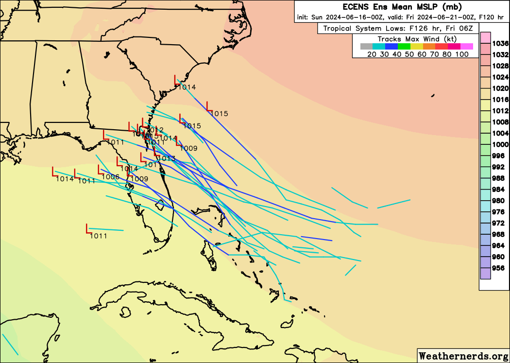
As we say often in this newsletter, things can change in a hurry in the tropics, and with formation areas closer to the U.S. in the early months, it’s always worth a daily check-in. Our forecast models reminded us of this over the weekend as they quickly latched on to a new system east of the Bahamas for possible development in the days ahead.
The National Hurricane Center added the area to its outlook on Saturday and indicates the possibility for slow development as it moves toward Florida or the southeast U.S. for mid- to late week.
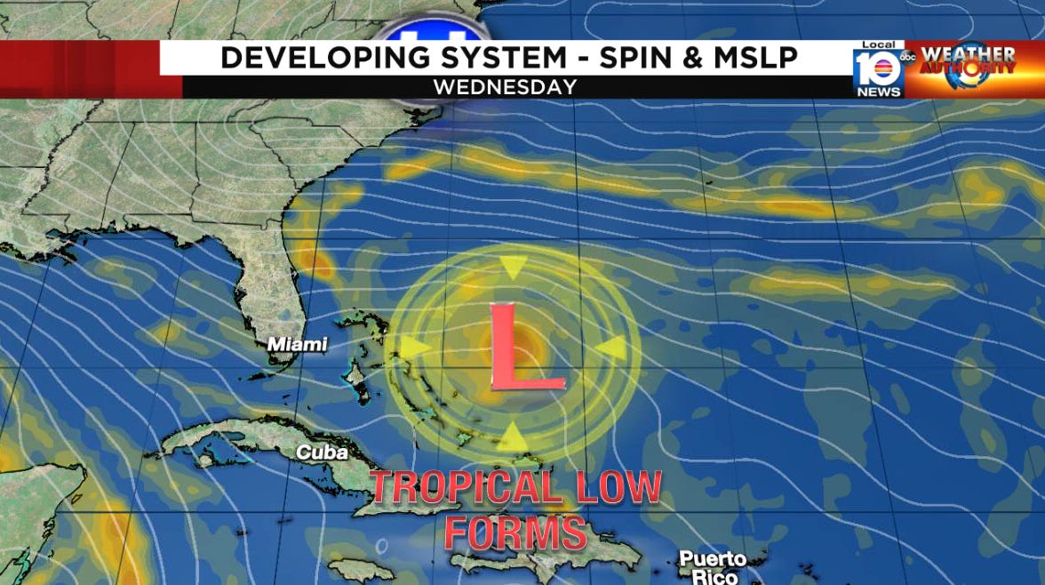
The system spins off from a broad area of low pressure left draped along the tail of a stalled front over the western Atlantic. Dying fronts are a common conduit this time of year for initially non-tropical areas of low pressure to transition into tropical systems when conditions are right.
As the front departs, it’ll leave behind the orphaned low pressure. In the wake of the front, strong high pressure will immediately build in from the north, essentially trapping the low-pressure system beneath.
The building high pressure will influence the low-pressure system in two important ways. First, the clockwise flow around the high-pressure ridge will steer the disturbance back to the west in the direction of the Bahamas and Florida – and quickly – without an obvious escape route. Secondly, the stark pressure difference will enhance convergence into the low-pressure area, which could help to hasten development. Neither of course, is good news.
The bright spot is that models for now generally keep the developing low weak on approach to Florida or the southeast U.S. by Thursday or Friday. However, it’s a small system that models notoriously have trouble “seeing” and can sometimes underestimate (global models are also not very useful for intensity forecasting). Additionally, the forecast model ensembles, which can be useful to gauge uncertainty, can also stumble with smaller systems since the ensembles have a lower resolution – meaning they smooth out the finer details and may miss the true strength and track of small systems. This isn’t to imply forecasts showing a weaker system are wrong, but it’s worth approaching with a pinch of skepticism knowing model biases and limitations and before we have access to more skillful intensity forecasts.
Overall the environment this week over the southwestern Atlantic ahead of the system looks modestly favorable for slow development. Some moderate southerly wind shear and dry air lurking ahead will probably help to stymie quick organization, but at this point don’t appear to be a significant deterrent. If it remains small, that could also offer additional protection against nearby wind shear and dry air.
Waters of course remain plenty warm for the time of year, especially near the Bahamas and Florida.

As for the heavy rainfall potential, the robust high-pressure steering will move this one quickly and a smaller system would suggest a smaller overall rainfall footprint. It’s too early to pinpoint exactly where this will head or what impacts could be, but the sharp pressure gradient could make for windy conditions and elevated rip currents at the coast regardless.
The trends since yesterday have been farther up the coast (east-central Florida to southeast Georgia), but until the low-pressure area is better defined, expect noticeable shifts in the models from run-to-run.

Coastal residents from South Florida and the Keys to South Carolina should monitor the forecasts closely.
We’ll have more updates throughout the week.
Heavy rains headed to Texas
As we discussed in earlier newsletters, a broad area of low-pressure is taking shape across the lower stretches of the Gulf of Mexico. The area will stay somewhat broad as it slowly pinwheels toward the coast of northern Mexico or South Texas from Tuesday into Thursday.

Development looks possible this week but regardless a prolonged heavy rain event and flash flood threat will be the primary impact. The sprawling gyre already produced widespread flooding across parts of Central America over the weekend and the Weather Prediction Center is indicating a moderate risk of excessive rainfall for southeastern Texas, especially by Tuesday into Wednesday, with rainfall reaching a foot or more in some places.


I m SO grateful for this Sunday special "eye on the tropics". Yes things chang fast and that is exactly why we depend so much on your update and explainations. Your emails are extremely important to. us. Gratitude hardly express how much I learn and appreciate what you are doing for us lay people.
Thank you very much, watching closely here in Tampa Bay St. Petersburg Florida for any squalls and rain wind impacts, I’ve been so interested in hurricanes since 2004 Charley.