Possible Early Development Next Week in the Atlantic
June tropical cyclones are rare in the deep tropical Atlantic, but not impossible
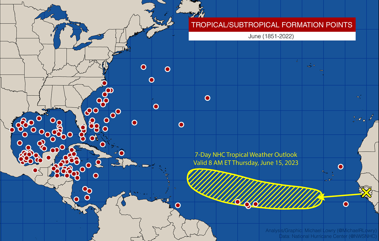
An early season tropical disturbance rolling off Africa is being given a low chance of development into next week by the National Hurricane Center.
The tropical wave, which we discussed first in Tuesday’s newsletter, is moving into an area not typically favored for June development. Since records began in 1851, only three tropical systems have formed in the area being outlined by NHC Thursday morning – Elsa in 2021, Tropical Depression Two in 2003, and Ana in 1979. Of the 133 tropical or subtropical systems observed in June, only seven have been recorded near the Main Development Region (or MDR) of the Atlantic, a peculiarity in a year marred by some of the warmest June waters ever measured in the North Atlantic.
While none of our computer models suggest significant development for now, there’s certainly a window for the disturbance to overcome the typically high bar for deep tropical formation in June. The most noteworthy boost to development beyond the abnormally warm waters through the Main Development Region (MDR) – waters in the MDR are already as warm as they typically are in September – is a fast-moving disturbance high up in the atmosphere known as a Convectively Coupled Kelvin Wave (CCKW). The configuration of upper-level winds associated with these CCKWs can either promote or suppress development odds in the deep tropics before and after their passage.
In the case of the eastern Atlantic disturbance, an active branch of the CCKW is forecast to pass over the Main Development Region by the middle of next week.

This typically does two things. First the CCKW moistens the atmosphere and promotes rising air and storminess. Then, a day or two after its passage, wind shear characteristically drops, which is what our forecast models indicate by the latter part of next week.

This should give the wave a fighting chance at formation by the middle to latter part of next week. Regardless of development, increased shower activity will be moving toward the Leeward Islands and the northeastern Caribbean for late next week and next weekend.

It’s too soon to speculate on its potential beyond the Caribbean, but we have plenty of time to follow it in the days ahead. Otherwise, no other areas of potential development are expected in the Atlantic into next week.


