Invest 94L May Grow into a Tropical Depression by Next Week
System will be approaching the Windward Islands by next Tuesday into Wednesday
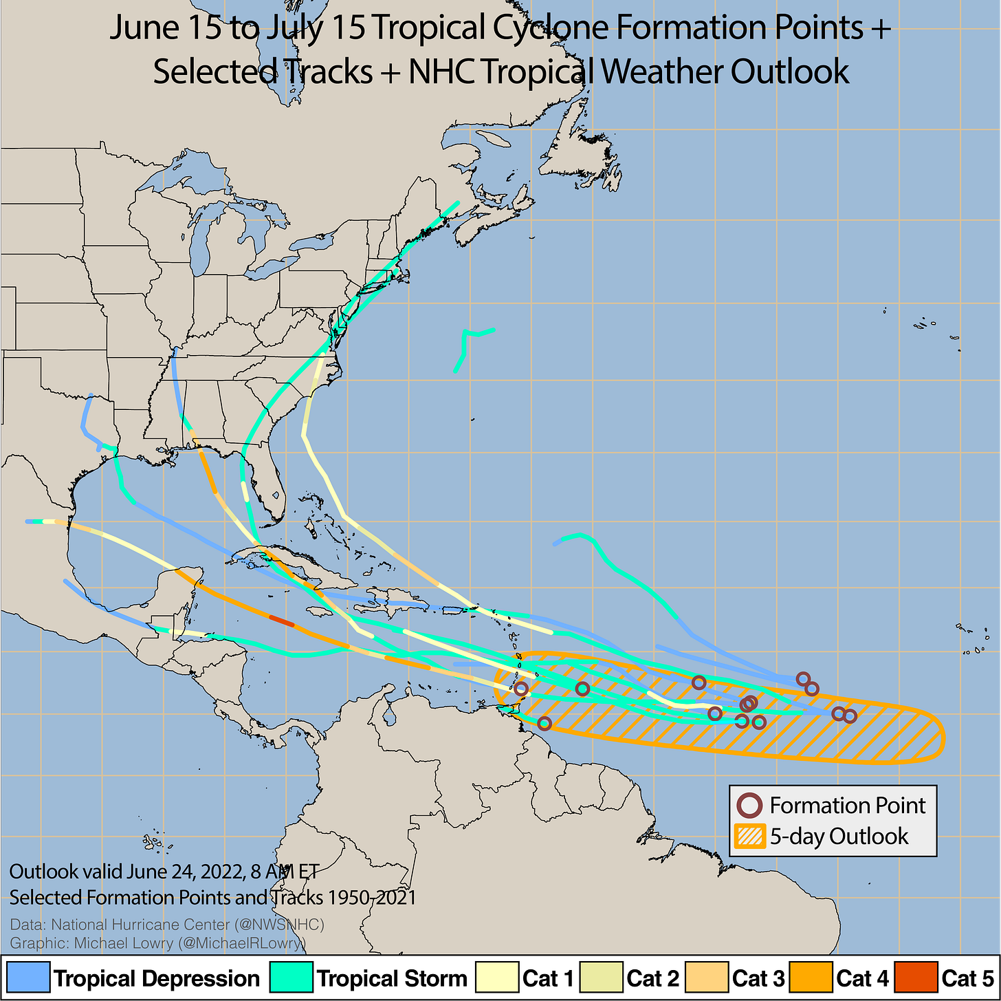
It isn’t every year that we look to the Main Development Region of the eastern Atlantic – the deep tropical belt where most of our strongest hurricanes form – in June for tropical formation. In fact, since the advent of satellite coverage in 1966, of the nearly 300 storms that have formed in the traditional Main Development Region, only two have done so in June – an unnamed storm in 1974 and Ana in 1979. Even considering storms that formed technically just outside this belt, like Elsa last year that came together at only 9.4 degrees north latitude, storms forming here this early in the season are in the lowest percentile of storms originating this far east.
So it’s unusual, to say the least, to see the National Hurricane Center highlighting a disturbance – already designated Invest 94L – in the far eastern Atlantic for tropical development before even reaching July as they are this morning. As we’ve discussed since the beginning of the week, there are a variety of factors coming together to make the typically hostile environment out here more conducive to tropical activity in the coming days. Chief among these changes is a reduction in disruptive wind shear, which is usually the single most prohibitive factor to tropical development across the Main Development Region in late June and early July. The lessening of this wind shear has only just begun and is forecast to follow the disturbance as it nestles safely to the south of stronger upper-level winds on its journey toward the Caribbean Sea.

We also discussed last week the possibility of the tropical Atlantic heating up due to weaker than average trade winds from the east, which results in less ocean mixing and cooling. Indeed, the warmth in the Atlantic continues to rise and as of this week, the Main Development Region is the 7th warmest on record going back 40 years –behind some very active hurricane seasons like 2010, 2005, 2020, and 2011. The combination of the thermodynamic profile (the water temperatures) and conducive dynamics (lower wind shear) of the region are two big supportive factors in development ahead. You can see this on our statistically-based intensity models which use these environmental factors as input and are fairly aggressive in forecasting strengthening next week.
Invest 94L is positioned not only far east, but far south and is expected to continue on a westward trajectory as it approaches the Windward Islands – the southern-most islands of the eastern Caribbean – by Tuesday into Wednesday of next week. Longer range models are in fairly tight agreement with keeping 94L riding westward through the central Caribbean and well south of Puerto Rico courtesy of a strong high-pressure ridge to the north. While it’s far too early to speculate on possible U.S. impacts, the low latitude track and strong high-pressure ridge into next week will both work in favor of keeping this one south. Unfortunately, the low-latitude does mean an increased likelihood of land interaction. Of the 13 or so storms that have formed as far south as 94L since 1950, only two managed to miss land.
The bottom line for south Floridians is we have plenty of time to watch this. Enjoy the weekend and continue to check back with WPLG for updates.


