Signs the Tropical Atlantic Could Heat Up in the Coming Weeks
Caribbean disturbance brings heavy rain to Honduras, Belize, and southeastern Mexico
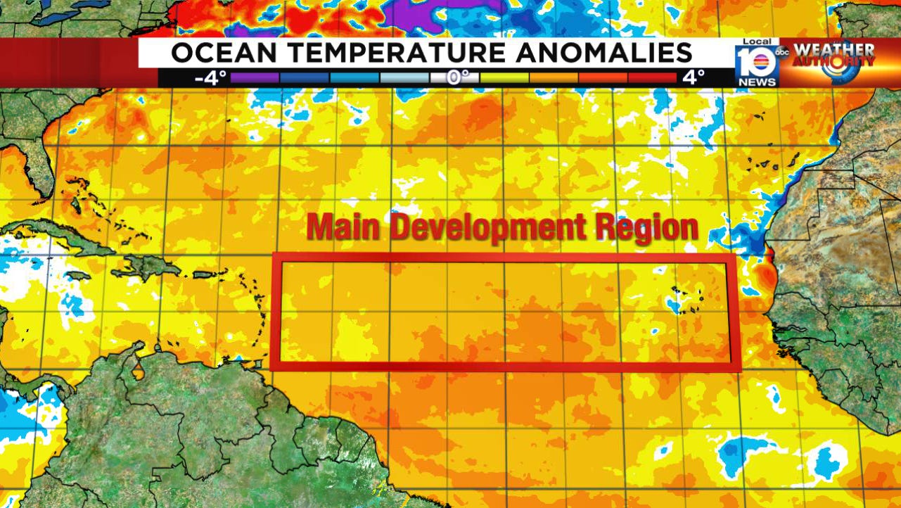
So far this hurricane season, water temperatures across the main development region – commonly called the MDR, where the majority of Category 3, 4, and 5 hurricanes form later in the season – have been running above average, though not exceptionally so, through the first half of June. This early in the season, the warmth of the MDR is less crucial to storm formation, as most systems form closer to the U.S., where still-hostile wind shear tends to be the primary hurdle to storm organization.
As we progress from June to July, our gaze turns eastward to more robust disturbances moving through the deep tropical Atlantic. Since the beginning of the satellite era (roughly the mid-1960s) – which greatly improved our ability to spot storms over the open Atlantic – only two of 69 storms, or about three percent of storms that formed, originated over the MDR during June. By July, though, on average about one in four storms originate over the MDR, and by August – the start of the Cabo Verde season – nearly half of storms that form historically do so over the MDR. So the MDR and the amount of heat it contains become increasingly relevant for developing systems the deeper we get into the hurricane season.
Over the next few weeks, changes in the atmosphere may usher in renewed warmth to the MDR. The Atlantic subtropical ridge of high pressure, the base of which is typically positioned just north of the MDR, is forecast by all our major global models to move appreciably northward. This will not only lower environmental pressures through the MDR, but also reduce the brisk trade winds that move systems from the coast of Africa across the Atlantic. The reduction in trade winds reduces ocean mixing and prevents cooler water from below the ocean surface from mixing to the top. The upshot should be a gradual warming of the Atlantic MDR in the coming weeks as we transition into July.
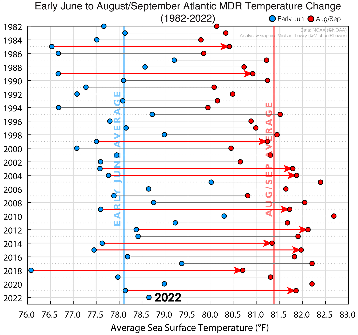
Though very warm water in the tropical Atlantic isn’t necessarily a prerequisite for a busy hurricane season, it is a common trait among them. The relationship between very warm surface waters in the MDR and overall hurricane activity is significant, especially by July and August. The years with the warmest Augusts and Septembers across the MDR – 2020, 2017, 2005, and 2004 – also saw the highest levels of hurricane activity in recent memory. Of course, there are always warm outliers like 2015, but other factors, such as a record strong El Niño that year which increased Atlantic wind shear, help to explain why season activity underperformed.
The ocean’s memory is longer than that of the atmosphere – it takes longer to heat it, but it retains the heat longer and isn’t as quickly affected by changes in air temperature (a physical property known as specific heat). It’s the reason why water temperatures in the Atlantic peak in late September while air temperatures peak in August. It also helps to explain why hurricane seasons that start with above average water temperatures often end up with above average temperatures during the busy months of August and September.
In fact, over the past 40 years, of the 10 seasons with waters as warm as 2022 in early June, all but one – 1987 – ended with above average warmth for the peak of hurricane season, and all but one – 1987 – ended up with very active hurricane seasons. The average number of named storms for those 10 seasons with early June MDR waters as warm as 2022 was 19 (average number of named storms is 14), in line with most seasonal hurricane forecasts so far.
We’ll see what the coming months bring, but all signs point to a tropical Atlantic conducive to storm growth. For now, at least, the tropical Atlantic remains mostly quiet. The disturbance down in the Caribbean will bring heavy rainfall through Honduras, Belize, and southeastern Mexico over the weekend and into early next week, but will remain mostly over land and isn’t expected to develop. Otherwise, no organized tropical activity is anticipated across the Atlantic at least through the weekend.


