What to Expect in Coming Weeks Across the Atlantic
A welcome lull falls over the Atlantic for the remainder of this week
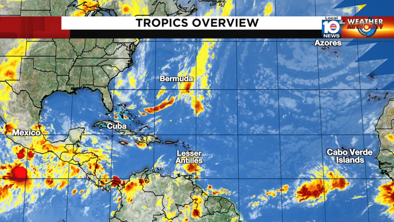
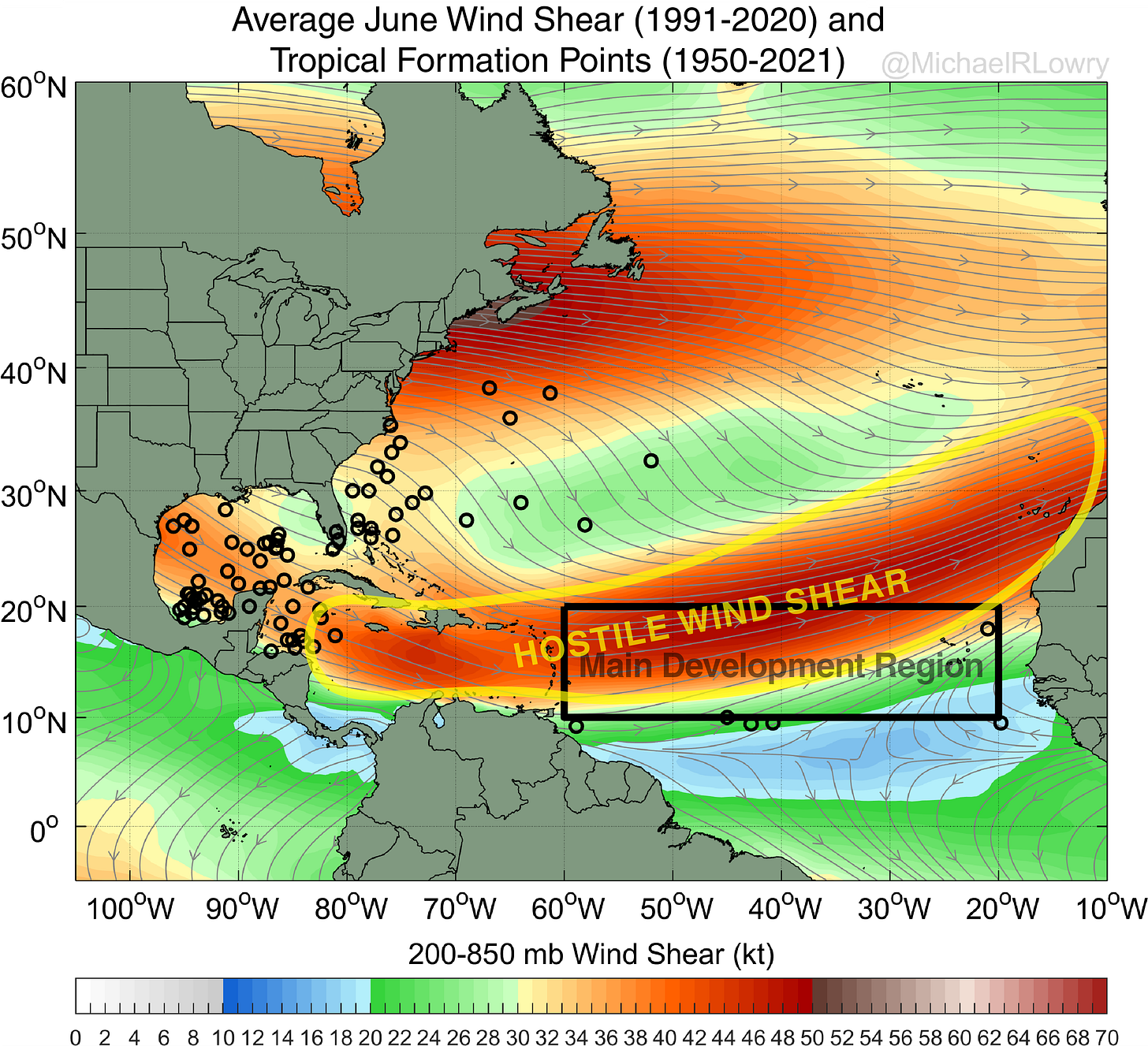
Hurricane season is often served to us in doses, with a helping of activity followed by a stretch of calm. This week we find the Atlantic in a lull. Although several disturbances dot the waters from off the Yucatan Peninsula of Mexico to the Cabo Verde islands off the coast of Africa, conditions remain largely unfavorable for development. A ribbon of characteristically hostile upper winds stretches through the tropical belt and doesn’t appear in any hurry to relax its grip. This should keep any would-be systems from organizing through at least the end of the work week.
Many of our models do show a let-up in wind shear into next week in the eastern tropical Atlantic. As I discussed in yesterday’s newsletter, this time of year is a time of transition for the Atlantic, where we begin to look farther out for possible development, especially by July, as the high wind shear in the Main Development Region of the Atlantic begins to subside and tropical waves – those large disturbances rolling off the coast of Africa every few days – have more real estate to organize and strengthen.

It's still a little early to expect formation over the deep tropical Atlantic, but with wind shear expected to be running noticeably below average to start July and shear naturally beginning to subside, we’ll keep a closer eye to the disturbances moving through the tropical belt of the eastern and central Atlantic. In the meantime, enjoy the welcome break this week across the Atlantic.


