Alberto Forms, Bringing Major Coastal Flooding and Heavy Rains to Texas
Major coastal flooding and heavy rains affecting parts of South Texas today into Thursday from the first named storm of the hurricane season
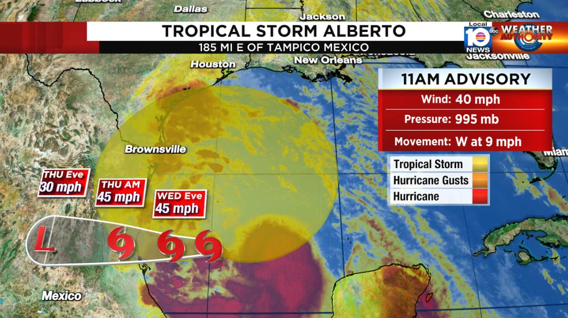
The large and lumbering circulation of the tropical disturbance formerly designated Potential Tropical Cyclone One has been upgraded to Tropical Storm Alberto, the first named storm of the 2024 Atlantic hurricane season.
Satellite from Wednesday morning showed storms blossoming over the center of Alberto’s expansive circulation, with weather extending hundreds of miles away.
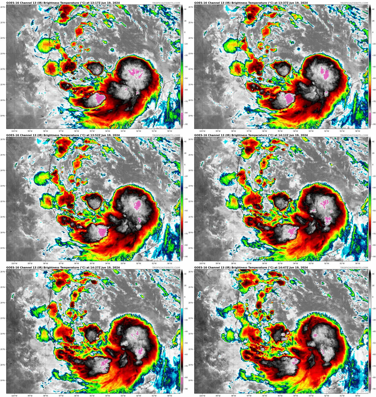
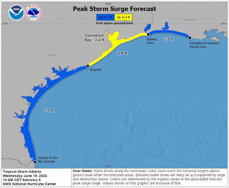
Moderate to major coastal flooding is already occurring along the shorelines of South Texas from tropical storm winds reaching over 400 miles north of Alberto’s center.
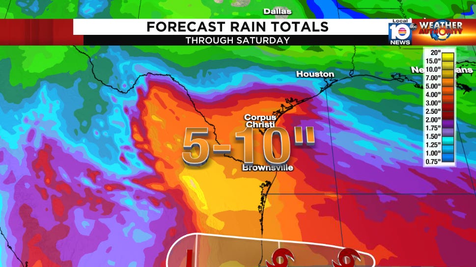
Up to 15 inches of rain is also anticipated across northeastern Mexico and South Texas through tomorrow.
So far the rain has generally underperformed in South Texas, with radar estimating the highest totals of 2 to 4 inches over the past 24 hours in a small strip centered over mostly wetlands south of the Houston metro.
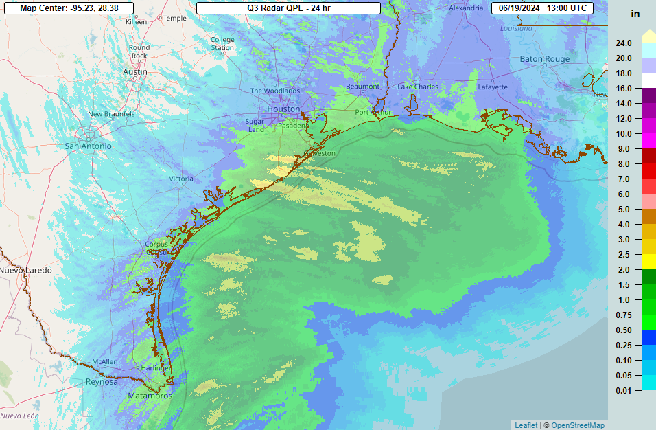
That said, the available moisture remains high and forecast models continue to indicate the possibility of double-digit rainfall totals in South Texas – mainly from the Texas Coastal Bend south of Matagorda Bay – through Thursday.
The coastal flood threat from strong onshore winds will also persist through Thursday.
Conditions should begin to improve for South Texas by Friday, albeit perhaps only briefly before the next system moves in this weekend.
Round 2 this weekend for northern Mexico and South Texas?
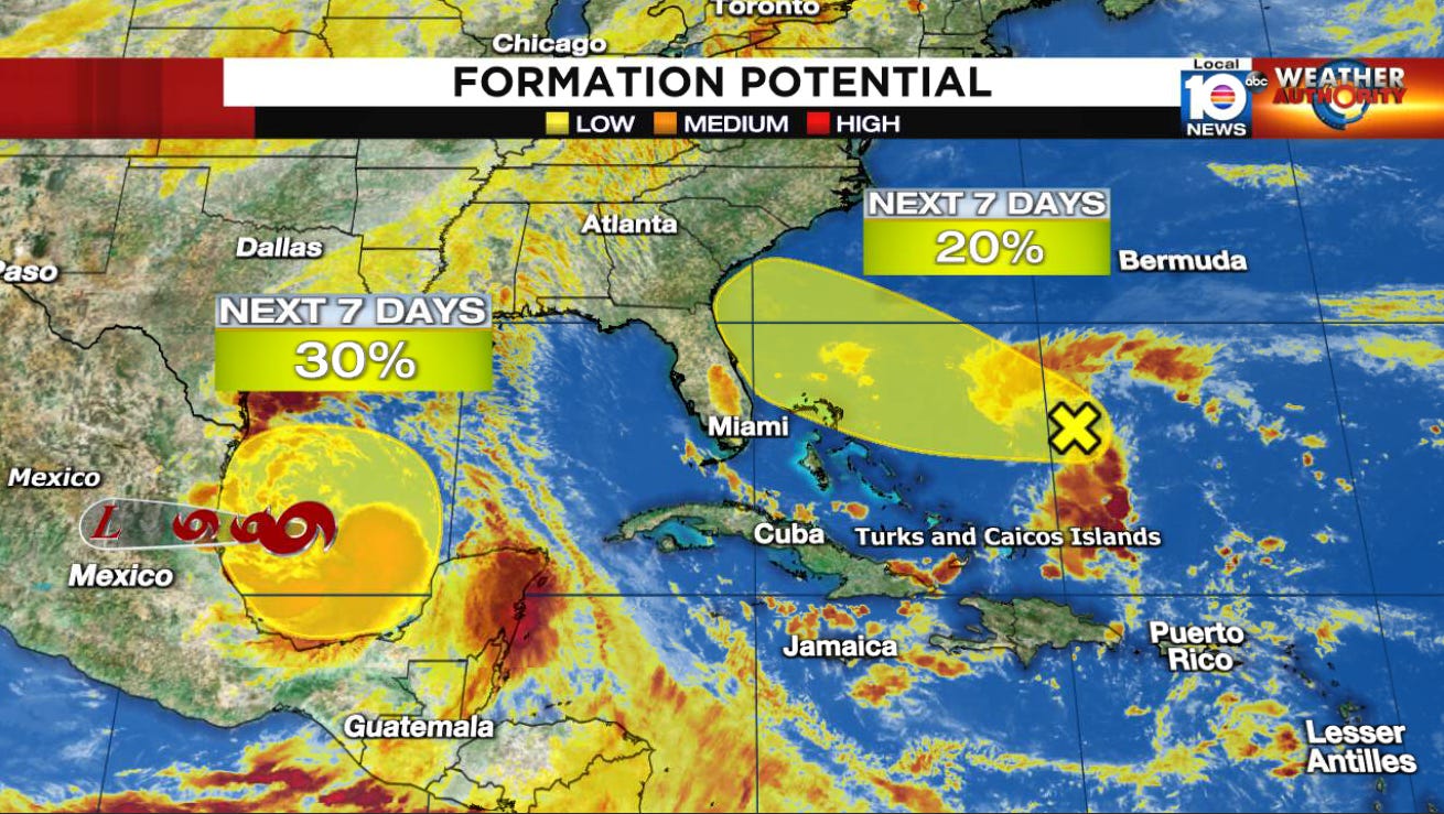
Forecast models continue to advertise yet another broad area of low-pressure taking shape on the heels of Alberto in the southern Gulf this weekend. For now the Hurricane Center gives the area a low chance of development but regardless another tropical surge will overspread many of the same areas affected by this week’s weather beginning Saturday into Sunday.
None of our models indicate significant tropical development with this secondary disturbance but it could compound any flood issues encountered over the next few days. Much of northern Mexico and South Texas need the rain, so hopefully the rounds of showers are of the beneficial rather than flooding variety.
Disturbance expected to stay weak as it approaches the southeast U.S. late tomorrow
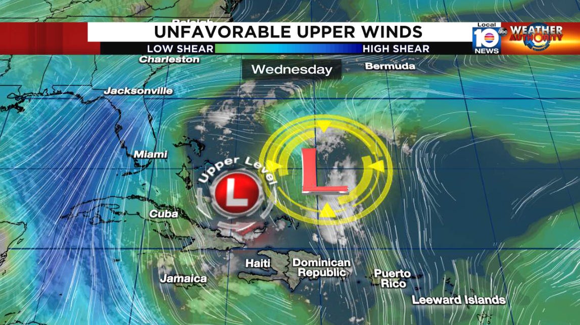
The area of low pressure nearing the Bahamas that we first wrote about on Sunday is showing a little more spunk this morning. The same upper-low that’s helping to spark storminess over the disturbance is also holding it in check with strong southerly wind shear.
High pressure steering to the north will sweep the system toward the southeast U.S. for tomorrow and Friday, but earlier indications it might sync up with the attendant upper-level low and find a pocket of low wind shear have faded. With strong upper-level winds tearing at developing storminess, it’s unlikely we’ll see any significant development before it reaches the coast early Friday.
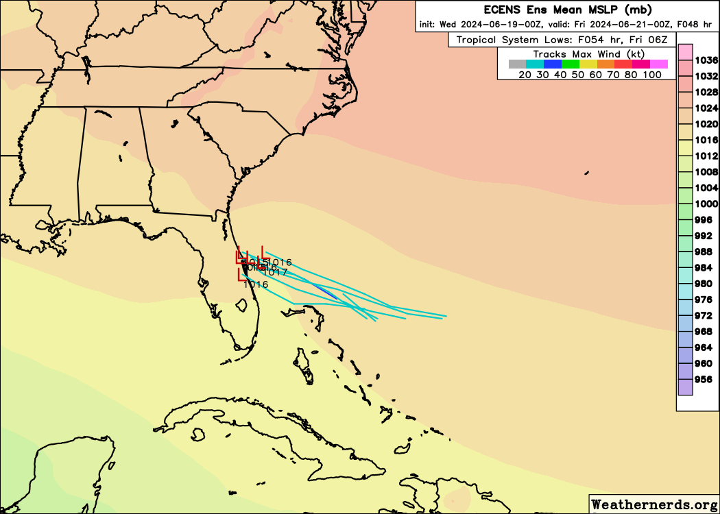
Any inclement weather will remain largely north and east of the low-pressure area, and South Florida shouldn’t see any direct impacts. The disturbance may bring elevated rain chances farther up the east coast of Florida through the South Carolina Lowcountry, but the main hazards will be in the water, where the system will worsen already-agitated surf and dangerous rip currents for most beaches along the southeastern U.S.
Unfortunately, it’s not the best week for those hoping to enjoy the early summer waters off the southeast coast. Be mindful of red and double-red flags at the beach which signify dangerous surf or waters closed to the public and be sure to always swim at guarded beaches.


