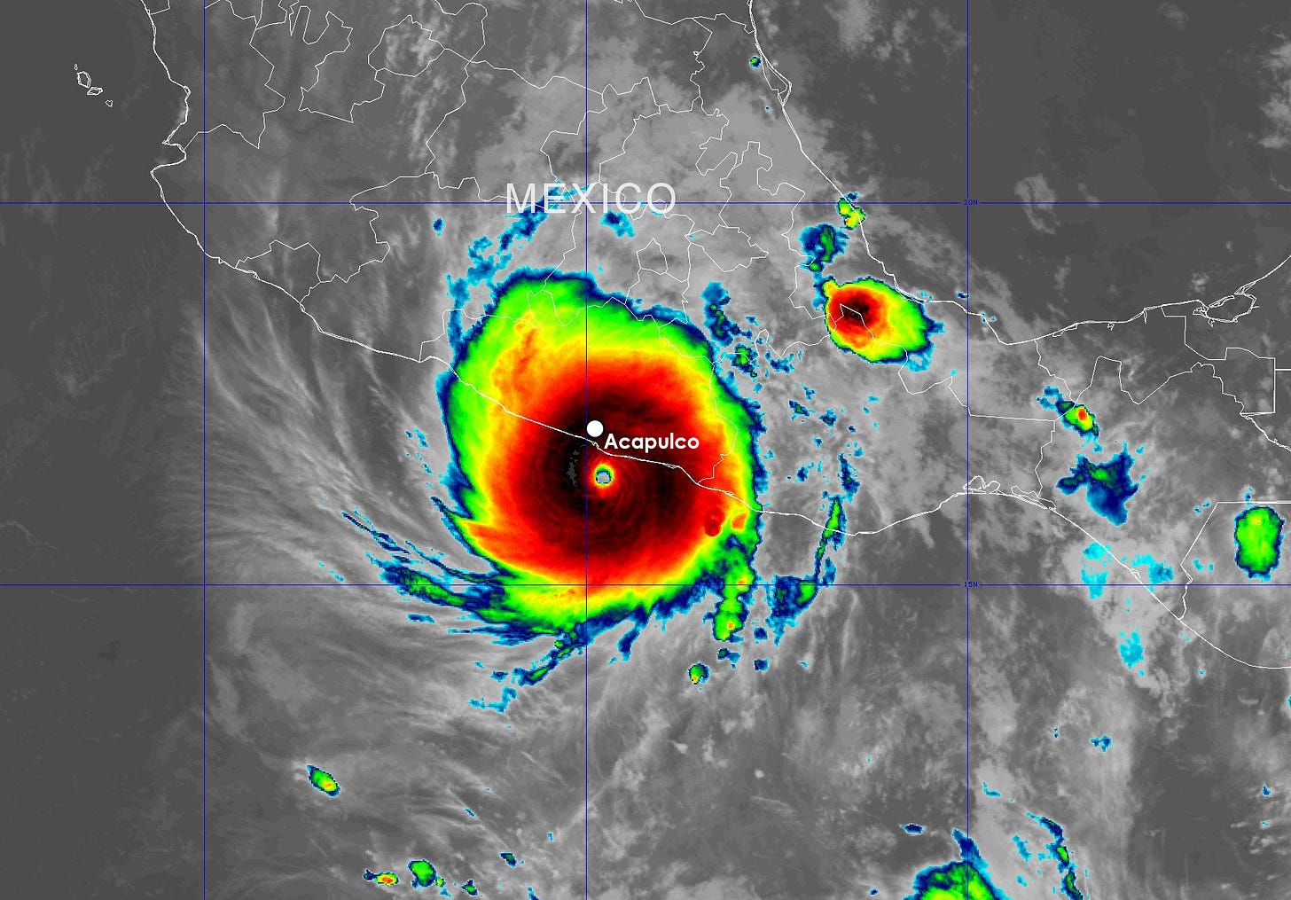
"Nightmare Scenario": Otis Stuns Forecasters, Rapidly Strengthens and Strikes Acapulco as a Category 5 Hurricane
Otis strengthened unexpectedly from a tropical storm to a Category 5 hurricane in the 24 hours leading up to landfall in Mexico on Wednesday

Only 24 hours before it hit, Tropical Storm Otis was forecast to come ashore along Mexico’s Pacific coast as a Category 1 hurricane. Instead, the storm rapidly strengthened 110 mph in 24 hours – a rate exceeded only once (Hurricane Patricia in 2015) by any observed Pacific or Atlantic hurricane – striking near Acapulco around 2:25 AM ET Wednesday as a catastrophic Category 5 hurricane with estimated winds of 165 mph, the strongest hurricane on record to hit Mexico from the Pacific side.

The stunning rate of strengthening – so fast by late Tuesday that satellite estimates couldn’t keep pace – was poorly forecast by all major hurricane models, with virtually none predicting more than a borderline Category 1 hurricane before landfall in Mexico.

Such unforeseen rapid intensification – from a tropical storm to a Category 5 hurricane on approach to land – underscores what’s long been viewed as a hurricane forecaster’s worst nightmare. The National Hurricane Center characterized the situation as a “nightmare scenario” for southern Mexico – including the Acapulco metropolitan area, home to over 1 million people – noting “no other hurricanes on record even close to this intensity for this part of Mexico.” The few hurricanes on record to pass near Acapulco never exceeded Category 1 status – Pauline in October 1997, Bridget in June 1971, and an unnamed hurricane in June 1951. Otis was an unprecedented landfall for this stretch of coastline.

Otis comes only two weeks after Category 4 Hurricane Lidia came ashore 40 miles south of Puerto Vallarta, Mexico, with 140 mph winds upon rapidly strengthening from a 75-mph hurricane in the 24 hours leading up to landfall. So far in 2023, the northeast Pacific has recorded 8 Category 3 or stronger hurricanes – nearly double the average – including five Category 4 hurricanes and two Category 5 hurricanes in the basin’s most active hurricane season since 2018.
Otis will quickly weaken inland over the mountains of Mexico but heavy rains will continue to produce flash flooding and the possibility of mudslides in areas of high terrain through Thursday.
Tammy restrengthens over the open Atlantic, forecast to become a large and powerful extratropical storm this week
Tammy is making a run at Category 3 strength this morning over the open waters of the western Atlantic, outrunning forecast expectations. The hurricane is expected to merge with a cold front by tomorrow and transition into a much larger hurricane-strength extratropical storm.
Tammy will gradually weaken into the weekend as it bends back toward the west or even west-southwest. Interests in Bermuda will want to continue to monitor the progress of Tammy and its extratropical spinoff. Though forecast uncertainty remains high, the storm system could pose a threat to Bermuda over the weekend.

As we’ve discussed in newsletters this week, though Tammy’s remnants could dip southwestward, it would likely remain weak in such a scenario and isn’t a current concern for Florida or the mainland U.S.


As always, thank you so much for a great update!
I feel very sorry for the people within striking distance of Otis. it will be hellish for them and with the strengthening happening so fast many won't be able to evacuate in time. I hope all stay safe.