


Monitoring the Caribbean into Next Week
No threats to South Florida or the mainland U.S. for the time being

As we discussed in last Thursday’s newsletter, history shows us the Caribbean is the main hot spot for late season tropical development. Right on cue, our forecast models are keying in on potential tropical activity late this weekend into next week down in the southern Caribbean Sea.
The key features we’ll be following are a tropical wave currently moving through the deep tropical Atlantic and an elongated strip of low pressure dangling into the central and eastern Caribbean. These two stormy areas are set for a Caribbean collision late this weekend where conditions look reasonably conducive for development.
Unlike in the Gulf of Mexico where water temperatures peak in late August and dip into the 70s by early November, the Caribbean is typically at its warmest in late September and doesn’t usually fall below 80 degrees until January. And unlike in the Gulf where temperatures have cooled recently, Caribbean waters are quite toasty, averaging around 85 degrees this week. It’s an important contrast that underscores the potential for late season development to our south.

That said, this isn’t something South Floridians or the mainland U.S. needs to be concerned with at this time. The upper-air pattern will tuck development odds away in the southern or western Caribbean into next week. A blistering zone of wind shear courtesy of an active subtropical jet stream isn’t going to let anything organized survive near our shorelines for the foreseeable future.

High pressure steering to the north would favor a westward track toward Central America for anything that forms next week, but we’ll need to see what shakes out over the weekend before speculating too far. The bottom line is it’s something to keep an eye to, primarily for interests in the Caribbean next week.
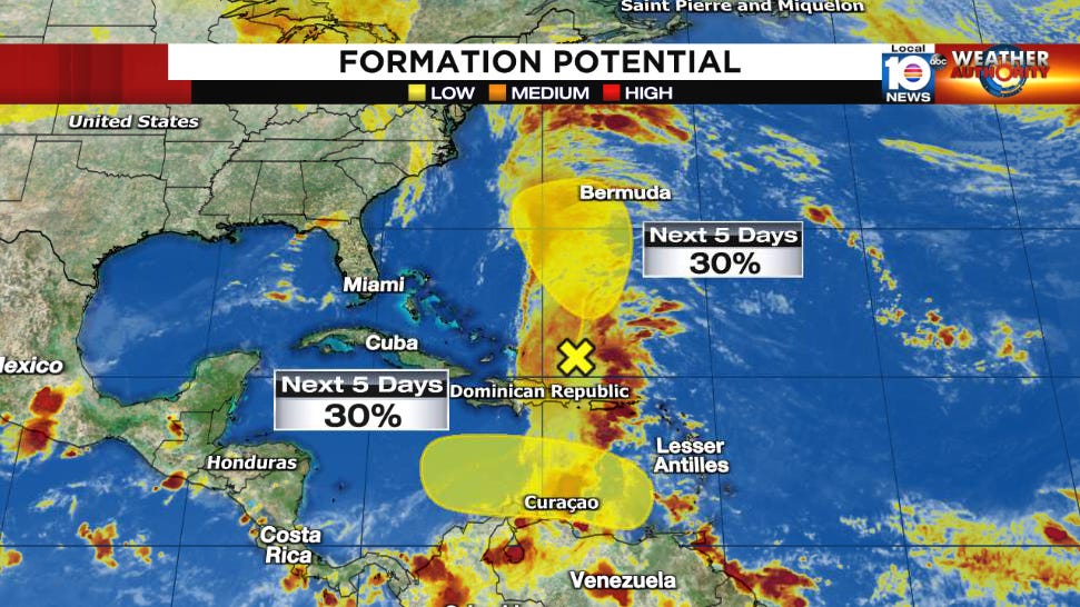
Elsewhere in the Atlantic, an area of low pressure north of the Dominican Republic and Haiti is forecast to lift northward toward Bermuda this week, where it’ll loiter around into the weekend. Although some development is possible with the system over the next few days, significant development appears unlikely.