La Niña on the Way: What it Means for Hurricane Season
El Niño’s official demise may come as early as the end of June and La Niña is close on its heels
It’s easy to get lost in the back-and-forth banter of El Niño vs. La Niña and forget which is better for hurricane season.
So let’s quickly review. El Niño is the abnormally warm tongue of water in the eastern Pacific straddling the equator, extending westward from Ecuador and Peru. A quintessential strong El Niño looks something like the one that just peaked last December.

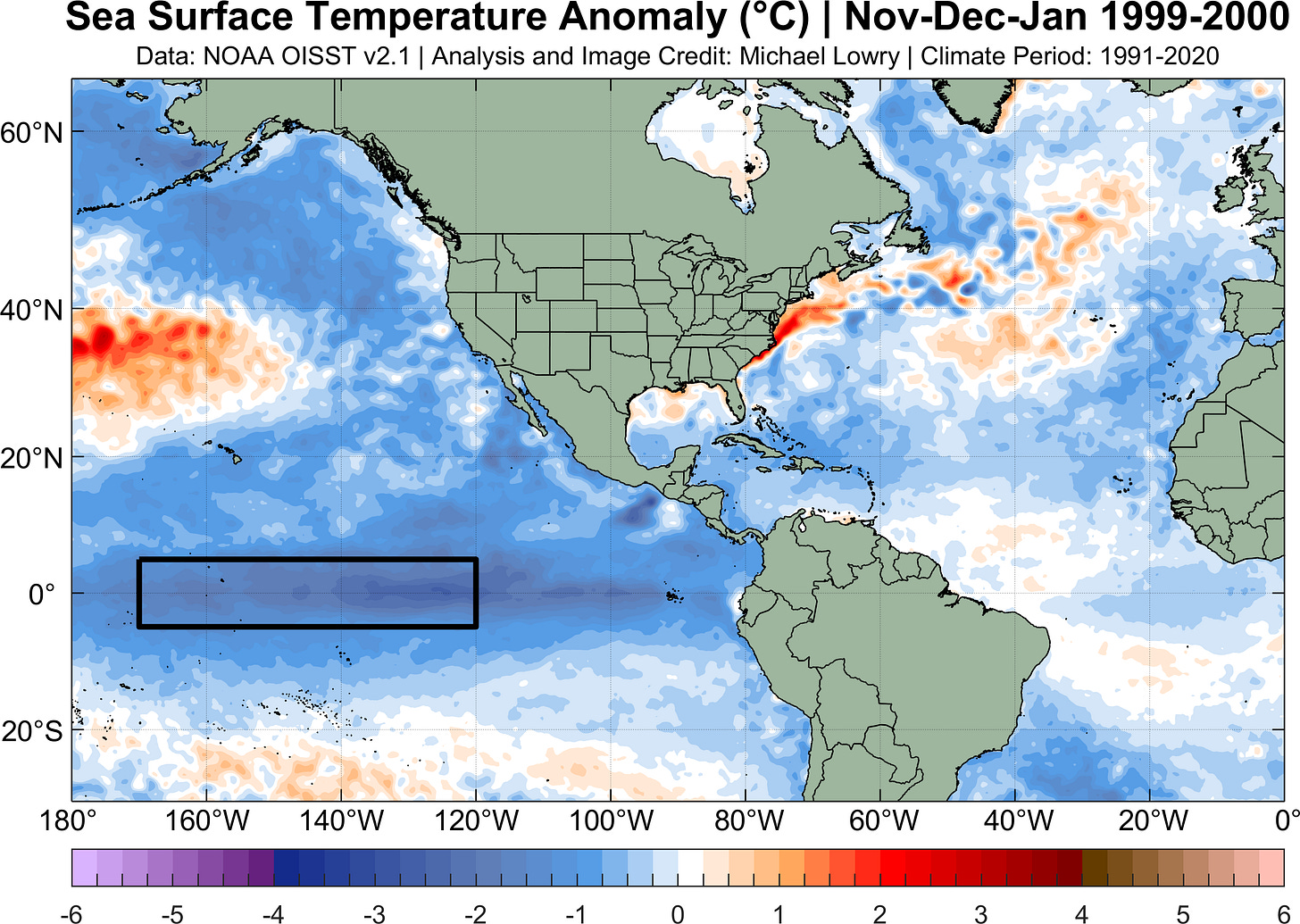
La Niña sits on the other side of the ENSO (El Niño Southern Oscillation) see-saw, with abnormally cold waters on either side of the equator in the eastern Pacific. It looks something like this in its textbook form.

Of course, neutral is somewhere between these warm (El Niño) and cold (La Niña) episodes.
Both La Niña and El Niño tend to peak around Christmastime (late December) and the origin of the moniker refers to the Christ child, since the warm episodes were first noticed by Peruvian fisherman near the time of the Nativity.
Are we in an El Niño or La Niña?
According to the strict definition, we’re still in the waning days of the strong El Niño that peaked last December, but for all intents and purposes, we’re in a neutral phase.
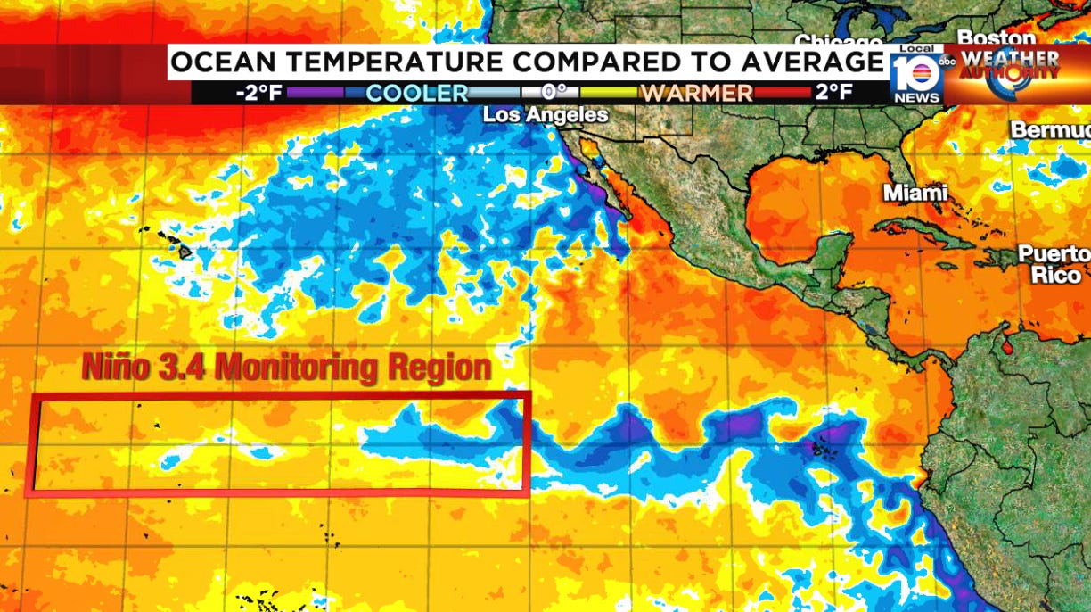
Generally speaking, when water temperatures in a certain monitoring region in the eastern Pacific – known as the Niño 3.4 Region – are within half a degree Celsius of average, neither El Niño nor La Niña conditions are present. Only when the waters deviate above or below half a degree Celsius from average in this monitoring region do we enter El Niño or La Niña territory.
The following animation shows the progression from El Niño to neutral conditions ongoing across the eastern equatorial Pacific.

La Niña is forecast to arrive by peak hurricane season
The waters in the eastern Pacific are forecast to continue to cool into the fall. Government forecasters predict La Niña will most likely arrive sometime between July and September and persist through the most active part of the Atlantic hurricane season from August to October.

According to NOAA, there’s only about a 20% chance we don’t see a full fledged La Niña by the time the hurricane season peaks this fall.
Is El Niño or La Niña better for hurricane season?
For the Atlantic hurricane season, we always pull for El Niño. Usually, El Niño pumps up wind shear across the tropical Atlantic – especially in places close to land areas like the Caribbean – and that can really stifle hurricane activity. Recently, El Niño has been less effective at reducing hurricane activity because the unprecedented Atlantic warmth has counteracted its usual influence.
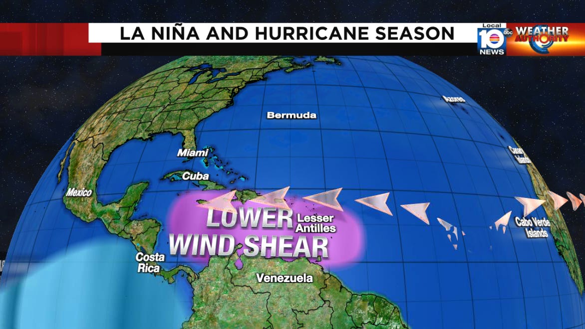
La Niña is something we don’t like to see heading into the Atlantic hurricane season. The wind shear that can inhibit hurricane development is reduced during robust La Niña episodes.
Not only that, but the wind shear is mostly reduced in the western Atlantic, and the number of mainland U.S. hurricane landfalls has been shown to be nearly twice as high during La Niña years (and even higher for Category 3 or stronger hurricanes).
Needless to say, the forecasts for an impending La Niña combined with chart-topping waters across the tropical Atlantic are giving everyone some pause this hurricane season.
All quiet in the Atlantic for now
As we discussed in Monday’s newsletter, a staunch jet stream through the Gulf and Caribbean will keep the tropics quiet into the weekend.
By middle next week, the jet stream will lift northward which may allow for some tropical moisture to spread into South Florida. For now, models don’t show any threat of tropical development, but as upper-level winds begin to relax, we’ll keep an eye to the western Caribbean and Gulf as we head into the middle part of June.


Wow, THANK YOU SO MUCH for this excellent information about el nino and la ninya defination and development! This topic is something my husband and I talking a lot about. This was terrific information!