Harold Heralds First Atlantic Landfall of 2023, Franklin Floods Hispaniola
Harold moving farther inland as a tropical depression, Franklin brings flooding rains to the Dominican Republic and Haiti today through Thursday. No current threats to South Florida.
As storms are wont to do this time of year in the western Gulf – especially this August with Gulf sea surface temperatures soaring to all-time highs – Tropical Storm Harold quickly regrouped and attempted to strengthen in the hours before landfall over South Texas late Tuesday morning. Harold is the first landfall of the 2023 Atlantic hurricane season. The median date for first U.S. landfall is July 15th, based on 1966-2022 climatology.
Fortunately Harold moved inland before gathering too much steam, but still packed a punch, bringing wind gusts of 60-70 mph to the beaches of North Padre Island and Corpus Christi, resulting in sporadic power outages and minor coastal flooding. Rainfall totals of 4-6 inches were largely welcomed in an area plagued by moderate to severe drought.
Harold has since weakened to a tropical depression over northern Mexico and west Texas, but continues to bring heavy rains to the Big Bend region of Texas.
Franklin, Emily’s ghost, and 92L
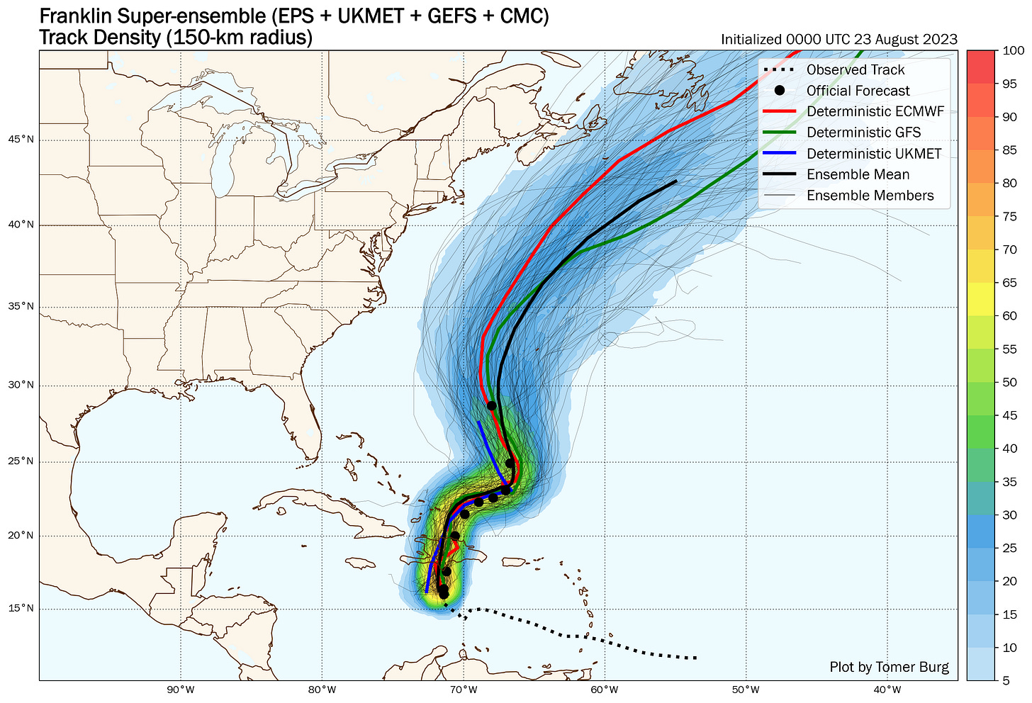
Meanwhile in the central Caribbean, Tropical Storm Franklin is traversing the island of Hispaniola today, bringing torrential rains, life-threatening flash flooding, and mudslides to the Dominican Republic and Haiti through tomorrow. Although Franklin’s circulation will be disrupted by the high mountains of Hispaniola, the system is expected to reorganize and strengthen into the second hurricane of the season over the southwestern Atlantic later this week. While forecast guidance keeps Franklin east of the U.S., interests in Bermuda will want to continue to follow the storm’s progress into early next week as it makes its closest approach.

Otherwise across the broader Atlantic, the remnants of Emily may briefly reform in the next day or two but will head quickly into the North Atlantic graveyard. Elsewhere, Invest 92L over the central Atlantic should stay weak and out to sea.
What we’re watching for next week
As we mentioned in earlier newsletters, models indicate a broad gyre of low pressure around Mexico’s Yucatan Peninsula and Central America to start next week. For now, models are unenthusiastic on development, but it’s an area we’ll keep an eye on as we head into the weekend.


Love these notes! Thanks for sharing!