Eyes to the Caribbean Next Week
Disturbance moving toward the Caribbean could develop as it tracks westward next week
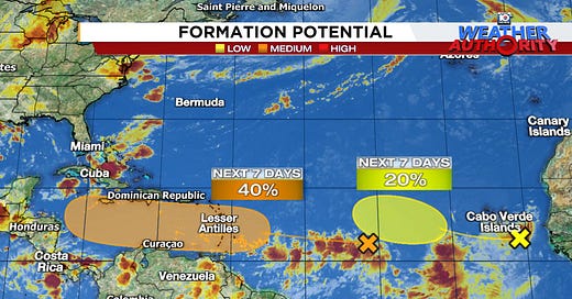
A disturbance currently located over the central Atlantic is forecast to slowly develop as it moves westward toward the easternmost Caribbean islands to start next week. The system will track deep into the Caribbean for the latter part of next week where conditions could favor more pronounced organization.
Interests throughout the Caribbean should closely monitor the progress of the system this weekend and into next week.
A little time to cook
Forecast models indicate the system will take a little time to come together this weekend. As we discussed in previous newsletters, the disturbance is embedded in a wider strip of storminess and spin draped across the eastern Atlantic and will need to consolidate and break away from this broad area of storminess first before development begins in earnest.

This means while we could see a tropical system (tropical depression or tropical storm) form before reaching the islands, we shouldn’t expect quick development east of the islands. The system should reach the Lesser Antilles at the entrance to the eastern Caribbean by late Monday into Tuesday, where it will continue westward into the middle and latter part of next week.
Warm waters ahead
In general, staunch high pressure steering to the north doesn’t favor a turn out to sea, so the mainland U.S. will want to follow the progress of the system come next week. The bigger concern is as it moves deeper into the western Caribbean later next week, where conditions appear more conducive to organization. Waters across the Caribbean are as warm as we’ve ever recorded them for the time of year and the overall upper-level wind pattern will be in a fairly conducive configuration.
A reservoir of some of the warmest, deepest waters anywhere on the planet is sitting in the western Caribbean and while that alone doesn’t guarantee anything, it does tell us to take approaching systems, especially developing or organizing systems, more seriously.

We’ll need to see exactly how the system comes together over the next several days before saying more about the forecast beyond the early part of next week. For now, the most immediate threat will be in the islands of the Caribbean beginning late Monday and extending into the middle part of next week.

Folks in Florida and along the U.S. Gulf Coast will want to check back periodically for forecast updates deeper into next week.
NHC adds another area to the map
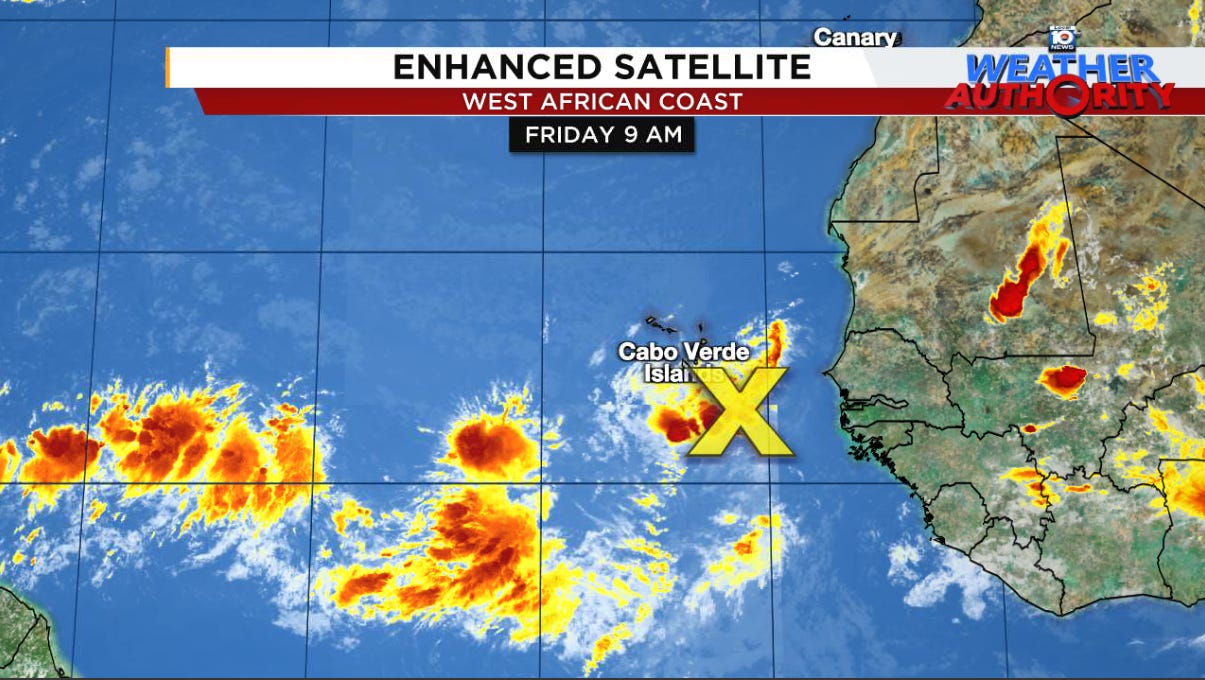
The large disturbance that we first mentioned in Wednesday morning’s newsletter was added to NHC’s tropical outlook map by Thursday evening.
The good news with this system is it’s far out over the eastern Atlantic and will be moving slowly so we have plenty of time to monitor it. For now, it’s simply a reminder that the busy part of the hurricane season is upon us.


Thank you, Mr. Lowry ⚘
Knew it was too good to last much longer. Looks like it is about to get hot and heavy soon. Darn it!