Bret Forecast to Strengthen, Head Toward the Caribbean Islands
Another disturbance in the eastern Atlantic poised to develop later this week
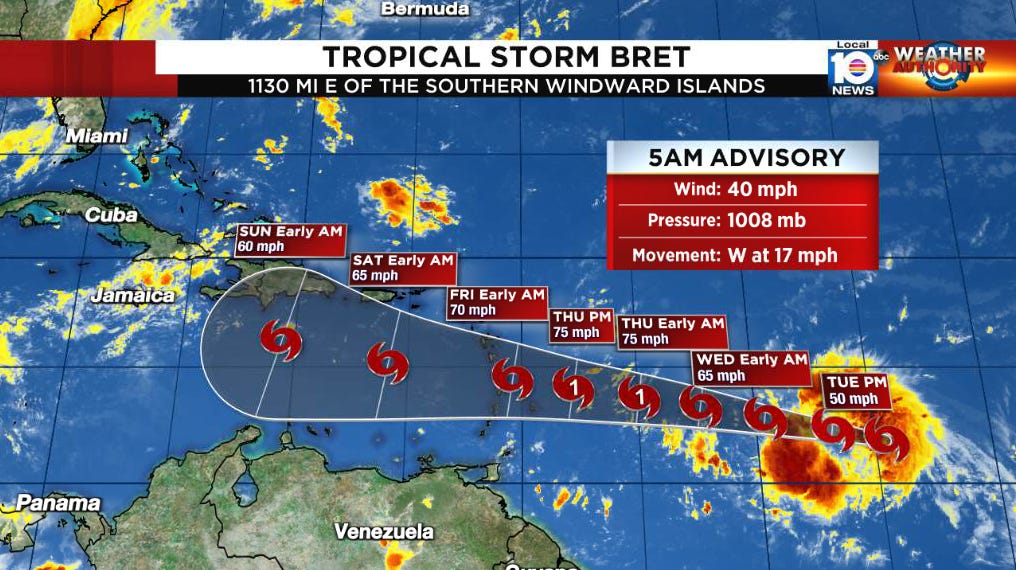
Tropical Storm Bret formed yesterday morning in the far eastern Atlantic, farther east than any other named storm in June by over 1200 miles. As we discussed in Monday’s newsletter, the first storm formation in the deep tropical Atlantic doesn’t typically come until around the first week of August. Only once since records began in 1851 has a June hurricane formed east of the Caribbean (the 1933 Trinidad hurricane). Bret is forecast to be the second June hurricane to do so by Thursday as it approaches the eastern Caribbean islands.
The good news so far is that Bret hasn’t been quick to strengthen. Yesterday, we mentioned the size of the system would likely mean slower organization. So far that’s been the case. Morning microwave satellite also indicates a still-undeveloped core, with the most intense storminess removed east of the circulation center, likely suggesting development struggles from westerly wind shear.

Although the official forecast continues to call for strengthening into a hurricane over the next few days, it’s worth noting that intensity guidance has largely trended downward and the NHC now forecasts Bret to be a tropical storm by the time it reaches the eastern Caribbean islands late Thursday or early Friday. Watches will likely be issued for parts of the Lesser Antilles later on Tuesday.
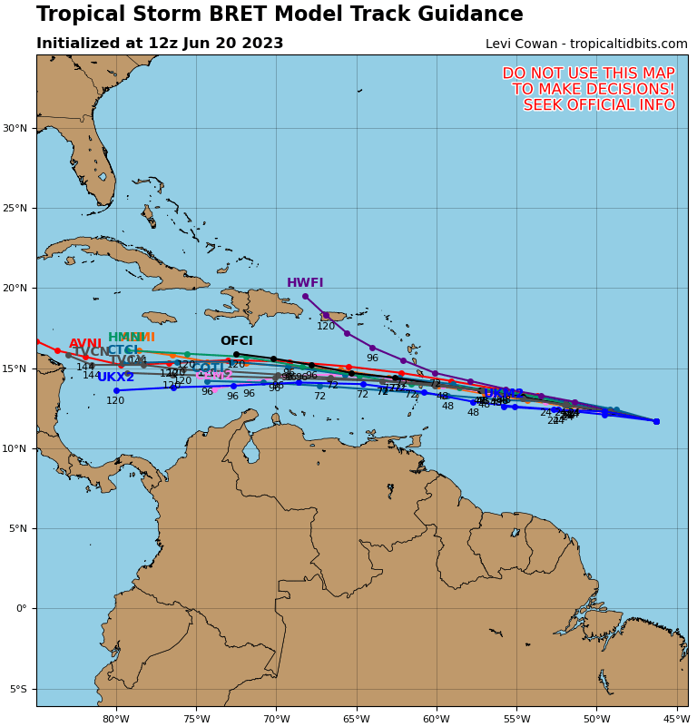
Computer models have come into much better agreement on Bret’s track this weekend, with a westerly course into the central and western Caribbean by early next week. Increasing wind shear in the Caribbean and drier air will combine to quickly topple Bret as it moves south of Puerto Rico and Hispaniola Friday and Saturday. With a more southerly track, the primary threat to Puerto Rico and the U.S. Virgin Islands will be increased seas and rip currents late week and over the weekend. It’s unlikely Bret survives beyond the central Caribbean and poses no threat to South Florida or the mainland U.S.
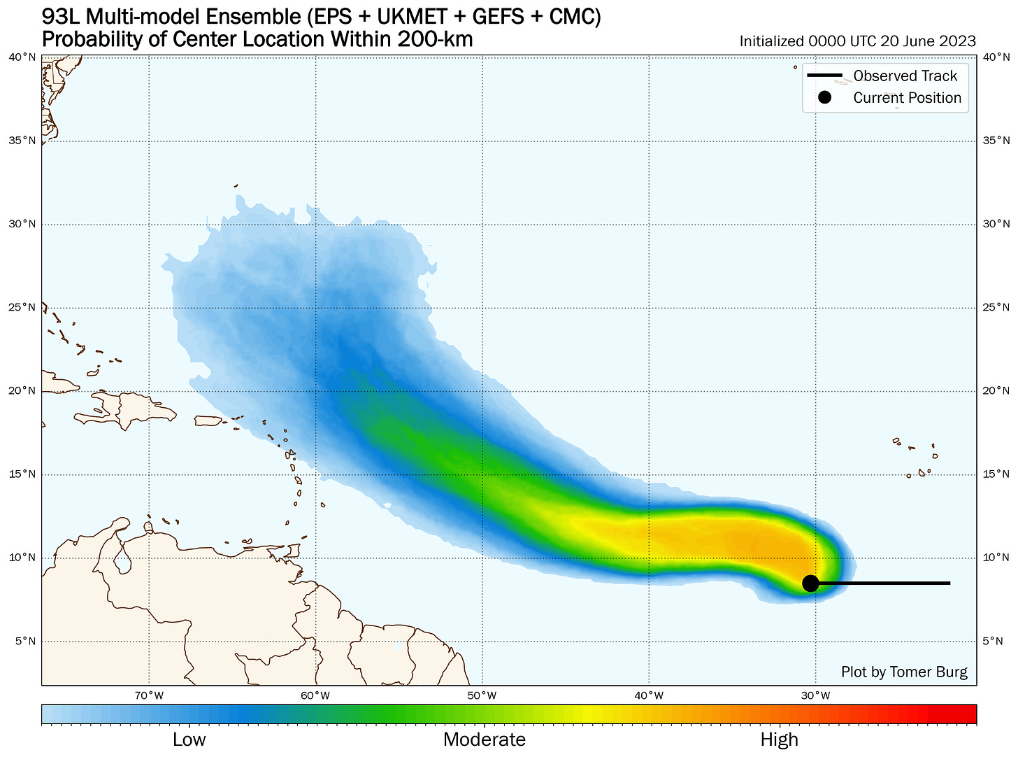
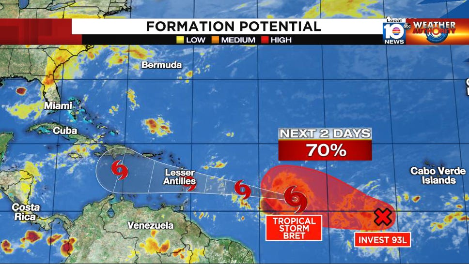
Behind Bret, we continue to monitor another potent tropical wave in the eastern Atlantic – dubbed Invest 93L – that will likely become our next Tropical Depression by tomorrow or Thursday.
While this would be another very unusual June system, unlike Bret it’s expected to take a more northerly trajectory and for now doesn’t pose any threat to land.
