Atlantic Heating Up, but Eyes on the Central Atlantic this Week
High chance Invest 91L becomes the Atlantic's next named storm
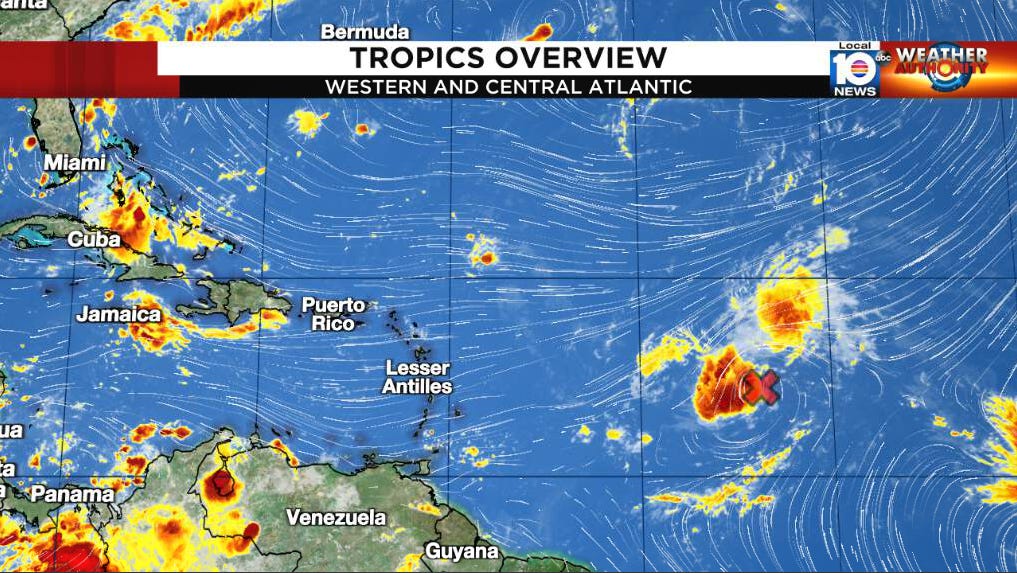
It’s looking a lot like late August out across the Atlantic today – with four areas being highlighted for potential development by the National Hurricane Center – but the broad low pressure area moving into the central Atlantic will be the main story this week.
A tropical wave that we’ve been tracking since it rolled off Africa eight days ago couldn’t overcome the many atmospheric impediments along the way and is briskly moving through the central Caribbean Sea near Jamaica this morning. With minimal storminess and a lackluster environment ahead, we’re not anticipating much from it before reaching Central America and southeastern Mexico early this week.
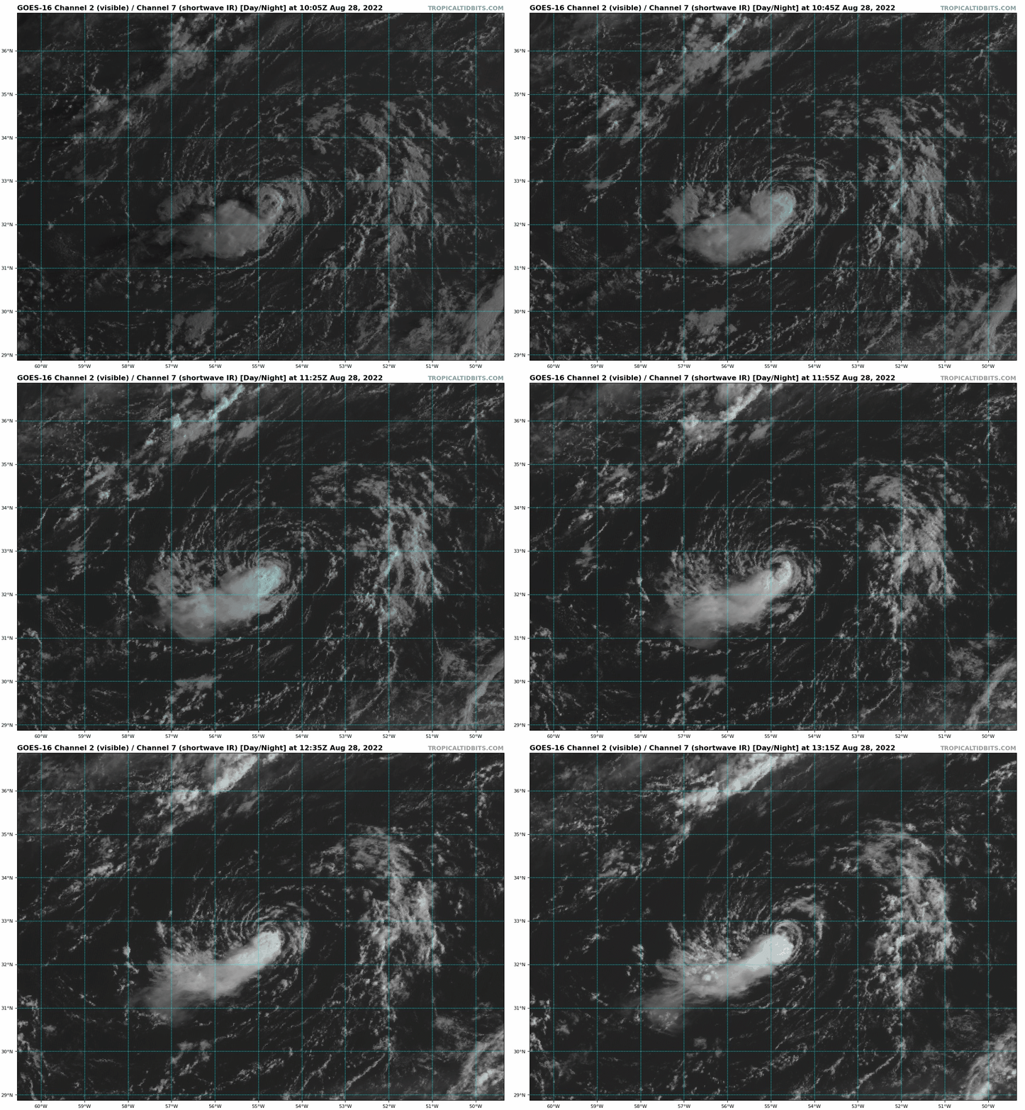
Meanwhile a small but tenacious low-pressure area that spun off a stalled front over the north-central Atlantic – designated Invest 92L by NHC yesterday evening – is meandering about 600 miles east of Bermuda. Showers and thunderstorms have been intermittently firing over the defined circulation but haven’t been able to persist due to steady northeasterly wind shear. It’s a tropical curiosity and doesn’t pose any threat to land but has low odds of development over the next day or two if convection is able to withstand the harsh wind shear.

The main act this week is the sprawling area of low pressure moving through the middle tropical Atlantic. With hearty support from forecast models, the NHC rightly raised the odds of the system – now dubbed Invest 91L – forming over the next five days to a high chance. As we mentioned in yesterday’s newsletter, the low-pressure area is large and still disorganized so it’s going to take a little time to cook.
Robust high-pressure steering to its north will weaken somewhat in the coming days due to a cut-off low in the middle part of the atmosphere pinwheeling southward, which will allow the system to not only gain a little latitude but slow down. By mid- to late week, with the cut-off low exiting the picture, subtropical high-pressure steering will rebuild, guiding 91L north of the northernmost islands of the Caribbean by Labor Day weekend. For now, models keep the core of the organizing storm north of Puerto Rico and the U.S. Virgin Islands, but the islands should stay vigilant, as the system is still in its formative stages.
91L doesn’t exactly have an easy road ahead. It will battle many of the same obstacles as other systems this year, including periodic intrusions of dry air and less-than-ideal upper-level winds. Because of this, intensity guidance isn’t terribly bullish for now, but there’s still a high likelihood of a named storm by the end of the workweek entering the western Atlantic.
The Turks and Caicos and southeastern Bahamas should carefully monitor the system this week and into next weekend.
Although extended-range models into Labor Day hint at a weakness in the western subtropical ridge (something we’d be happy to see in South Florida), it’s far too soon to say with any confidence what will happen that far out. There’s still a tremendous amount of uncertainty just in the next few days, so we’ll just keep a wary eye to this one in the coming week and be ready if the threat mounts.


