What Lies Ahead for the Atlantic?
It's been an usually quiet 45 days in the Atlantic, but late August is a make-or-break part of the hurricane season
If you’re a regular reader of the daily newsletter or follow the tropics with any consistency, you know how unusually quiet it’s been in the Atlantic since the start of July.
Since Tropical Storm Colin – which formed on July 2nd over South Carolina and quickly fell apart 24 hours later on July 3rd over North Carolina – the Atlantic hasn’t recorded any organized tropical systems over its vast expanse of waters from Africa to the Gulf of Mexico. The last time we’ve gone such a stretch without a single tropical depression, storm, or hurricane was 1999, which like 2022 was also a strong La Niña year.
But 1999 – “a year for which both overall hurricane activity and U.S. hurricane landfall probability [were] above average” – for all its early shortcomings, lit a fuse starting on August 19th, rattling off four named storms, three hurricanes, and two Category 3 or stronger hurricanes by the end of the month. By the end of the hurricane season, 1999 had bested even bullish seasonal forecasts and ended one of our most active seasons on record. The lesson isn’t that 2022 is another 1999, but rather that hurricane season can flip in an instant, and usually around this time of year.
To go 45 days in July and August without a named storm is undoubtedly unusual but not unprecedented. It happened in 1999 and it happened in 1967. On average a full 87 percent of tropical activity happens after today. Late August is a critical time of year in the timeline of a hurricane season. Even 1967 and 1999 had recorded named storms by the end of August, so we’re watching with bated breath to see what the next two weeks brings for the Atlantic.
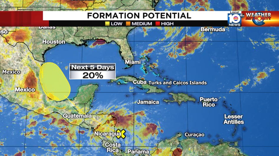
This week looks mostly quiet. The only active disturbance we’re following right now is the tropical wave in the southwestern Caribbean mentioned in yesterday’s newsletter headed toward northern Mexico and southern Texas for the upcoming weekend. Development chances remain low and the upshot will be the potential for more beneficial rains in the wake of Invest 98L to drought-stricken areas. This one isn’t a concern for us in South Florida.
Beyond this week, the long-range forecast models are showing signs of life, especially into the last week of August. The upper-level pattern will become more conducive to storminess across the deep tropical Atlantic, coinciding with the traditional ramp up in hurricane activity. It’s a bit premature to say much more today, but suffice it to say we’ll have more to add in the coming days as the outlook becomes clearer. Stay tuned.


The upper-level pattern will become more conducive to storminess across the deep tropical Atlantic, coinciding with the traditional ramp up in hurricane activity.
Oh crap! Knew it was too good to hope for a peaceful season.