Watching the Eastern Atlantic for Early Season Activity
Late June climatology is a high hurdle to clear, but a changing atmosphere ahead could lower the bar
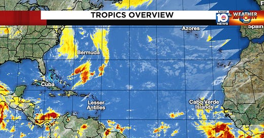
We continue to monitor the large disturbances – tropical waves – rolling off the coast of Africa every several days. Although it’s still early in the season to traditionally expect significant development with these rotating thunderstorm systems, there are a number of factors in place suggesting a more conducive environment ahead for some of the disturbances.
While the tropical Atlantic hasn’t completely shaken the Saharan dust that’s been plaguing it in recent weeks, the dust concentration has subsided since peaking early last week and is now running slightly below average. Forecasts show a steady reduction of overall dust cover over the coming weeks, with no major dust outbreaks on the horizon.

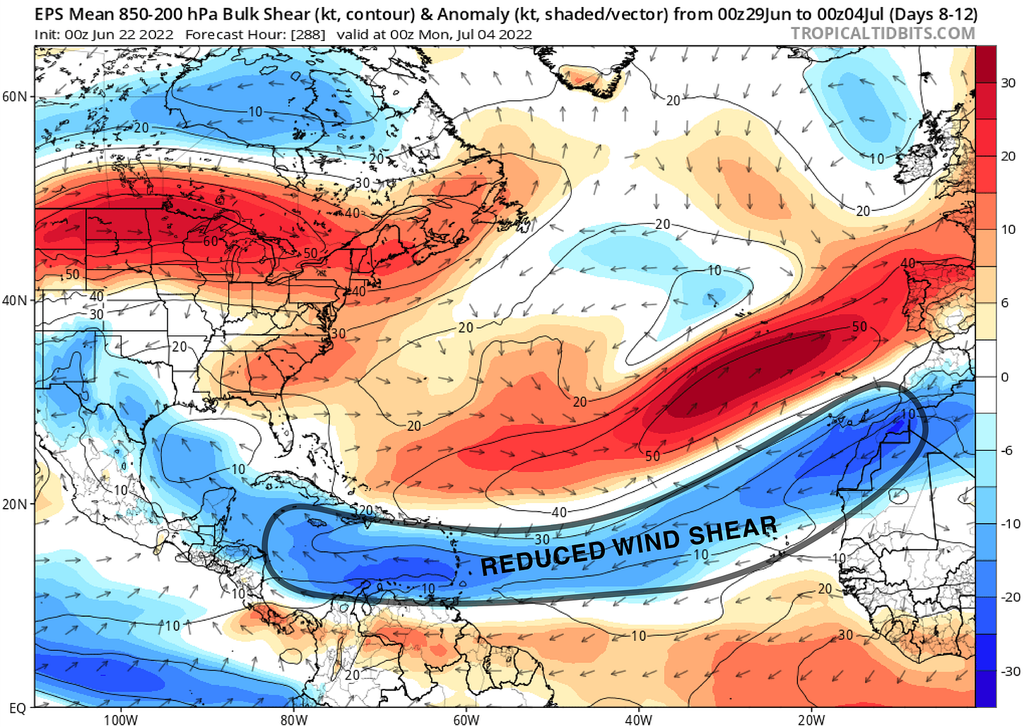
More importantly, models continue to advertise a sharp decrease in typically strong wind shear through the deep tropics over the next few weeks. These strong upper-level winds are generally the single most prohibitive factor to tropical formation across the eastern Atlantic in late June and early July. It’s not usually until late July and August that these blistering upper-level winds relax enough to allow budding disturbances to begin to organize.

As the large disturbances roll off Africa, they often get tangled up in the monsoon trough that drapes from Africa into the far eastern tropical Atlantic. This transition zone of winds – where winds from the southwest wrap into winds coming from the northeast – can act as an umbilical cord for fledgling tropical waves, providing a source of moisture and background spin needed to support early development. Far-south storms like Bertha in 2014 and Danny in 2015 can trace their beginnings to tropical waves propped up by the monsoon trough. The monsoon trough is currently situated farther north and west than usual, which may also ripen the environment ahead for tropical waves like the one moving off Africa this morning.
Although at this time computer models are only lukewarm on the idea of development across the eastern Atlantic tropical belt, it’s a trend worth following given the unusually conducive environment, especially by middle to later next week. Elsewhere, we’re not expecting anything of significance across the more typically favored areas of the western tropical Atlantic or Gulf of Mexico at least through the weekend.


