


Tropical Wave Train Picking Up but Models Muted for Now
Robust tropical waves dotting the eastern Atlantic tell us it’s August, but models aren’t biting just yet


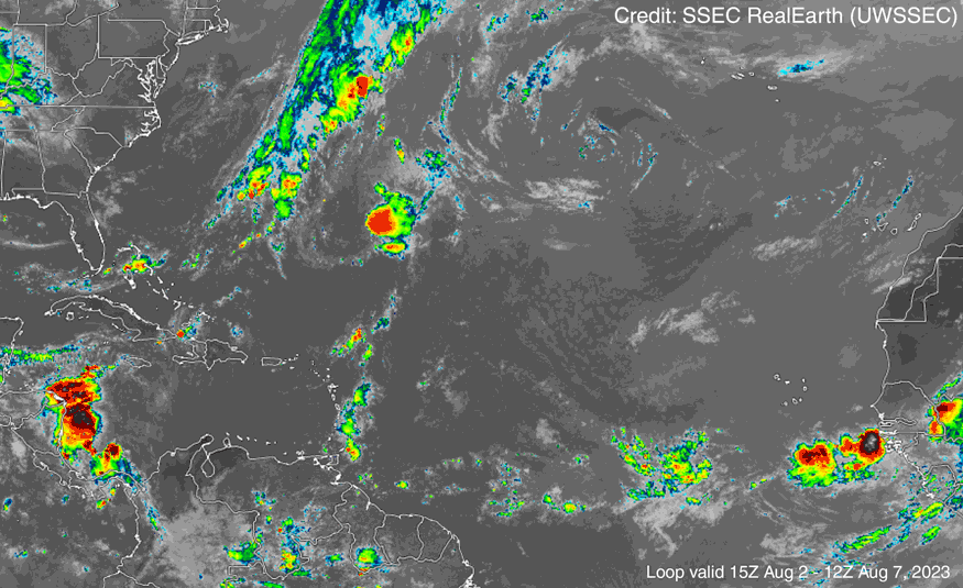
The sporadic sputtering of tropical waves peppering the Atlantic as they roll westward from Africa to the Caribbean is the telltale sign of August, but for now forecast models remain cold to development.
Nevertheless, it’s the time of year when subtle shifts – a change in day or location – can alter the outlook in a hurry. It’s the time of year we pay closer attention to these disturbances that might otherwise go overlooked in June and July.
Tropical waves – ripples in the east-to-west flowing atmospheric winds about 10,000 feet up that resemble ocean waves – are with us throughout hurricane season, but it’s in August that they have the greatest chance of development.

Although tropical waves are the seedlings for over half of all named storms each hurricane season, nearly 85% of the strongest Category 3, 4, and 5 hurricanes arise from them. So the waves are important, especially in August and September.
We’ll be watching two waves this week in the Atlantic, one currently midway between Africa and the Caribbean and the other just west of Africa. For now, they’re tangled up within an umbilical cord of storminess and background spin called the monsoon trough, which is giving them some flare on satellite.
Both of these disturbances will be driving westward this week, and although wind shear remains relatively light, a healthy dose of dry, sinking air east of the Caribbean islands will limit their development potential in the near term. As we discussed last Thursday, we’ll want to keep an eye on the westernmost disturbance as it enters the Caribbean later this week where conditions may become a little less hostile.
That said, none of our models show significant development in the week ahead with either of these two waves, but we’ll keep an eye on them for any mischief down the road.
Back here in South Florida, our biggest concern this week won’t be from tropical rainfall but from the triple-digit feels-like temperatures and the return of excessive heat, marking a continuation of what’s been the warmest summer on record for much of our area.