Tropical Storm Alex Finally Forms About 175 Miles East of Cape Canaveral While South Florida Dries Out From Saturday's Floods
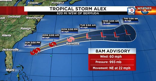
After flying six full missions into once Potential Tropical Cyclone One, the Air Force Hurricane Hunters were finally able to find a well-defined circulation center this morning about 175 miles east of Cape Canaveral, Florida. With winds already exceeding tropical storm strength (greater than 39 mph) near its center, this finding allowed the Hurricane Center to christen Tropical Storm Alex – the first named storm of the 2022 Atlantic Hurricane Season.
As of 9 AM ET Sunday, a new Hurricane Hunter plane just passed through Alex’s circulation center. While it’s still early in the mission, they’re finding winds near 80 mph at flight level (about 5,000 feet above the ocean surface), suggesting maximum surface winds near 60 mph, as indicated in NHC’s morning update.
Alex is forecast to make its closest approach to Bermuda Monday afternoon but should be commencing a weakening trend by then as it quickly accelerates eastward and toward the open north Atlantic.
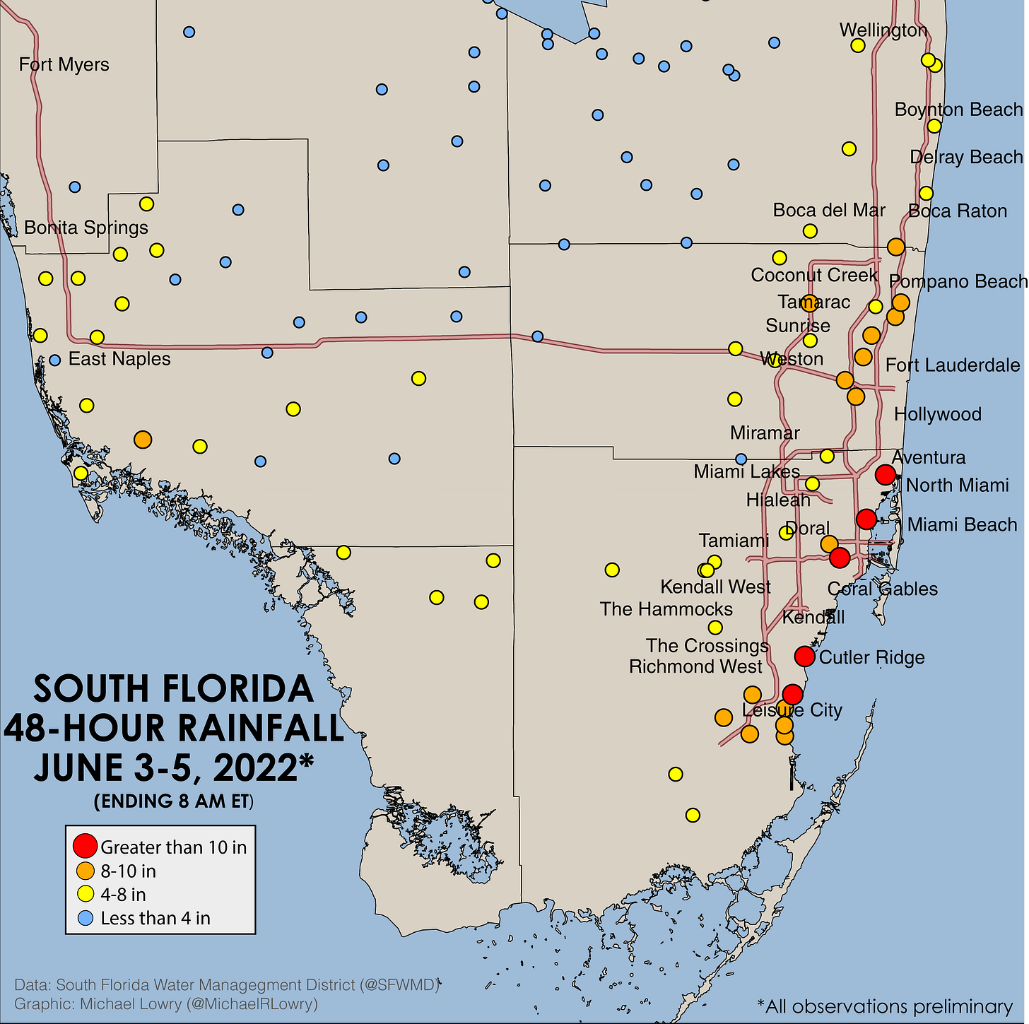
Back in South Florida, flooded areas continue to dry out after yesterday’s deluge. Preliminary totals indicate some spots in the Miami metro received over a foot of rainfall during yesterday’s heavy rains. The below map shows 48-hour rainfall totals from selected South Florida Water Management District (SFWMD) sites (ending 8 AM ET Sunday) across the area. While these observations still need to be quality checked, they give a general flavor or where some of the heaviest rainfall fell.
A return to more seasonal weather, with scattered afternoon showers and thunderstorms, is expected for the start of the week. Elsewhere in the tropics, things are looking nice and quiet.


