Tropical Development Possible in the Caribbean Later this Week
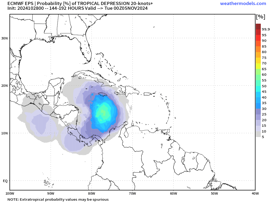
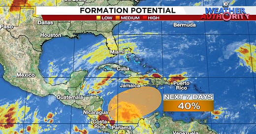
A tropical depression or named storm could form by late week or the weekend, but may meander into next week
As we detailed a week ago in this newsletter, the Caribbean is expected to make another run at tropical development later this week or into the weekend as we turn the calendar to November.
Over the weekend the National Hurricane Center added the potential development area to its tropical outlook and now indicates a tropical depression could form by late week as it drifts over the central or southwestern Caribbean.
Although the system will initially come about from the collision of winds between the Atlantic and Pacific, causing widespread storminess across the Isthmus of Panama, it’ll get an energy boost from a fast-passing jet stream dip come Friday into Saturday. This may hasten early development but will also mean nearby wind shear and dry air, so it’s also not an ideal setup for quick organization and likely means weather associated with it gets shunted toward the eastern Caribbean.
Unfortunately, the longer it takes to lift and organize this week, the longer it may just sit and fester over the Caribbean. Models show staunch high pressure building over the eastern U.S. and Florida by late week which will stifle thunderstorms and lead to breezy conditions over South Florida, but will also block the system in the Caribbean from escaping north and out to sea.

The upshot is the system may simply meander around the Caribbean and could even drift westward into next week. Models are all over the place on its eventual steering but since it’ll likely loiter for another 6 or 7 days, heavy rain and flooding could be problematic across parts of the central and eastern Caribbean – from Jamaica to Haiti and the Dominican Republic and even into parts of Puerto Rico.

For now, this isn’t a concern for the mainland U.S. and Florida. At least through this week, a curtain of wind shear will guard our shorelines stateside and high pressure will keep the late season shenanigans to our south. Of course we’ll monitor the trends if this lingers into next week, but as we discussed last week, climatology is a tall hurdle for storms to overcome once November rolls around.


Thank you for the info. Hopefully it will be well behaved and go out to sea if it does form.
Ty Mr. Lowry 😀
🍂🍂👻🍂🍂