Tropical Atlantic Rests in the Wake of Beryl
Beryl produces 113 tornado warnings on Monday, the most issued for any single July day since at least 1986
The eyewall of Hurricane Beryl – the ring of strongest winds and heaviest rain surrounding the eye – scraped through the Houston-Galveston area Monday morning, plunging over 2 million customers into darkness and delivering the strongest winds to the metro and highest storm surge into Galveston Bay since Hurricane Ike in 2008.
Winds gusted as high as 89 mph on the campus of Rice University only a few miles southwest of downtown Houston and storm surge flooding topped 5.5 feet at the head of Galveston Bay, with the combination of heavy rain and storm surge rocketing Houston’s web of bayous into major flood stage.
As Beryl’s outer bands dragged across eastern Texas and western Louisiana, it produced 113 tornado-warned storms Monday, the most tornado warnings ever issued by the National Weather Service on a single July day since records started in 1986.

So far, the Storm Prediction Center has confirmed 15 tornadoes from Beryl across eastern Texas, northwestern Louisiana, and southern Arkansas, with at least one fatality.
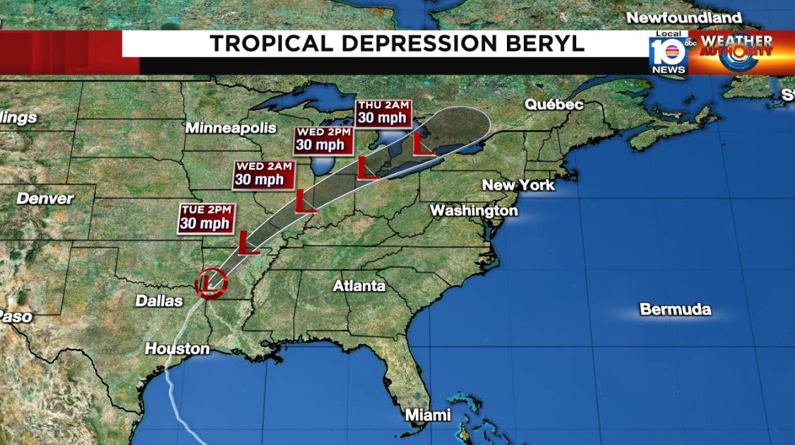
Beryl is quickly shedding its tropical characteristics over the Lower Mississippi River Valley but its tropical rains will bring the continued threat of scattered flash flooding and river flooding as far north as the Great Lakes region through tomorrow.
Atlantic pauses to catch its breath
Beryl catapulted the Atlantic to its most active start on record, outpacing even 1933 and 2005, our two busiest hurricane seasons on record. In fact, if the Atlantic were to observe only typical tropical activity from today through the end of the hurricane season, the 2024 hurricane season would still be classified as “hyperactive” according to Accumulated Cyclone Energy or ACE because of Beryl’s contributions.
Tropical activity tends to come in waves, even during the most active hurricane seasons. Hurricanes and tropical systems often cluster around the conducive configuration of upper-level winds – known as the Madden-Julian Oscillation or MJO – which is moving into a state less prone for tropical development in the Atlantic. Additionally, the Saharan dust from the deserts of North Africa is at its peak coverage across the Atlantic.
So for the next week or two we’re expecting activity largely to move into the Pacific, while the Atlantic catches its breath. But don’t be fooled by the mid-late July pause. We’re expecting the activity to pick up again, especially once we’re into August, as it always does.


