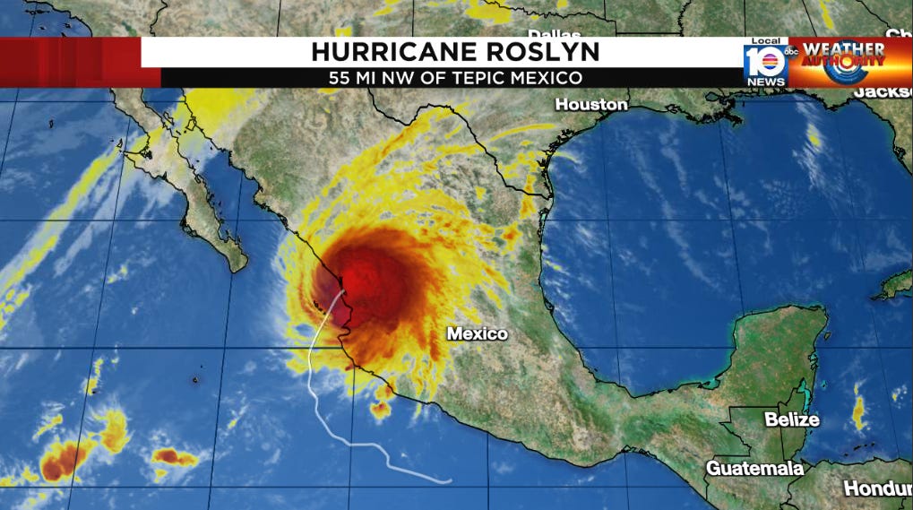
Roslyn Strikes Western Mexico, Strongest Eastern Pacific Landfall in 7 Years
Atlantic remains quiet this week
Hurricane Roslyn continued to strengthen yesterday as expected, with Hurricane Hunter aircraft finding winds of 130 mph during their afternoon mission while the storm was located about 150 miles southwest of Puerto Vallarta, Mexico.
Category 4 Roslyn – the third Category 4 hurricane of the busy 2022 eastern Pacific Hurricane Season – weakened only slightly overnight before coming ashore at 7:20 AM ET north of Puerto Vallarta in the Mexican state of Nayarit. With its 120 mph winds at landfall, Roslyn became the strongest hurricane to make landfall in the eastern Pacific since Patricia roared ashore some 175 miles to the south in Jalisco 7 years ago to the day on October 23, 2015.
While the mountainous terrain of the Sierra Madre Occidental will quickly shred Roslyn’s circulation today, torrential rainfall will accompany the system inland, where flash flooding and the potential for life-threatening landslides will be a major concern in the coming hours across west-central Mexico.
Here in the Atlantic, we expect another quiet week. Invest 94L in the north-central Atlantic is being blasted by strong upper-level winds and shows no signs of organization. It will move quickly to the west-northwest this week over the open Atlantic before jet stream winds whisk it northward toward the Canadian Maritimes.
Long-range models are beginning to sniff out the possibility of storminess by early November in the southern Caribbean, but it’s not something we need to worry about right now. As we’ve discussed in previous newsletters, we’d expect another named storm or two before the end of the season, but the progression of cold fronts lets us rest a little easier here in South Florida by this point in the season.


