
Powerful Typhoon Bavi Could Become the Strongest Storm of 2026 So Far, Takes Aim at U.S. Northern Mariana Islands
Typhoon watches issued for the Mariana Islands, including the U.S. territories of Guam and Saipan, as Bavi rapidly intensifies and threatens to strike Monday local as a Category 5 equivalent

The Western Pacific typhoon season is off to a scorching start in 2026, with four typhoons and one super typhoon (with winds of at least 150 mph) recorded so far.
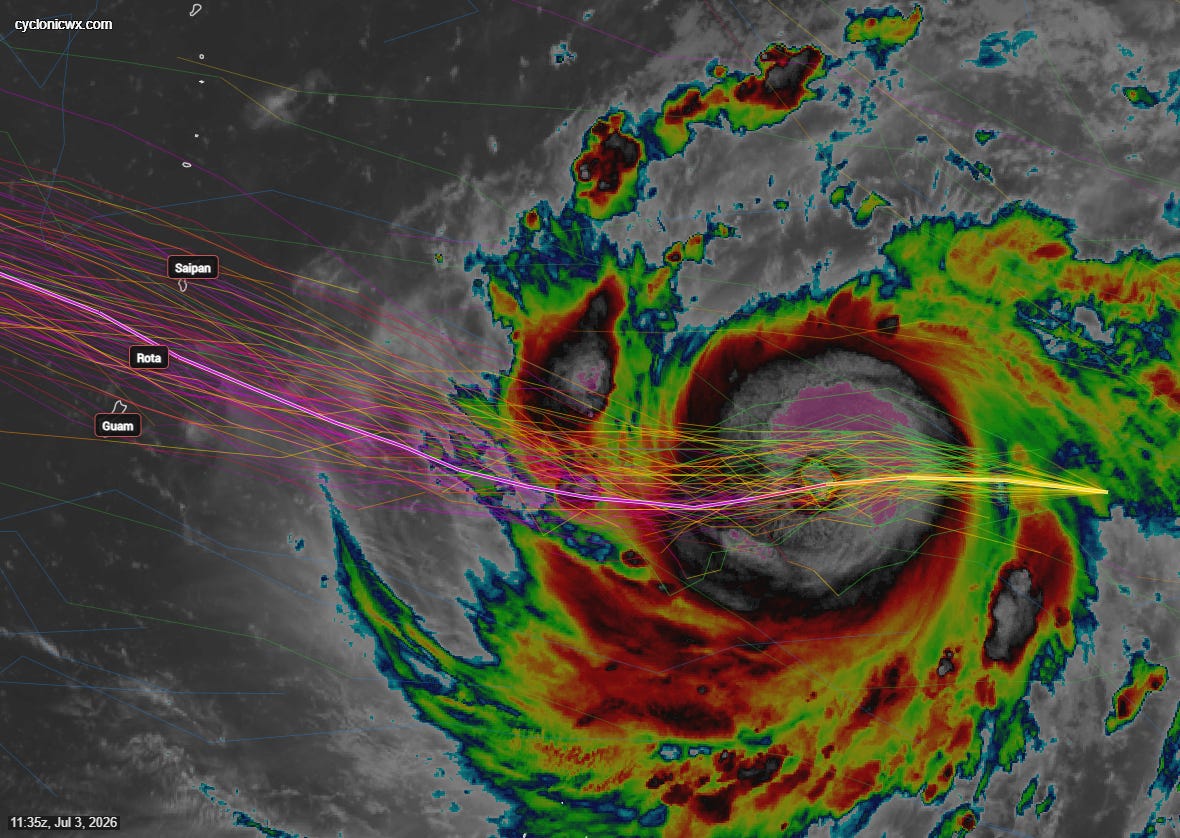
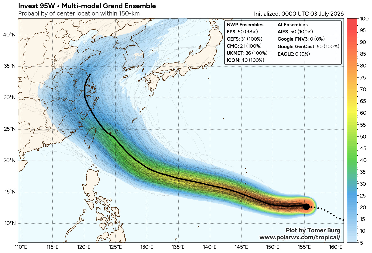
The world’s most active tropical basin, which churns out storms all year but is most active between May and October, is poised to deliver its most powerful storm of the year yet, as Typhoon Bavi rapidly intensifies and takes aim at the Mariana islands, including the U.S. territory of Guam and commonwealth islands to its north like Rota, Tinian, and Saipan by Monday, July 6th local time (Sunday, July 5th eastern time).
The National Weather Service in Guam issued a Typhoon Watch late Friday local for the entirety of the Marianas in anticipation of winds exceeding typhoon strength (74 mph or stronger) in the next 2 to 3 days. The office warns winds could top 170 mph across the archipelago as Bavi makes its closest approach, and seas could reach nearly 50 feet.
A typhoon is simply the regional term for a hurricane in the western North Pacific (like pop is to soda). Hurricanes and typhoons are physically no different and spin in the same direction (counterclockwise).
A worrisome forecast
Even for the seasoned, hardened Marianas – no stranger to the most powerful storms on Earth – Bavi’s forecast is a cause for concern.
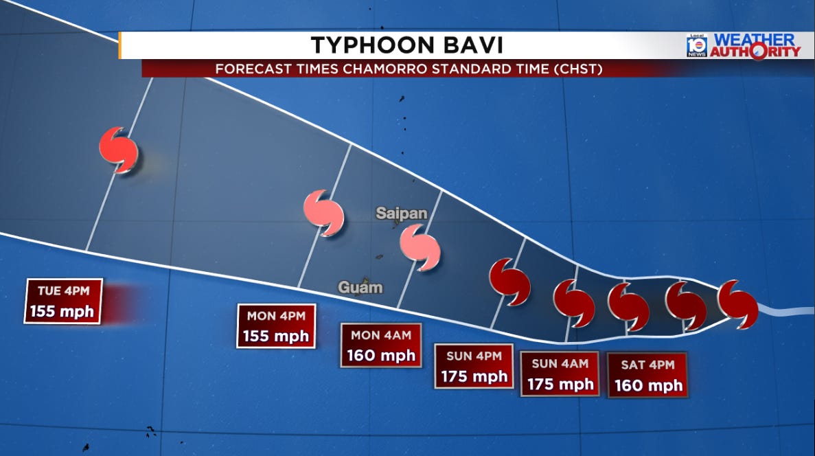
The typhoon was well on its way to super typhoon status early Friday and will likely reach Category 5 status in the next 6 to 12 hours. Officially, the Joint Typhoon Warning Center (the Department of Defense-operated hurricane center of the Pacific) is forecasting Bavi’s winds to top 175 mph as it approaches the Marianas in the coming days. This would rival Typhoon Sinlaku earlier this year as the strongest storm globally so far in 2026.
As of early Friday, roughly 60% of Google’s DeepMind machine learning-based ensemble system forecast Bavi’s intensity to top 180 mph.
Saipan, Tinian, and neighboring Guam are still recovering from Typhoon Sinlaku, which struck as a strong Category 4 equivalent typhoon back in April.
Although all islands in the Marianas will see impacts, Bavi’s center track will prove critical in the coming days, and small deviations could land the worst conditions anywhere from Guam to Saipan. As of Friday evening local (Friday morning eastern time), the most likely track takes the center of Bavi about 75 miles north of Guam between Rota and Saipan, but Guam, Rota, Tinian, and Saipan are all within the average error this far out and should closely monitor forecasts this holiday weekend.
Bavi has the potential of being stronger than Sinlaku in April or even Mawar in May of 2023, the strongest typhoon to hit Guam since Super Typhoon Pongsona in December 2002.
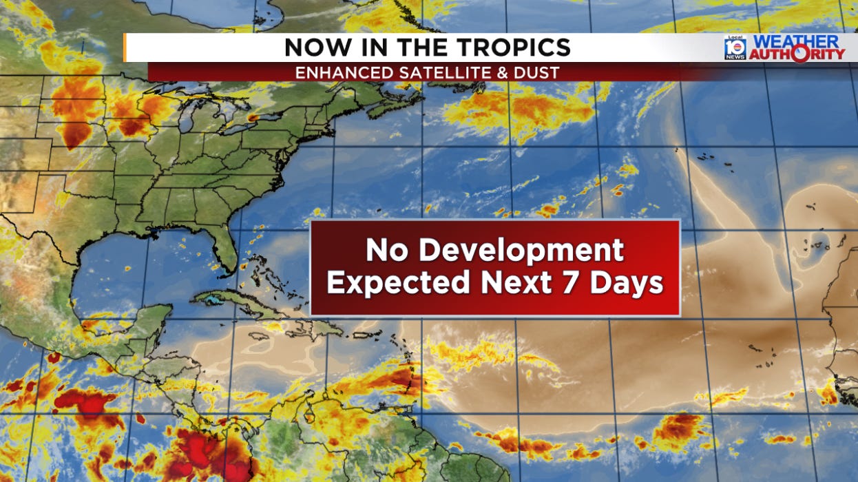
Nothing brewing across the Atlantic
As we’ve covered in newsletters this week, the Atlantic is taking an extended holiday vacation. We don’t expect any new activity across the basin at least through mid July.
That storm is chilling ~ (I think) it's right in the place where el Niño creates an area of rising air in the Pacific. So much juice in the atmosphere, that thing is strong.
The Atlantic might get a pass this year (for the most part, I guess), but I'm quite concerned about 2027 & the Gulf Coast. It leaves a gordion knot in my guts, a rebound la Niña will NOT be welcome.
So, I'll make best use of my time till then.
Ty Mr. Lowry, always appreciate you.
🌬 🌺