
Powerful Gabrielle Exits Stage Right as Two New Systems Take Center Stage
Newly designated Invests 93L and 94L could develop as they track deeper into the western Atlantic this week

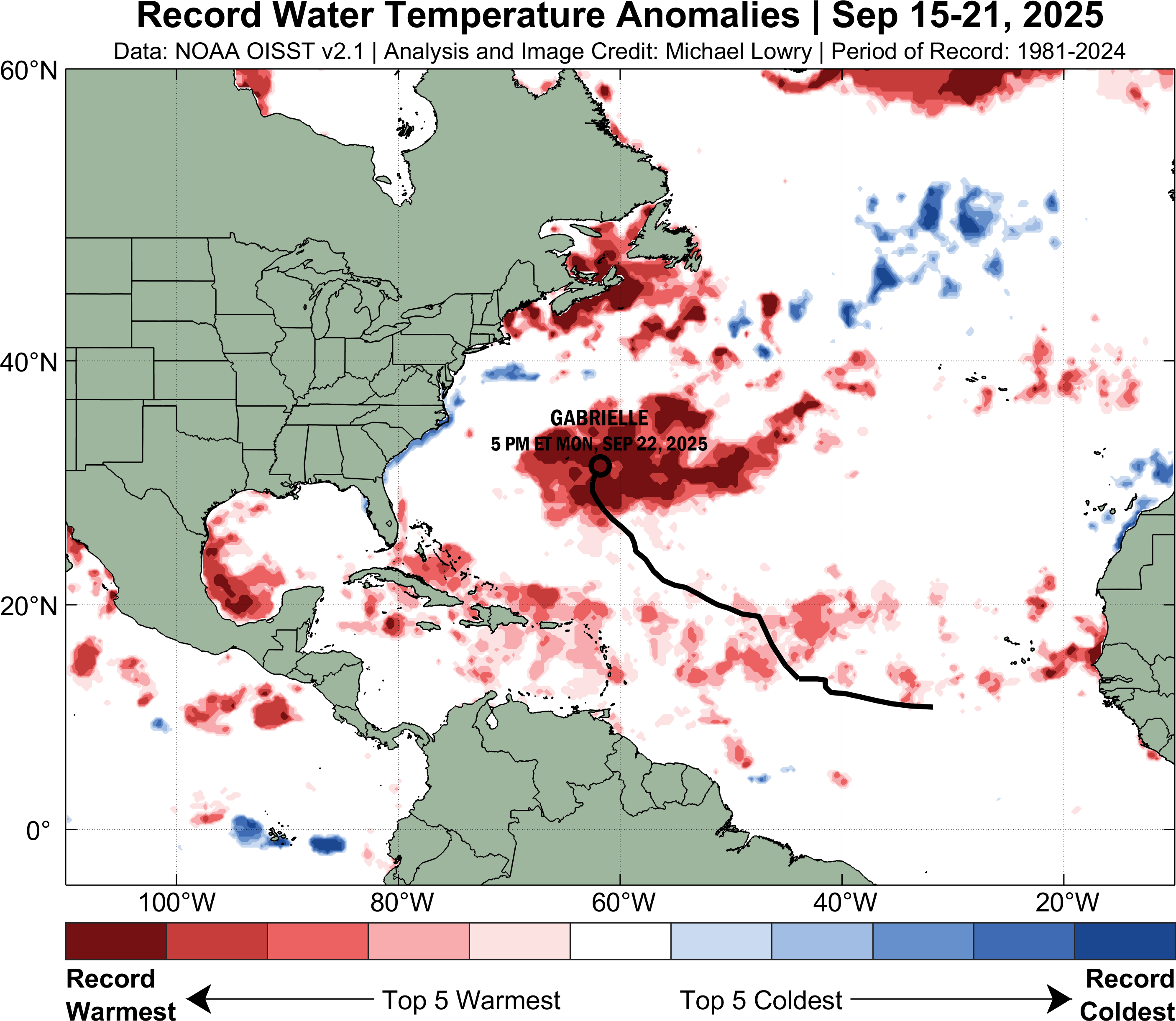
Gabrielle topped out as a powerhouse 140 mph Category 4 hurricane Monday evening as it passed about 200 miles east of Bermuda.

Gabrielle’s rapid strengthening on Monday – a 60 mph increase in its maximum winds from only 24 hours earlier – coincided with its passage over record warm waters for the time of year, supported by increasingly conducive upper-level winds.
Remarkably, the hurricane maintained its Category 4 strength through the overnight hours but is now gradually weakening and will weaken more quickly tomorrow and Thursday as it accelerates eastward in the direction of the Azores Islands of the northeastern Atlantic.
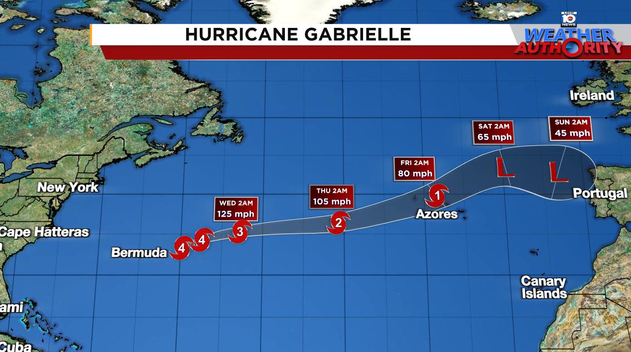
While Gabrielle could bring blustery conditions to the Azores by late Thursday and early Friday, it’s too soon to know whether it will pass over or just north of the Portuguese islands. Models for now suggest a more direct threat to the less populated northern islands like Flores Island and Corvo Island for late week.
Otherwise ocean swell from Gabrielle reaching the coastline from North Carolina through the Mid-Atlantic and Northeast U.S. will continue to create a risk of dangerous rip currents in the waters of local beaches for the next few days.
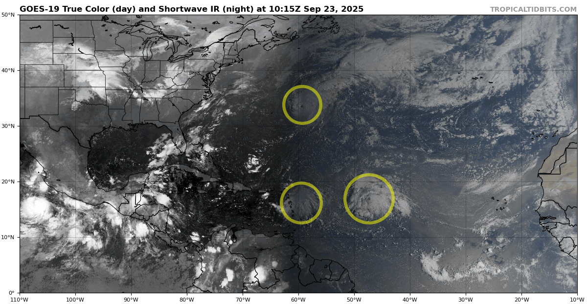
Two systems to watch this week
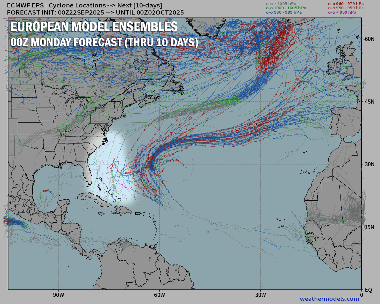
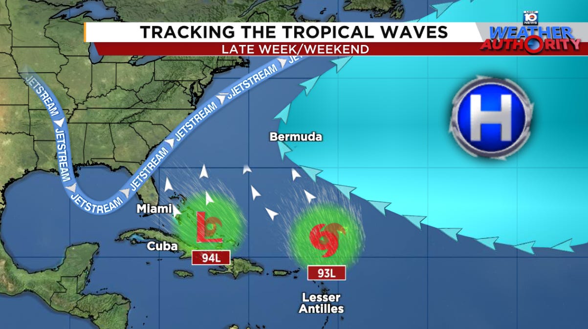
Next up are two robust tropical waves – designated Invest 93L (easternmost wave) and Invest 94L (westernmost wave) by the National Hurricane Center early Tuesday – moving toward the western Atlantic that are increasingly likely to develop by the end of the week.
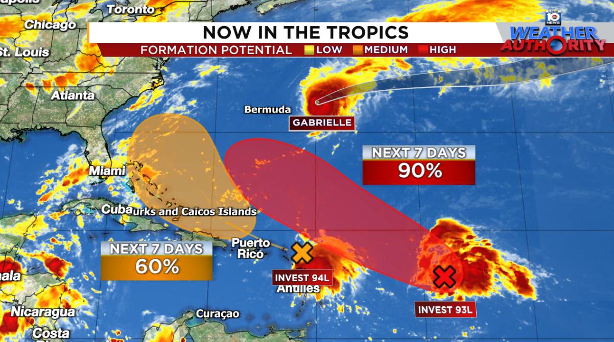
Invest 94L – the westernmost wave – will be the one that the Bahamas and southeastern U.S. will need to keep an eye on in the days ahead.
It’s currently bringing squally weather to the easternmost Caribbean islands as it tracks westward. Very strong wind shear will keep the system disorganized for the next few days. By Friday and Saturday, however, as it nears the Bahamas, wind shear will begin to relax as it moves over a well of warm water, which may hasten development.
The most bullish model camp on development is Google’s DeepMind AI-based hurricane model – a strong new performer so far this season – which turns the system sharply north near the Bahamas this weekend into early next week. Many scenarios from the DeepMind hurricane model are stronger, so we’ll need to monitor these trends closely.
Notably, there’s also been an uptick in the development signal for 94L from the conventional physics-based European model ensembles since Monday.
This would also suggest increasing development odds by the weekend as it nears the southeastern U.S.
A pronounced jet stream dip will help to turn 94L or what comes of it next week, but where the turn happens and how strong it gets before then will be critical to what impact if any we see in the U.S.
Even if the system stays weak and offshore, increasing tropical air could combine with a stalled front off the Carolinas early next week to worsen rainfall near the coast.
There’s higher-than-average uncertainty with 94L so check back frequently on the forecast this week.
Meanwhile, Invest 93L farther east will likely organize into a named storm in the coming days. Like 94L to its west, it will begin to turn north this weekend, but farther from the U.S. and the Bahamas.
Most of our guidance is bullish on strengthening 93L into a hurricane next week but keeping it safely east of the U.S. This one is looking like it’ll make a close pass to Bermuda, but west of where Gabrielle tracked, as a powerful hurricane from next Monday to Wednesday (September 29-October 1).
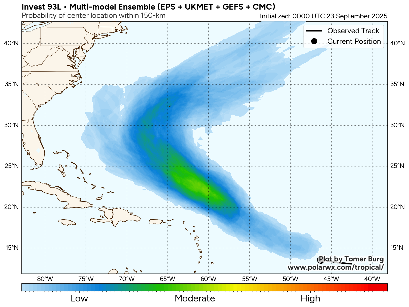
Interests in the British Overseas Territory will again want to follow the forecast trends this week.
With Gabrielle rocking cat 4 and predicted to be tropical for a long period recurving all the way to Portugal, I wonder if the avg ATL basin ACE will be exceeded adding to the prior big cat 5 fish named Erin. Honestly, the mid atlantic could use a tropical soaker storm, slow moving as we're in drought status. So, no more fish.. just some gentle giants.