Philippe and Rina Expected to Interact in a Very Uncommon Way
Only about 5% of the time do Atlantic storms get close enough to see the Fujiwhara effect

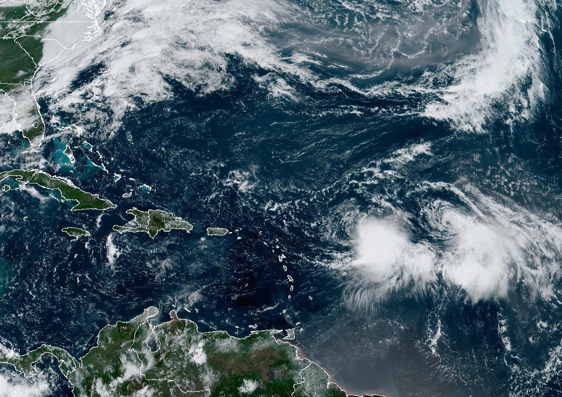
It’s been a tough week for forecasters at the National Hurricane Center trying to predict the next move of Tropical Storm Philippe. Their forecast headlines tell the story: “PHILIPPE’S FATE IS UNCERTAIN” sums up a frustrating week. The 5-day forecast point for Philippe shifted over 600 miles from Wednesday to today – from a post-tropical system over Puerto Rico to a strengthening storm moving northward into the central Atlantic.
In fairness to the top-notch forecasters at NHC, they’ve been dealing with what might arguably be a hurricane forecaster’s worst nightmare – the Fujiwhara effect.
The Fujiwhara effect, so named for Japanese meteorologist Sakuhei Fujiwhara who first described the phenomenon in a seminal 1921 paper, happens when the circulations of multiple low pressure systems (in this case two tropical storms) get close enough that they begin to rotate counterclockwise (in the northern hemisphere) around one another. In some cases, the two low-pressure systems may even get close enough to merge into one storm system. In most cases, however, one of the low-pressure systems is dominant and the bigger/stronger storm disrupts the circulation of the weaker storm.
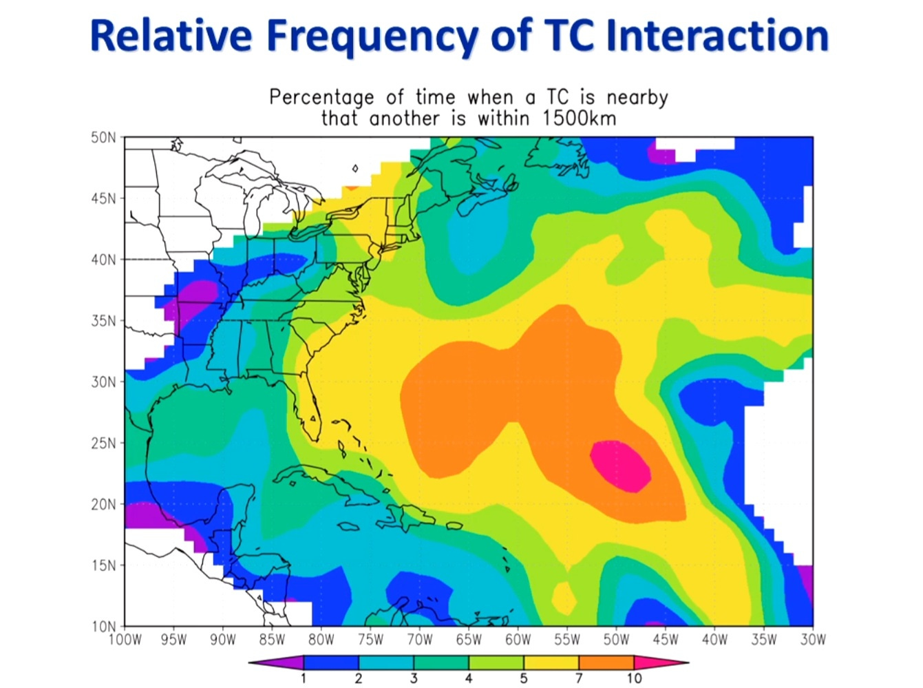
The Fujiwhara effect, also known as binary interaction by meteorologists, is most common in the larger storm systems of the western North Pacific but it does happen on occasion in the Atlantic. Research has shown that interaction between tropical cyclones can happen when they are generally within about 1500 km (900-950 miles) of one another. In the Atlantic, this only happens about 5% of the time, so while not quite rare, it’s pretty uncommon.

In the case of Philippe, its center is less than 600 miles removed from newly formed Tropical Storm Rina to its east.
Models indicate that Philippe will become the dominant storm over the coming days and the outflow from its circulation will gradually weaken Rina as Philippe becomes better organized. Philippe will initially dip toward the islands due to Rina’s circulation pushing it southward. Meanwhile, Rina will be slingshot northwestward courtesy of Philippe’s circulation. By the start of next week, Rina is expected to have weakened substantially and a strengthening Philippe will move more quickly northward around the western periphery of the subtropical high.
Though there still remains some uncertainty in how close Philippe’s circulation may get to the islands, neither storm right now appears to pose a significant land threat in the coming days.

Otherwise, things should be staying calm into next week. We may need to watch east of the Bahamas by late next week but at this point there’s not a lot of model support for development of this area. For now, we can enjoy a nice, quiet start to October.


A quiet October would be very nice 🎃
Thank you. Very interesting to learn about the Fujiwhara effect. Has it ever happened in the Gulf of Mexico?