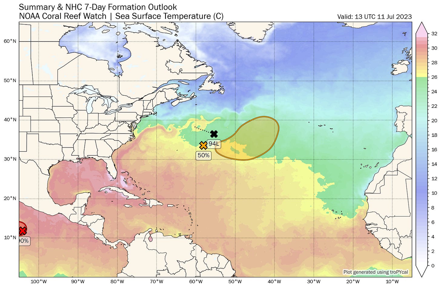
New Atlantic System Could Form Later this Week
A tropical or subtropical depression could form by Thursday or Friday but poses no threat to the U.S.
It’s been over half a century since a July tropical or subtropical depression has formed as far northeast in the Atlantic as newly designated Invest 94L – the non-tropical low-pressure system being monitored for development this week.
Over the next several days, 94L is expected to meander around the central Atlantic, squeezed between two competing areas of high-pressure steering. Along the way, it’s forecast to get scooped up within a jet stream dip where it could find a brief window of light winds over still-warm waters to transition into a short-lived tropical or subtropical depression on Thursday or Friday.
Water temperatures quickly drop off to the north and east, and as 94L – or what develops from it – moves into cooler waters this weekend, it’s expected to quickly shed its tropical or subtropical title. Regardless, 94L poses no threat to land.

Otherwise, despite record warm waters throughout the North Atlantic, the atmosphere should stay largely inhospitable to tropical activity for the next week or two.
The first major Saharan dust outbreaks of the hurricane season and seasonally strong wind shear are keeping the lid on organized storminess. As we discussed in previous newsletters, extended guidance doesn’t show this changing until late July or early August so for now we can enjoy a short summer sabbatical.


Despite the fact the Saharan dust will likely keep rains away and we are in a bit of a drought on this side of Florida, I am sincerely grateful for it being present to keep down the prospect of a tropical storm or hurricane which we really don't need.
as always, great info 🌟 I'm glad I came across your site - it helps me feel better during hurricane season
Ty ⚘