
Monitoring the Path of what Threatens to be the First Hurricane of the Season
Invest 97L on course to become a hurricane before the week ends, but exactly where and when it turns is still unclear

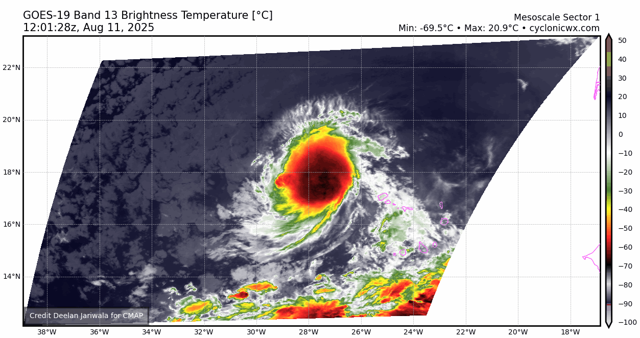
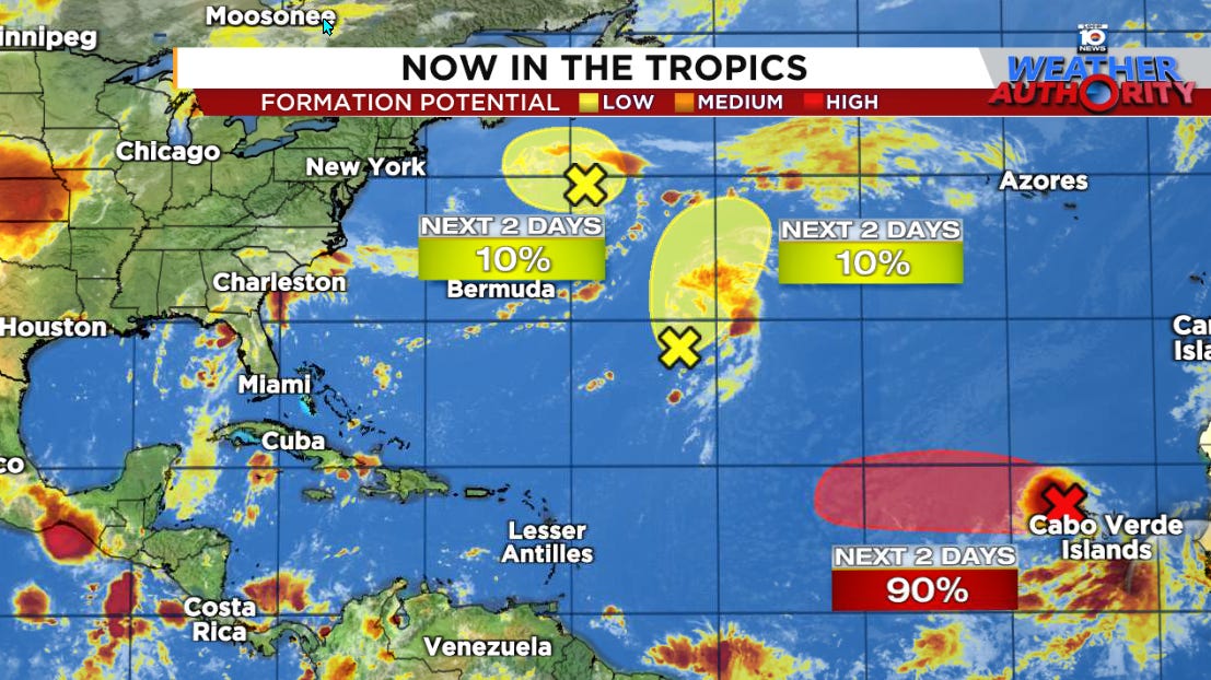
The tropical wave that moved off Africa Friday has been designated Invest 97L and it on the cusp of becoming a tropical depression or named storm. The next name on the list is Erin.
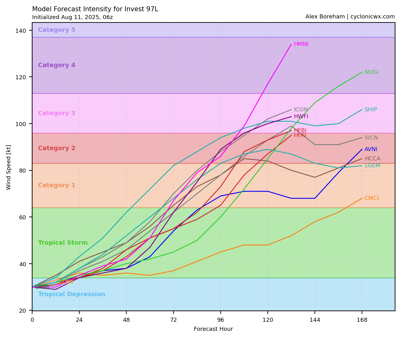
The system is just beginning its long journey through the Atlantic, but is expected to steadily strengthen in the days ahead, likely becoming the first hurricane of the season before the work week is out.
It’s too soon to rule out threats to land next week, but most reliable forecast models for now keep the system tracking north of the Caribbean islands and suggest a turn before reaching the Bahamas or U.S.
Regardless, until the system is better defined and models come into better agreement on its path, we’ll need to keep an eye on the trends.
Conducive conditions ahead
One thing’s clear about 97L’s future: the environment it’s moving into will favor steady strengthening this week. Water temperatures will quickly ramp up as it moves westward and upper-level winds will be light to negligible, so there won’t be much preventing continued organization.
That said, while models predict steady strengthening, at least for now the odds of rapid intensification are low this week. The intensity guidance suggests the system should become the first hurricane of the season between Wednesday and Friday this week as it moves through the open central Atlantic.
Is the U.S. in play?
The trends have so far been in favor of the system both passing north of the islands and turning east of the U.S. next week.
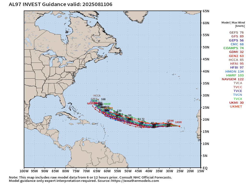
Because that turn isn’t forecast for another week when its moving into the western Atlantic, it may be still a few more days until we can firmly rule out any direct U.S. threat next week.
However, models are in good agreement with a break in the subtropical high pressure steering that’ll be guiding the potential hurricane westward next week. This should give the system an escape route to turn north before reaching Florida or the Bahamas.
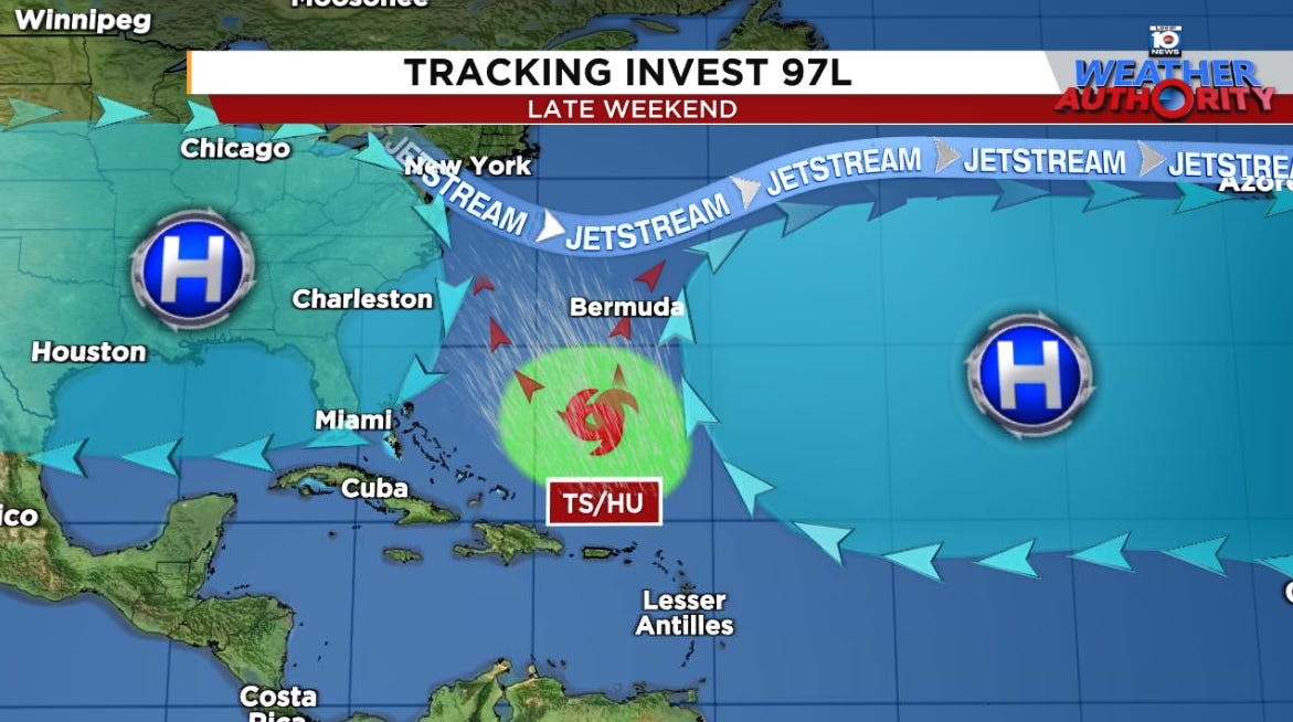
As with any possible hurricane turning north through the western Atlantic, Bermuda will need follow the forecast closely but we’re still 7 to 10 days away from that happening so there will be plenty of time to monitor.
The bottom line for the U.S. is that the trends are in our favor (especially for us in Florida) for this one finding an escape route, but let’s give it a few more days before confidently ruling out any direct threat down the line.
Activity to continue deep into August
More robust waves will be rolling off Africa next week and the Atlantic will remain in a favorable configuration for development so it’s likely we’ll see more activity deep into August.
At least for now any additional development threats next week will stay over the eastern or central Atlantic and far away from the U.S.