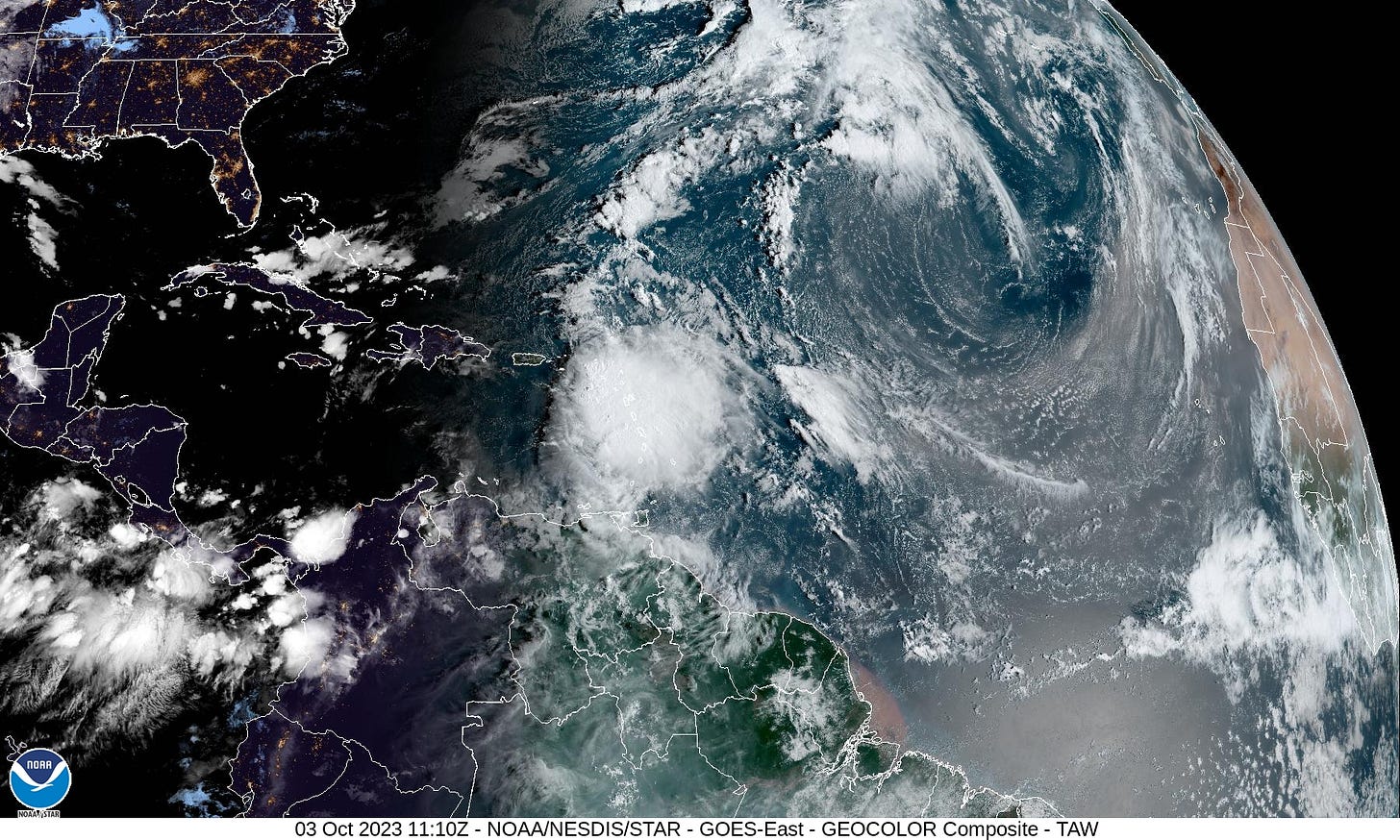
Major Flooding Ongoing Across Dominica and Guadeloupe from Philippe
Fickle Philippe’s dangerous tail bringing torrential rains and tropical storm conditions to parts of the northern Leeward Islands today
Philippe has been a persistent thorn in the side of hurricane forecasters. The storm, which formed 10 days ago midway between Africa and the Caribbean, ground to a halt late last week and took a southward dive east of the islands as it interacted with the circulation of nearby Tropical Storm Rina.
Initially forecast to turn quickly out to sea, forecasters gradually adjusted Philippe’s predicted track toward the islands of the northern Caribbean before righting the cone back toward the open Atlantic. It’s been a topsy-turvy outlook to say the least, an outlook forecasters at the National Hurricane Center would care to forget.
On average, the 5-day NHC track forecast error in recent years has been on the order of 190 miles, about the distance from Miami to Cape Canaveral. The average 5-day track error for Philippe so far has been nearly 450 miles, or the distance from Miami to Savannah, Georgia.

Though Philippe’s journey isn’t over, the forecast track has exhibited one of the higher errors for any storm in recent memory, challenging other difficult forecasts like Wanda in 2021 and Joaquin in 2015 (though not as severe as Cristobal in 2014).
This isn’t a criticism of the top-notch forecasters at NHC who continue to outperform many of our most reliable models for Philippe. To the contrary, it shows how good hurricane forecasts have become that these type of forecasts are the exception. Still, Philippe is a good reminder of error baked into any tropical cyclone forecast.
What’s next for Philippe?
Most of Philippe’s weather, including the tropical storm’s heaviest rain and strongest winds, have been displaced to its south and east. This has kept the worst of the storm away from the islands, but starting yesterday the storm center moved far enough northwest that its stormy tail moved over parts of the northern Leeward Islands, causing extensive flooding in some places, including on Guadeloupe and Dominica. Up to 8 inches of rainfall is possible from Dominica to Barbuda, primarily through today, which will cause additional flooding in the area.
As Philippe accelerates northward and away from the Caribbean later this week, it may find a window to strengthen some. Given the forecast uncertainty, interests in Bermuda should continue to monitor the forecasts in the event Philippe’s track shifts west. Although Philippe could gain hurricane status, intensity models mostly cap its future intensity as a strong tropical storm.
No new Atlantic systems expected this week
The tropical Atlantic elsewhere will take a breather, with no new storms expected for the remainder of the week.


