
Lisa Slams Belize, Messy System Shaping Up for Florida Next Week
Lisa Slams Belize, Messy System Shaping Up for Florida Next Week

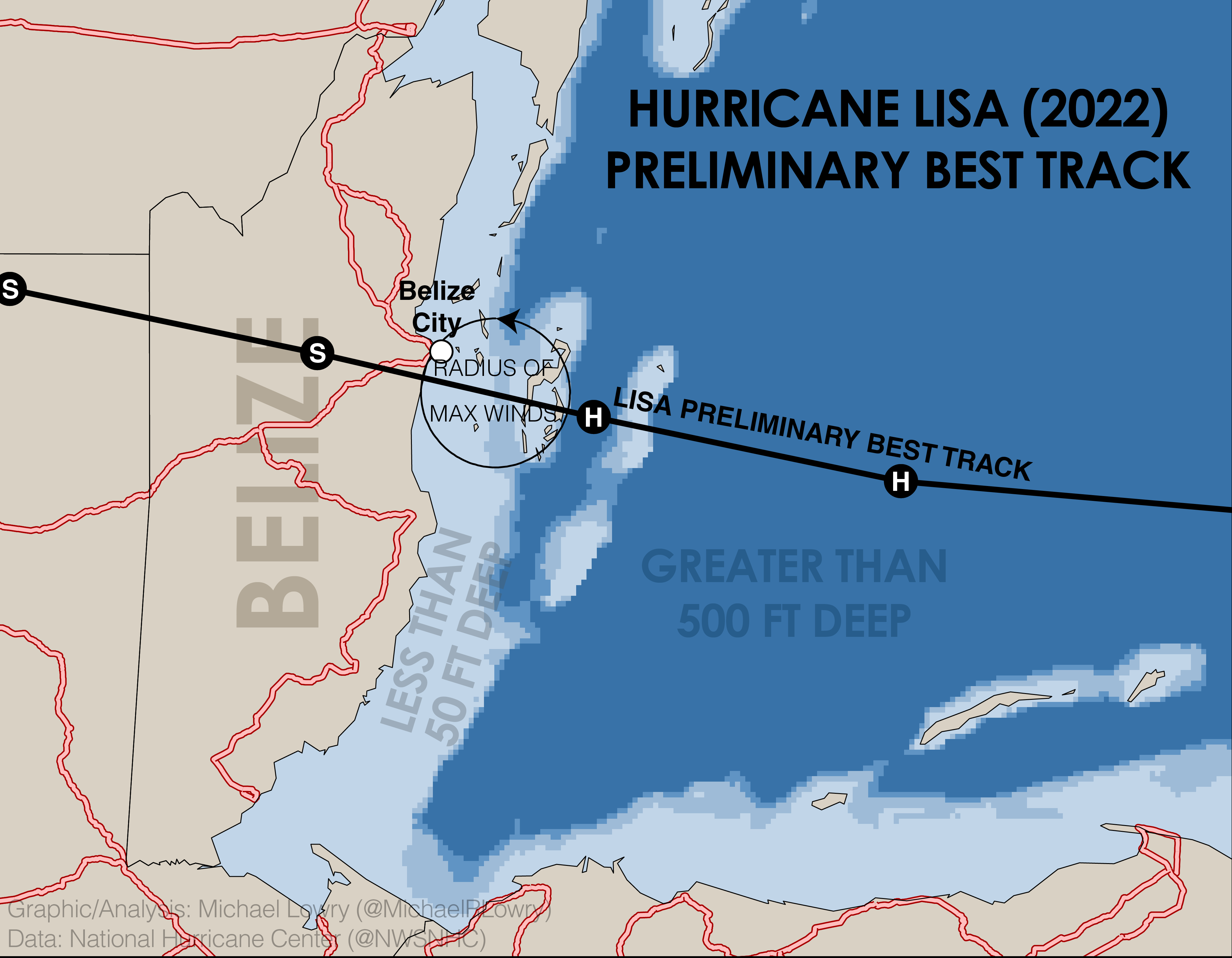
Hurricane Lisa packed quite a punch as it came ashore about 10 miles south of Belize City shortly after 5 PM ET yesterday. Though compact, its radius of maximum winds fell squarely over Belize City, pushing a destructive storm surge into Belize’s largest city.
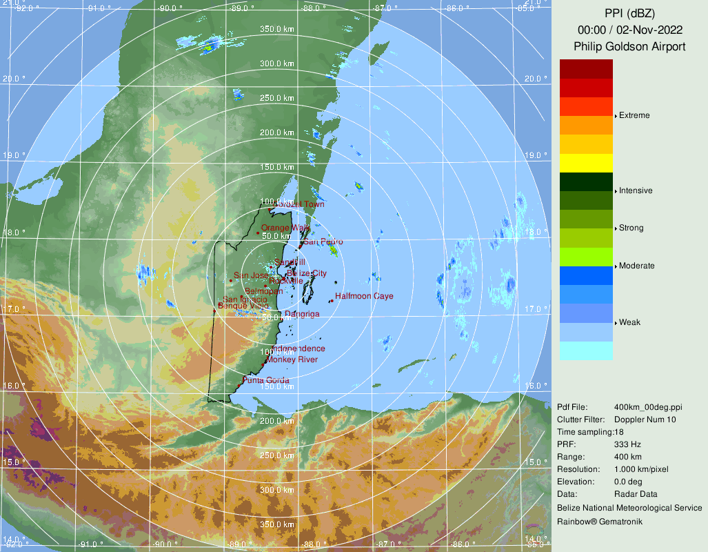
Though sharp fringing coral reefs can lessen the impacts of storm surge, Belize City sits shoreward of a long barrier reef lagoon, which allows storm surge to not only build up, but waves breaking over the coral reefs to regenerate before lapping ashore. Widespread coastal flooding was reported throughout Belize City, especially in the hours preceding landfall as the onshore component of Lisa’s eyewall winds lashed the coast.


Lisa’s circulation is quickly weakening over southeastern Mexico, but heavy rain and flash flooding continue to be a threat over the next few days. Lisa’s circulation will emerge over the southern Bay of Campeche by early tomorrow, but redevelopment isn’t expected.

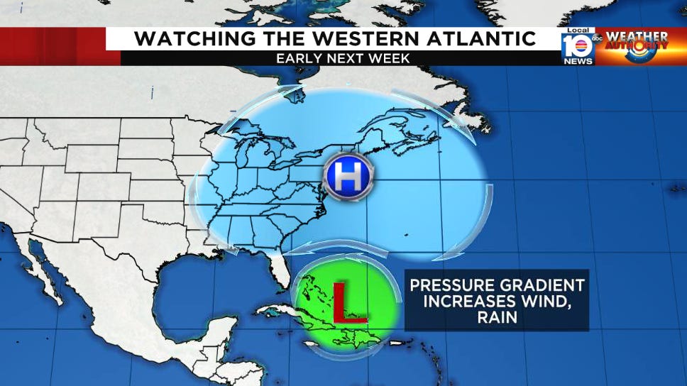
This weekend we’ll be following the beginnings of a big, messy weather system that will likely bring wet and windy conditions to Florida next week.
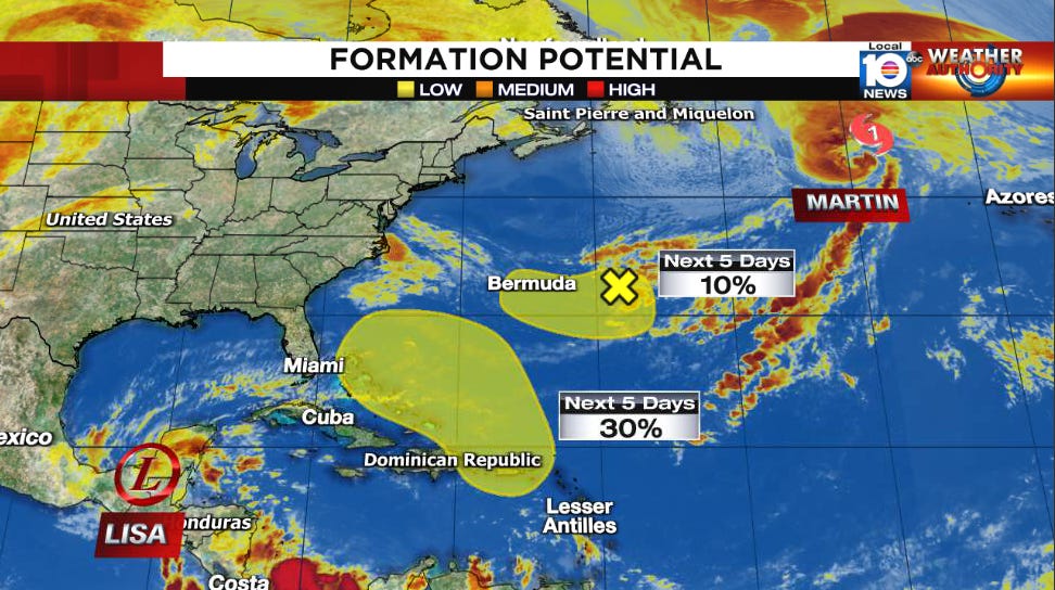
A sprawling area of low pressure at upper levels is slated to drop southward from the Carolinas into the Bahamas over the weekend and pinch off from its parent jet stream flow. The large, lumbering non-tropical area of low pressure will drift westward by early next week as disturbed weather from the eastern Caribbean gets pulled northward underneath.
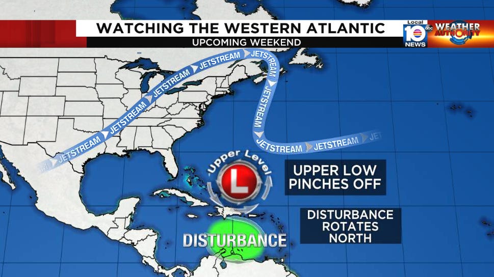
The upshot will be big sloppy weather system pinwheeling toward the Florida peninsula for the middle part of next week. The system may try to acquire tropical characteristics gradually but given the large, gyre-like circulation and nearby upper-level low, this process would take some time. Regardless, the contrast of high pressure to the north and such a large area of low pressure to the south will mean breezy weather, high surf, and the potential for rain squalls across South Florida beginning early next week.
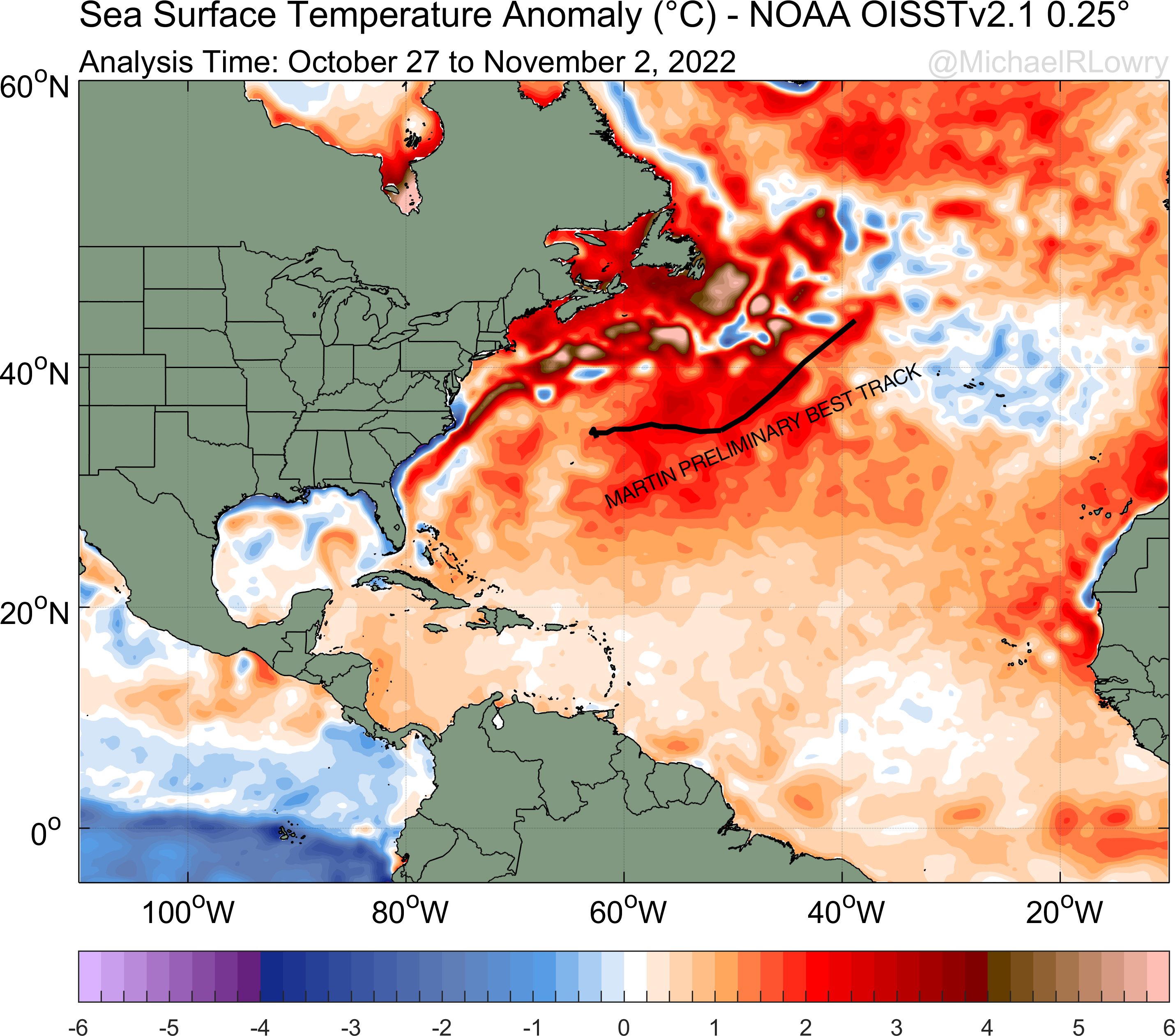
Elsewhere in the Atlantic, Hurricane Martin is accelerating northward into the far north Atlantic where it will merge with a powerful storm system by tomorrow. No Atlantic hurricanes have been recorded in November as far north as Martin was at 11 AM ET this morning (Florence in 1994 was the highest-latitude November hurricane on record), a testament to its unusual strength, likely aided by historically warm sea surface temperatures in this part of the world.
Wet and windy weather could delay the next Artemis rocket flight attempt for the 13th. So, expect that launch date to slip back a bit.