


Hurricane Hunters Set to Investigate Disturbance of Southeast U.S. Later Today
Low-pressure system could become a brief tropical depression or storm today or Saturday before moving inland over the Carolinas on Sunday

Author’s note: The taxpayer-funded tools from NOAA I consulted to provide the forecast information and analyses in today’s newsletter include real-time wind shear maps from the University of Wisconsin’s Cooperative Institute for Meteorological Satellite Studies (CIMSS) and satellite and tropical cyclone intensity guidance from the Statistical Hurricane Intensity Prediction Scheme (SHIPS) and Logistic Growth Equation Model (LGEM) developed and maintained by the Cooperative Institute for Research in the Atmosphere (CIRA) at Colorado State University. All of these critical tools that inform hurricane forecasts are slated for elimination in NOAA’s 2026 proposed budget.
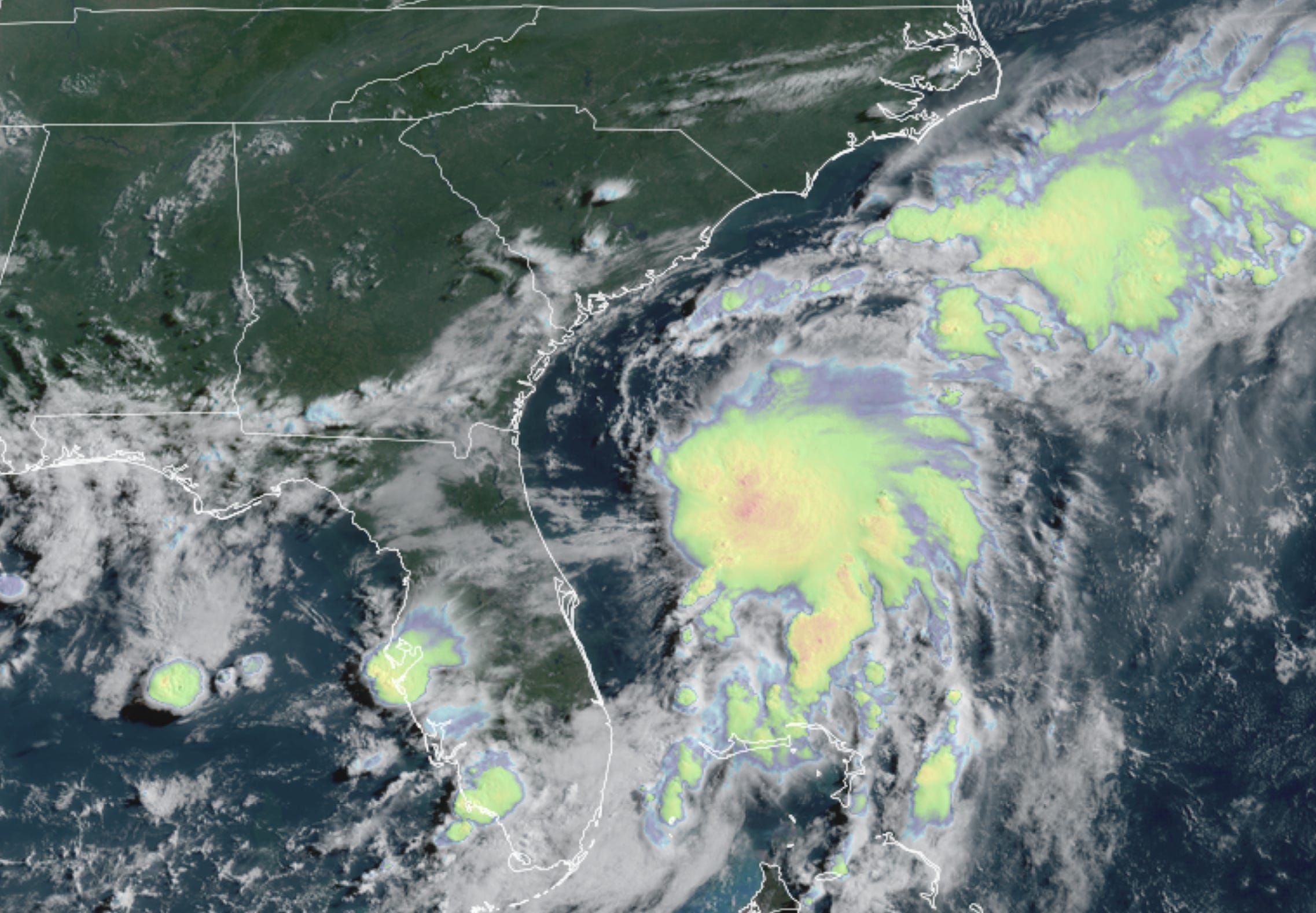
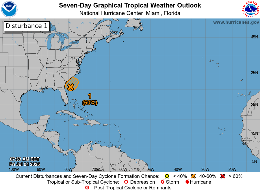
Showers and thunderstorms are becoming more concentrated around an area of low pressure – now designated Invest 92L – centered about 100 miles off the coast of northeast Florida. Current satellite trends and model guidance suggest a short-lived tropical depression or tropical storm could form later today or on Saturday before moving inland over the Carolinas by Sunday into early Monday.
The next name on the list is Chantal.
Air Force hurricane hunters are scheduled to fly from Keesler Air Force Base in Mississippi around noon today to investigate, and should arrive into the system shortly before 2 PM ET.
The good news is environmental conditions will only marginally support development over the next day or two before the system moves inland. Modest wind shear will remain in the vicinity as dry air lurks nearby, helping to keep what forms in check. Intensity guidance maintains a tropical depression or low-grade tropical storm this weekend.

As we’ve discussed in newsletters this week, the main threat regardless will be periods of heavy rainfall stretching from the Florida peninsula today into the coastal Carolinas this weekend. Though heavy at times, widespread flash flooding isn’t anticipated and the rainfall should be primarily a disruption for the July 4th holiday weekend.

A moderate risk of rip currents will also pose a risk to beachgoers from east-central Florida northward into the Outer Banks of North Carolina this weekend.