


Growing Threat to Florida's Gulf Coast as Forecasts Come into Focus
Invest 93L developing, forecast to strengthen and threaten Florida’s Gulf Coast early next week


An area of low pressure between Cuba and Mexico’s Yucatán Peninsula – designated Invest 93L by the National Hurricane Center – has steadily organized since Friday and is expected to become a tropical depression or storm by later today or Sunday. Forecast models have come into better agreement with a strengthening storm system – likely a tropical storm or hurricane – approaching Florida’s Gulf Coast by next Tuesday into Wednesday. Residents along the eastern Gulf from southwest Florida to coastal Alabama should closely follow the forecasts into next week.
What we know now
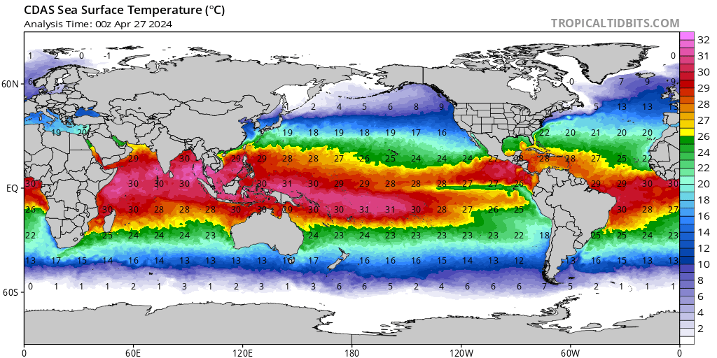
Satellite trends since Friday have shown a steadily organizing low-pressure system over the northwestern Caribbean. Invest 93L is percolating in a remarkably pristine environment of very low wind shear under a sprawling upper-level high and atop one of the warmest, deepest reservoirs of water on the planet. The system will fester near the Yucatán Peninsula this weekend and into Monday in a no-man’s-land of steering.
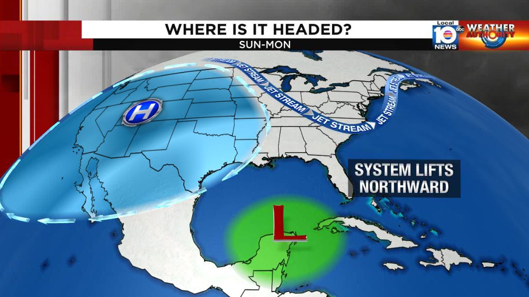
By late Monday into Tuesday, a developing storm will accelerate northward toward Florida’s Gulf Coast and come ashore from late Tuesday into Wednesday.

What we don’t yet know
The biggest and perhaps only deterrent to strengthening this weekend will be how much Invest 93L interacts with land. Model guidance continues to advertise the low-pressure area becoming established over the Yucatán Peninsula and not moving much until Monday. This would limit 93L’s development potential over the next few days, though not necessarily enough to prevent it from forming. If thunderstorms consolidate east of the Yucatán – as the trend has been so far this morning – a stronger system could take shape this weekend.
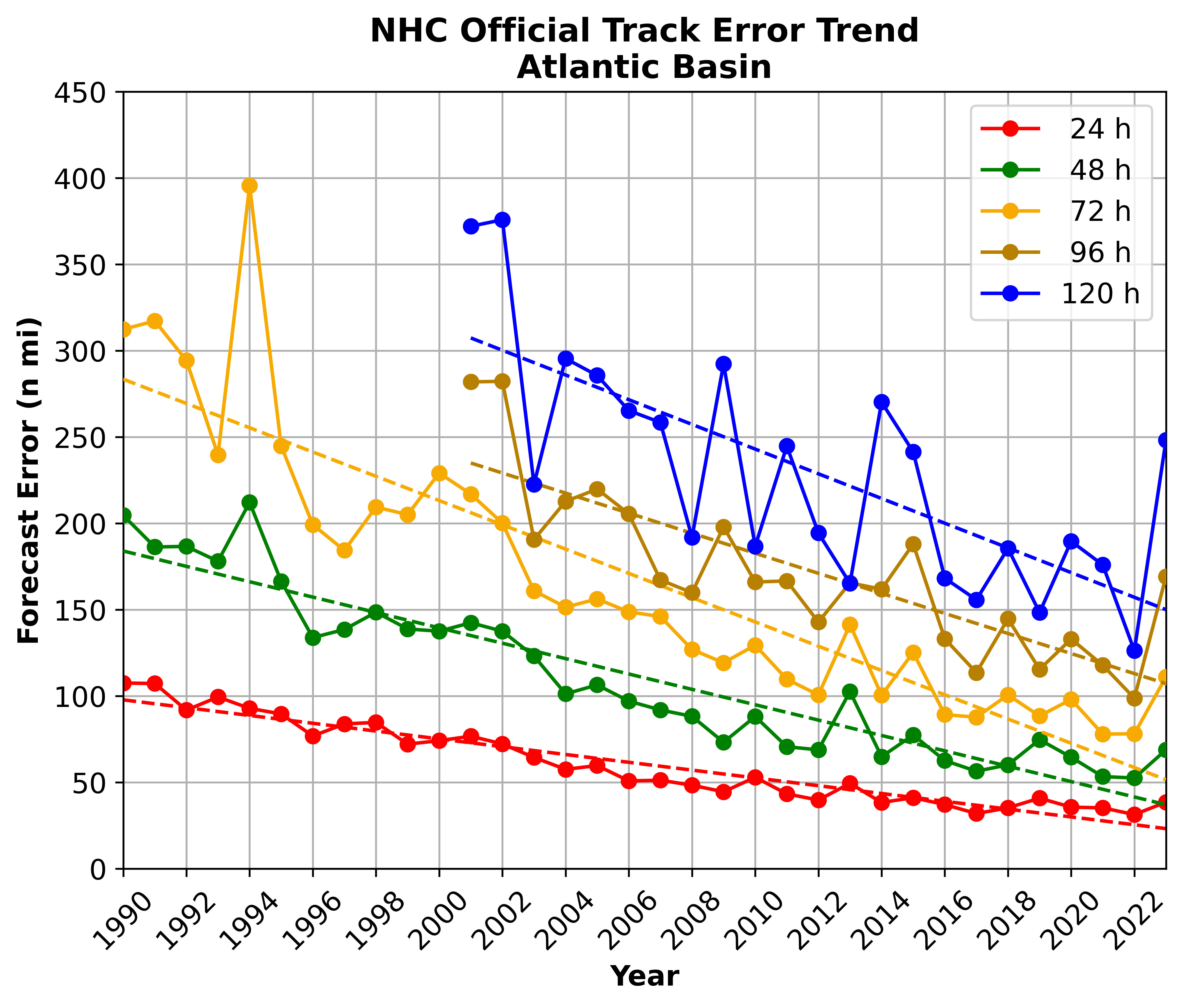
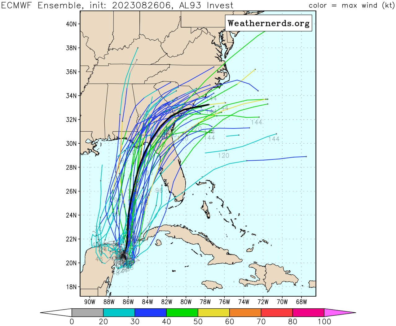
It's tempting to take model forecasts as gospel when they appear to hone in on a threat area, but readers are reminded the average track error 4-5 days out for developed systems is 150-200 miles, roughly the distance from Tampa to Tallahassee as the crow flies. The error is even greater for systems that haven’t yet formed. Until we have a well-defined circulation center, buyer beware on forecast models. Residents all along Florida’s Gulf Coast and into coastal Alabama should continue to closely monitor the changing forecasts.
The system’s organization this weekend will also factor into its potential strength down the road. While the consensus for now suggests a tropical storm moving into the eastern Gulf early next week, the configuration of upper-level winds could favor additional strengthening, perhaps into a hurricane. A northward scenario would favor a stronger storm, with southward scenarios tending to a weaker storm with less time over Gulf waters.
The bottom line
Invest 93L poses a growing threat to the eastern Gulf of Mexico next week. A tropical storm or hurricane could threaten Florida’s Gulf Coast by Tuesday into Wednesday. Residents should finalize preparations over the weekend and listen to local authorities as forecasts come into focus next week.
Franklin on its way to becoming a hurricane

After several days fending off ferocious wind shear, Franklin is finally strengthening and will likely be upgraded to the second Atlantic hurricane of 2023 by later today. Hurricane Hunters flying Franklin this morning are finding increasing winds and lowering pressures, suggesting an intensifying storm.
The center of Franklin is expected to pass safely west of Bermuda, though gusty winds and outer bands could affect the archipelago as the storm makes its closest approach next week. The storm is no threat to the United States.
Elsewhere across the Atlantic

Invest 92L in the central Atlantic will be curling up into the open Atlantic and remains no threat to land.
We’ll be following another tropical wave forecast to move off Africa by early next week, but for now development odds remain low.
Well we really need to the rain on this side of the state as we are 17" below what we normally get in this, our "rainy" season. Well Tamps said they were that low and they have gotten more than we have down here so I expect we are about 20" below. Still I just checked and there were 13 "I" named storms that had been retired due to destructive power and cost, Ian was added this year to make 14 and "I" was already the most retired letter names for storms. Have to remember that although this one (will be Idalia) is expected to be at most a Cat 1, that can change.
Laura was predicted at first to remain a tropical storm yet became a major Cat 4. She went over Hispaniola and the full length of Cuba which would normally break these storms down yet she intensified rapidly once in the Gulf and the water is much warmer this year. These things can be quite unpredictable no matter how good they are and how hard the meteorologists try to keep up with them. Mr. Lowry is one of the best and is great at keeping us updated on what he can.
Here's hoping she behaves as although we are desperate for rain down here, southwest Florida hasn't recovered from hurricane Ian yet and a strong tropical storm let alone a minor Cat 1 hurricane could be devastating here. We are definitely paying close attention to these reports