


Earl Forecast to Become a Strong Hurricane by the Weekend, Bermuda in the Cone
Hurricane Hunters find stronger winds, prompting special update from NHC this morning

Although Tropical Storm Earl’s development has been largely stymied by relentless wind shear, by mid-week a more favorable orientation of upper-level winds may allow Earl to organize into a strong hurricane as it bends northeastward in the direction of Bermuda.
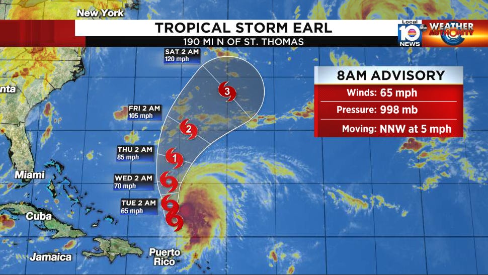
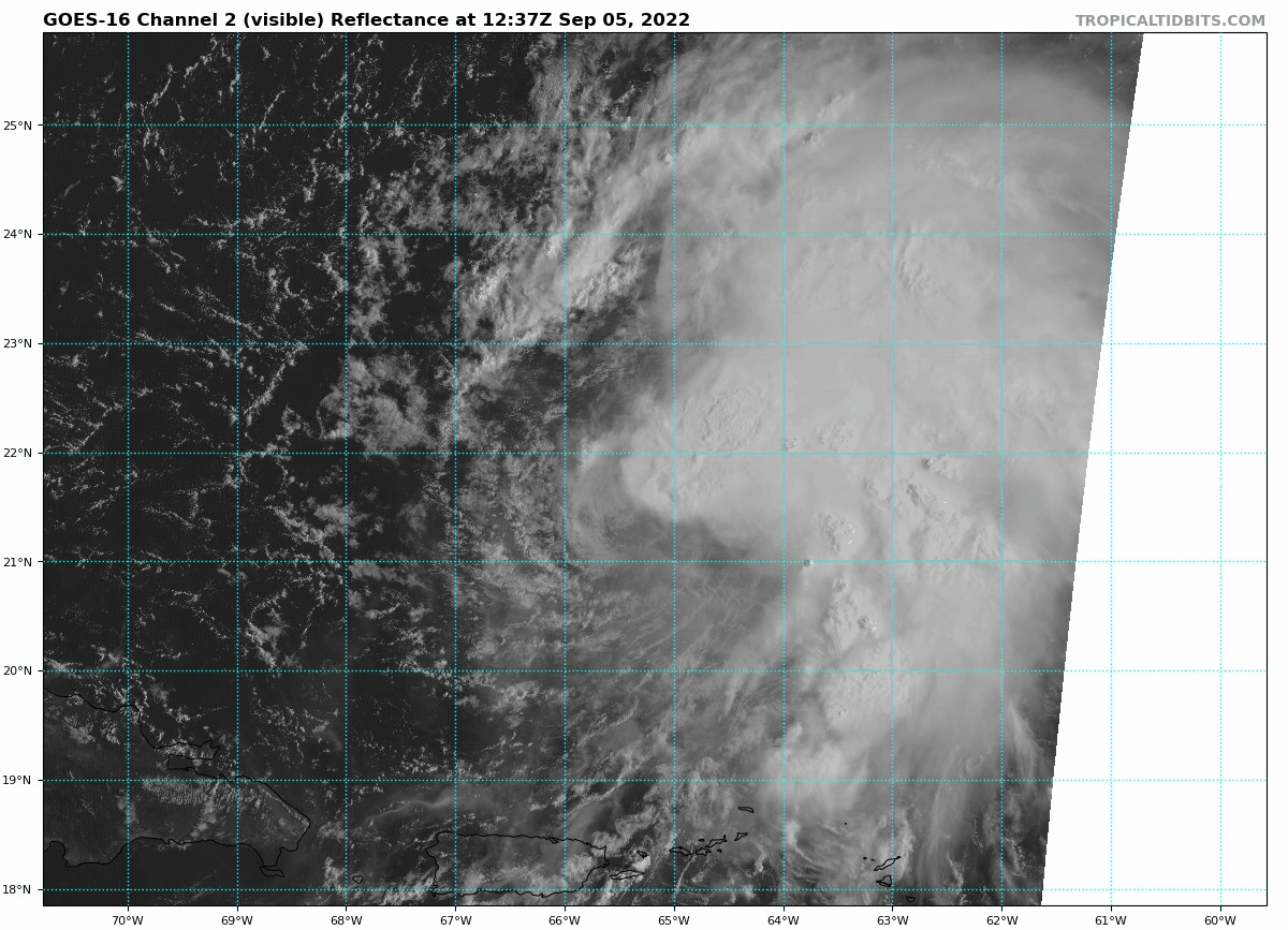
While several bursts of thunderstorm activity – including yesterday morning and late last night – have bristled against the acerbic winds aloft, repeated blows of near-constant wind shear have kept Earl – now over 200 miles north of San Juan, Puerto, Rico – from reaching its full potential.
Despite its swirling low-level cloud center once again peeking out from underneath higher thunderstorm tops, a NOAA hurricane hunter research airplane flying inside the storm this morning found some impressively gusty winds from instrument packages dropped in the immediate vicinity of the storm center.
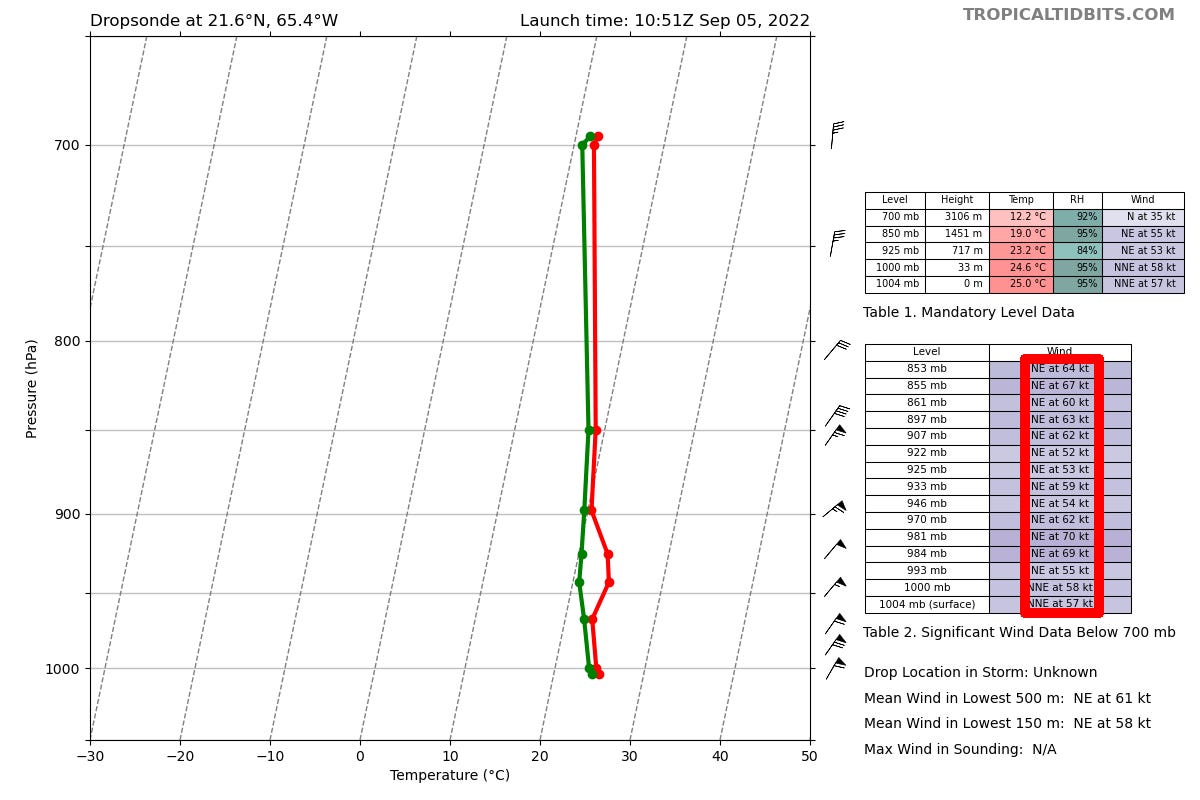
The plane also observed winds at flight level (about 10,000 feet above the ocean) above 70 mph and estimated surface winds near 65 mph, prompting the National Hurricane Center to issue a special update shortly before 9 AM ET Monday for a stronger storm than assessed and forecast only a few hours earlier.
If Earl finds the right environmental pocket of lighter wind shear, all indications are it’ll grow to a much stronger system. The big question is when and where that happens. Computer model guidance suggests the window may open up by mid-week as Earl moves northward around the western periphery of high-pressure steering to the east in the general direction of Bermuda. Due to the large uncertainty this far out, interests in Bermuda should closely monitor the changing forecasts in coming days.
Earl is forecast to reach Category 3 strength by the weekend, which – if forecasts materialize – would make Earl the strongest Atlantic hurricane so far of 2022.
In the far north Atlantic, hurricane Danielle is peaking as a high-end Category 1 hurricane with 90 mph winds. It’ll get caught up in the high-latitude jet stream in the coming days as it wraps up into a larger, non-tropical weather system.
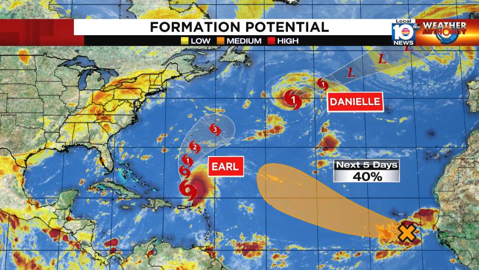
Another system off the coast of Africa has a medium chance of development this week but will be steered northward into the open Atlantic by a weakness in the subtropical high-pressure steering.
So glad Earl is not coming our way and it looks as if the new system off Africa won't head here either. Hope our luck holds good.