
Development Odds Dwindle, but Heavy Rain and Flood Threat Remains
Invest 93L slides into South Louisiana today, bringing periods of heavy rainfall and flash flooding through tomorrow

Author’s note: The taxpayer-funded tools from NOAA I consulted to provide the forecast information and analyses in today’s newsletter include forecasts from state-of-the-art models developed and maintained by the Atlantic Oceanographic and Meteorological Laboratory (AOML), satellite data from the Cooperative Institute for Research in the Atmosphere (CIRA), and wind analyses from the University of Wisconsin’s Cooperative Institute for Meteorological Satellite Studies (CIMSS). AOML, CIRA, and CIMSS are just a few of the dozens of weather and climate facilities slated for elimination in NOAA’s 2026 proposed budget.
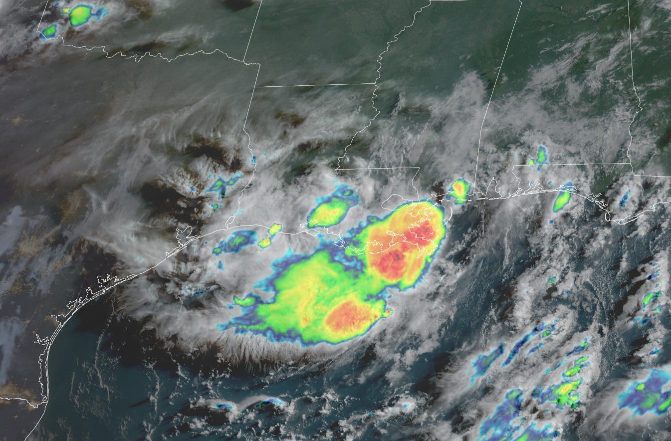
The disturbance we’ve been tracking all week – designated Invest 93L by the National Hurricane Center – is making its last stop along its Gulf Coast tour today in Louisiana.
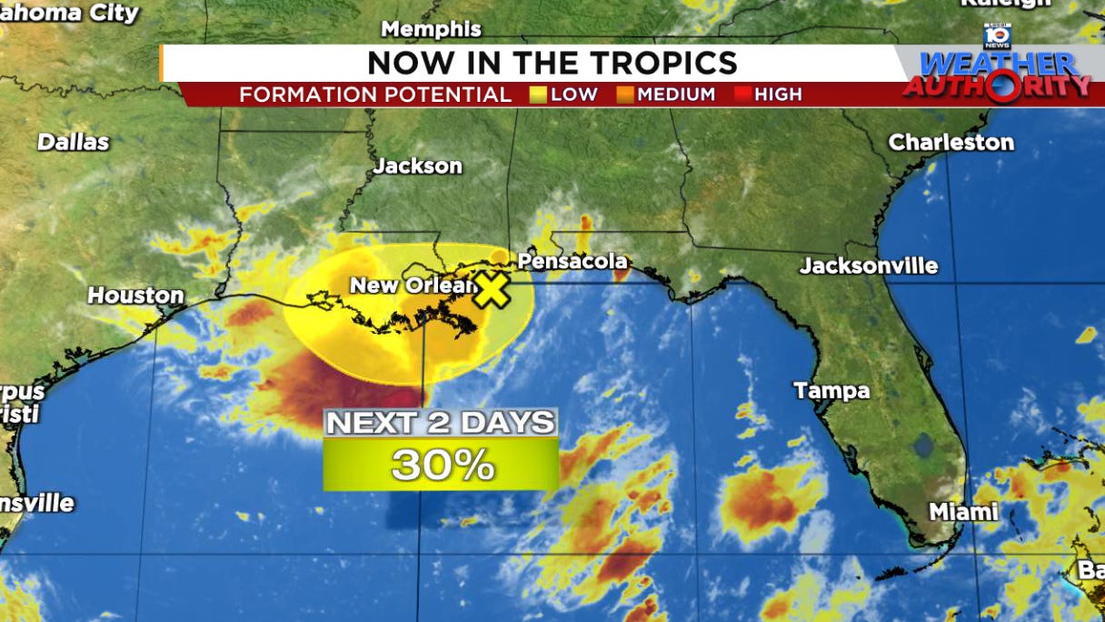
The system largely remained over land as it scraped the coastline from Florida’s panhandle westward on Wednesday, preventing it from turning into anything more than a disorganized tropical rainmaker. Its final stop in Louisiana today and tomorrow will seal its fate, but even as development odds tumble, it will continue to bring the very real threat of heavy rainfall and periods of flash flooding to cap the workweek.
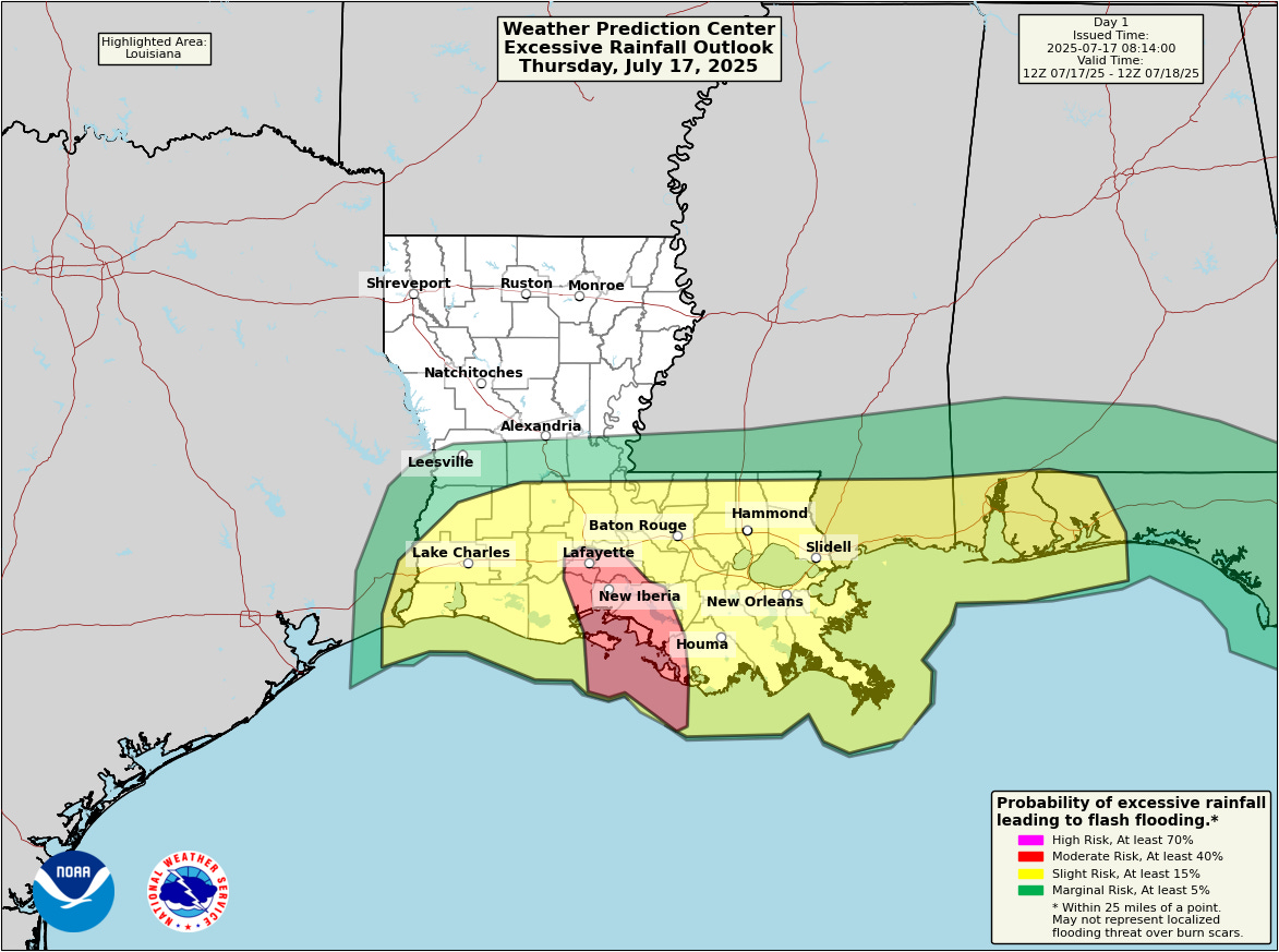
Flash flood threat today and Friday for southern Louisiana
The good news so far with 93L is land impediments – more than initially anticipated by forecast models – have kept thunderstorm activity around the low-pressure area highly disorganized. As a result, predicted rainfall totals have trended downward since yesterday and the greater flood threat looks to be today rather than Friday.
Nevertheless, the plume of tropical air will push available atmospheric moisture to the upper tier, not just for July but for any time of year.
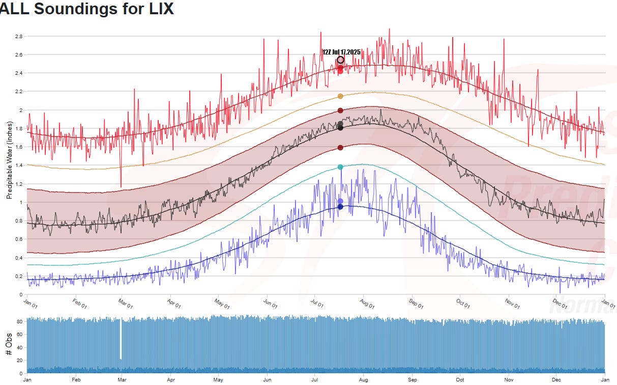
This means ample energy to power heavy rainfall in places today and tomorrow with widespread areas of 4 to 6 inches and up to 10 inches, leading to pockets of significant, localized flash flooding.
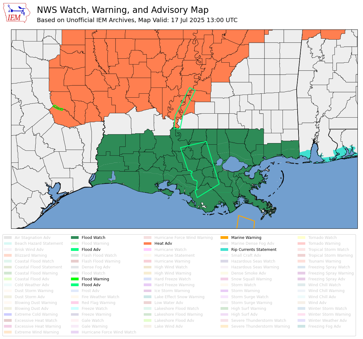
Flash flood guidance suggests storms will need to produce heavy rainfall rates exceeding 3 inches an hour for significant flash flooding, generally a high bar, but certainly a possibility with repeating rounds of storms and such juicy air overhead.
The heavy rain and flash flood threat will taper off on Saturday as 93L becomes strung out inland over the lower Mississippi River Valley.
Tropical Atlantic heating up
The cooldown across the deep tropical Atlantic we saw going into the start of the hurricane season appears to have halted and reversed in recent weeks.
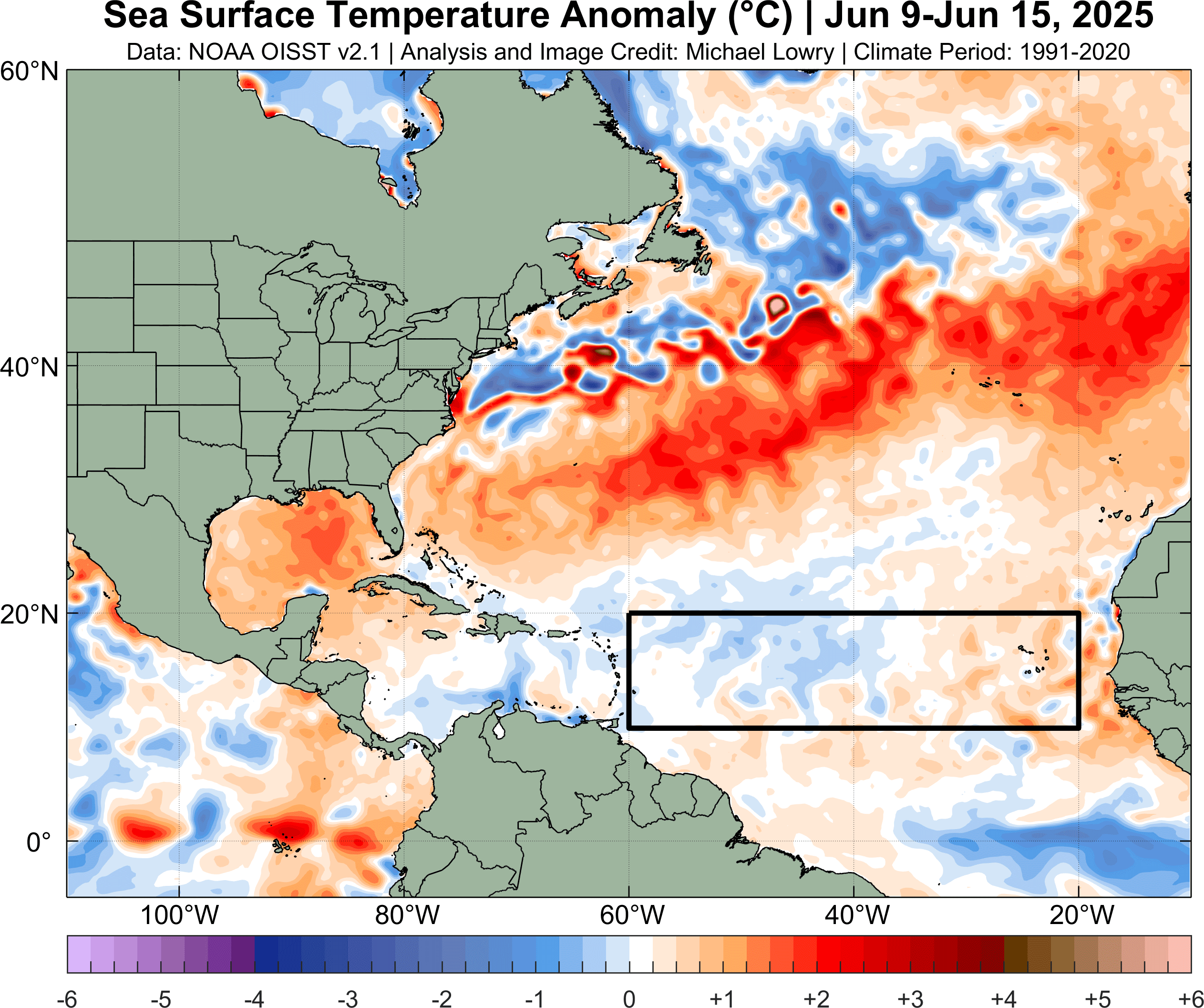
The main development region of the Atlantic – where most of our strongest hurricanes get their start in August and September – has made quite the comeback thanks to a weaker subtropical high pressure zone to the north easing east-to-west trade winds over the tropical Atlantic.
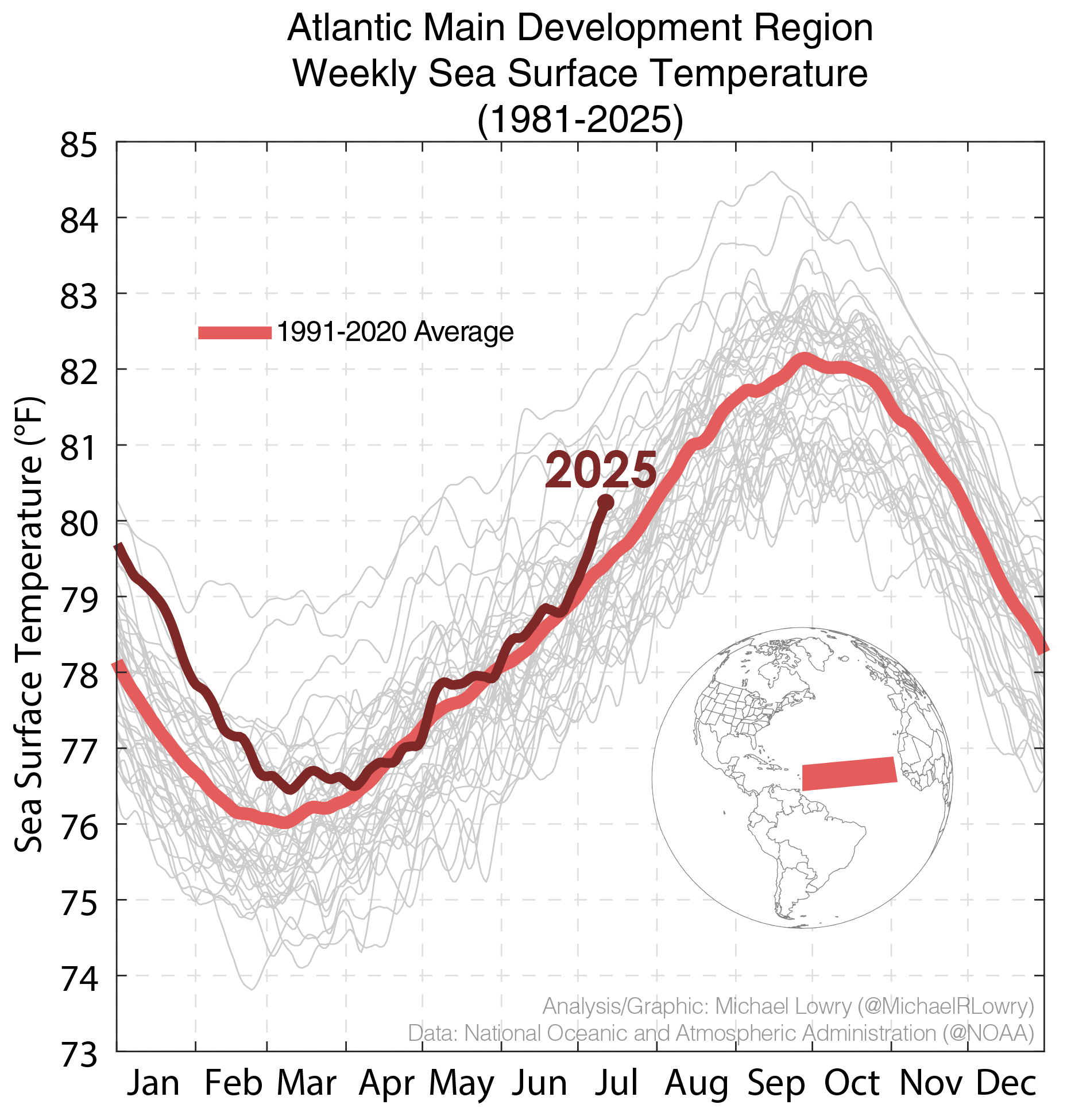
I expect the trend will continue into early August, with models showing the Bermuda/Azores high-pressure area weaker than usual, which will dampen trade winds and allow the warmup to persist.
It’s worth noting the warmth across the subtropics (particularly in the band from around 30°N to 40°N east of the U.S.) isn’t a pattern that typically promotes rising air and storminess in the tropical belt, but a warmer MDR would – all else equal – counteract its influence.
For now, the tropical Atlantic will stay dormant, but as we’ve discussed in previous newsletters toward the end of July and into August the upper-level configuration of winds is expected to shift and could help kickstart the season.