


Central Atlantic Disturbance Headed Toward the Northern Caribbean Islands
NHC bumps development odds in morning tropical weather outlook

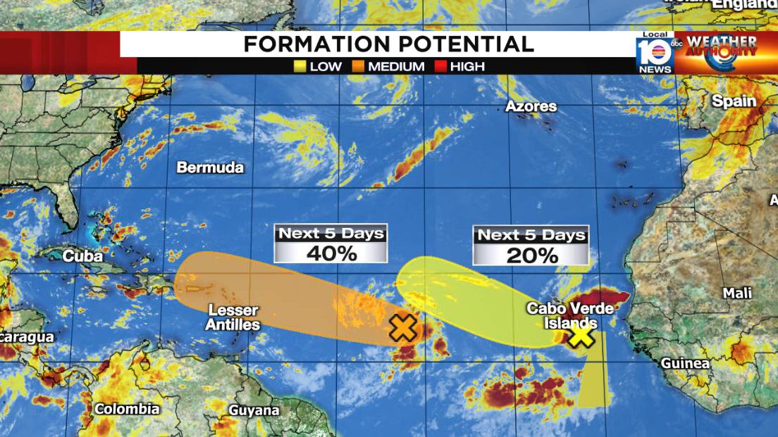
The National Hurricane Center has bumped the odds of development for a disturbance moving through the central Atlantic this morning as it heads toward the northern Caribbean islands for the weekend.
Though forecast models have been lukewarm at best on development prospects for the system – located about midway between Africa and the Caribbean – in the short term, the environment appears conducive to gradual organization. What’s been most impressive so far with this disturbance has been its ability to maintain persistent storminess – albeit still disorganized – unlike other “dry” disturbances we’ve watched struggle in this part of the Atlantic in 2022. While some dry air lurks to the north and west, it’s embedded in a broad envelope of juicier air, as seen on the water vapor picture this morning.

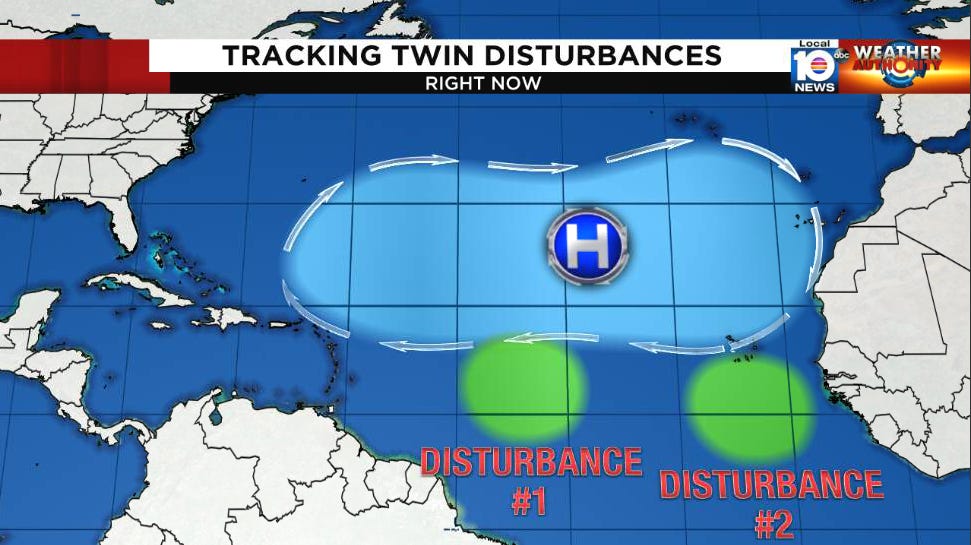
Wind shear should remain light for at least the next several days as the leading disturbance (Disturbance #1) moves westward under the influence of clockwise steering around high pressure to the north. Another disturbance (Disturbance #2) closer to Africa with lower development odds will follow for now.
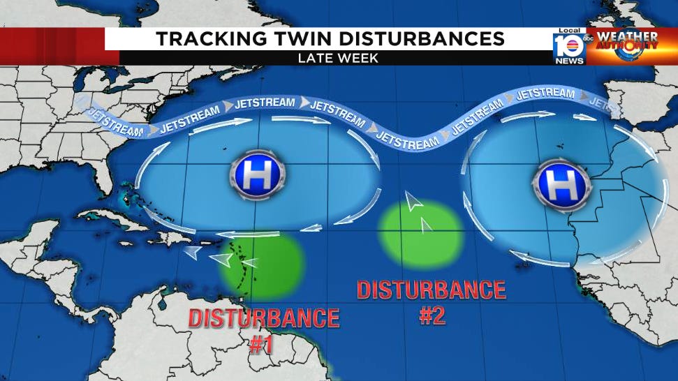
By late week, a dip in the jet stream over the eastern north Atlantic will carve out a channel in this high pressure steering for the lagging disturbance (Disturbance #2) to pull northward. Meanwhile, the leading disturbance (Disturbance #1) with the higher development odds will continue westward toward the Greater Antilles, including Puerto Rico and the U.S. Virgin Islands by Friday into Saturday.
Interests in the islands should continue to monitor the progress of the system. At the very least periods of heavy rain and gusty winds will accompany the strong disturbance through the islands.
Entanglements with the islands and high wind shear forecast north of the islands and over the Bahamas suggest that longer term the disturbance may struggle, but that’s still a solid week out so we’ll want to continue to monitor the forecast trends.

There’s no reason to get out over our skis on this one, but it’s something to keep an eye to in the days ahead as we’re still very much in the heart of hurricane season.
Thanks. Great info!!!
I still do not expect much development. It likely will die out before it ever got near Florida.