Beryl Strikes North of Tulum, Targets South Texas for Final Act
Beryl clipping Mexico’s Yucatán Peninsula, but forecast to emerge over the Gulf and restrengthen as it bends toward the Texas coast
Author’s note: Eye on the Tropics is a weekday newsletter covering the entire Atlantic, but with a South Florida bent. When storms threaten South Florida, we will publish special newsletter editions, including on weekends. Since many of our subscribers reside in Texas, we encourage you to take a look at The Eyewall, another no-hype outlet for hurricane coverage, but with a Texas bent. Editors Matt Lanza and Eric Berger provide excellent daily coverage of hurricanes that offer local insights for our Texas readers.
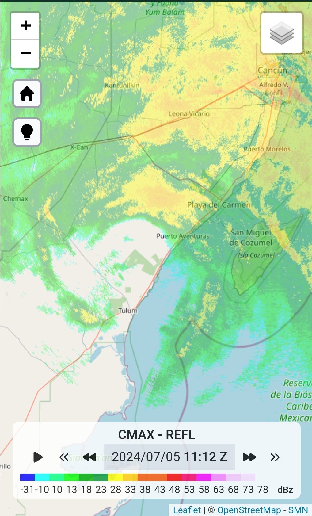
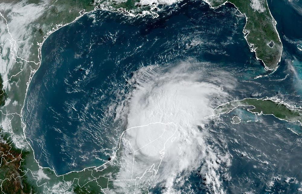
After another bout of unforeseen strengthening late Thursday, Beryl finally lost some muster on approach to Mexico’s Yucatán Peninsula early Friday, where it struck just north of Tulum as a Category 2 hurricane.

Though officially winds were estimated at around 110 mph, satellite and radar trends suggest those estimates could be generous as Beryl’s eyewall became noticeably eroded – particularly on the southern side – in the hours leading up to landfall, as wind shear and dry air finally infiltrated the hurricane’s core.

Nevertheless, Beryl again outperformed earlier forecasts calling for a weaker Category 1 hurricane on approach to the Yucatán. The theme of Beryl’s lifespan so far has been a tendency to overachieve, and that penchant was on full display Thursday evening as Hurricane Hunters flying Beryl recorded another round of sudden restrengthening. Fortunately for southern Mexico, the strengthening trend was short-lived, but even the last-minute weakening wasn’t enough bump Beryl down to earlier expectations.
Beryl is the strongest hurricane to strike near the resort areas of Cozumel, Cancun, and Tulum since Hurricane Delta in October 2020. Hurricane Emily in 2005 was the last major (Category 3 or stronger) hurricane to strike these areas and Hurricane Dean in 2007 was the last Category 3 or stronger hurricane to hit anywhere on the Yucatán Peninsula.
Trending toward South Texas for Beryl’s final act
The strengthening trend and northward blip late Thursday were not positive developments for the residents of South Texas. As we’ve been discussing in newsletters this week, a stronger hurricane would feel a more northward pull from a jet stream dip at upper levels as it approaches the western Gulf of Mexico late Sunday into Monday. Stronger hurricanes are also taller hurricanes, so their tracks are more greatly affected by steering features higher up like weaknesses caused by the jet stream.
Since Beryl overperformed late Thursday, tracking north of earlier forecasts, it will likely come out stronger on the other side of the Yucatán, having spent less time over land. Additionally, forecasts have slowed since yesterday, which will allow Beryl more time over water this weekend to recharge and feel the tug toward South Texas.
Overall conditions ahead in the Gulf look increasingly conducive for restrengthening and a stronger hurricane can’t be ruled out, especially given Beryl’s history. Even hurricane models with a known high bias like the HWRF have largely underdone Beryl’s intensity so far, so it’s not unreasonable to approach lower intensity guidance will some skepticism.
For now, forecasts suggest a Category 1 or 2 hurricane threat to northern Mexico or South Texas south of Matagorda Bay for early Monday. Beryl will unfortunately slow down once it moves deeper inland over South Texas which means a growing concern for flooding rains. The National Weather Service is already highlighting a risk for excessive rain for Monday into Tuesday stretching beyond the borders of South Texas into the Texas Hill Country and Houston metro so it’s something we’ll need to watch for upward trends in the days ahead.
The bottom line for residents and holiday beachgoers in Texas is Beryl is becoming a growing threat that needs to be taken seriously. Possible impacts could start as early as Sunday so check back frequently for the latest forecast information and follow the guidance this weekend from local officials.
Atlantic showing signs of a short post-Beryl slowdown
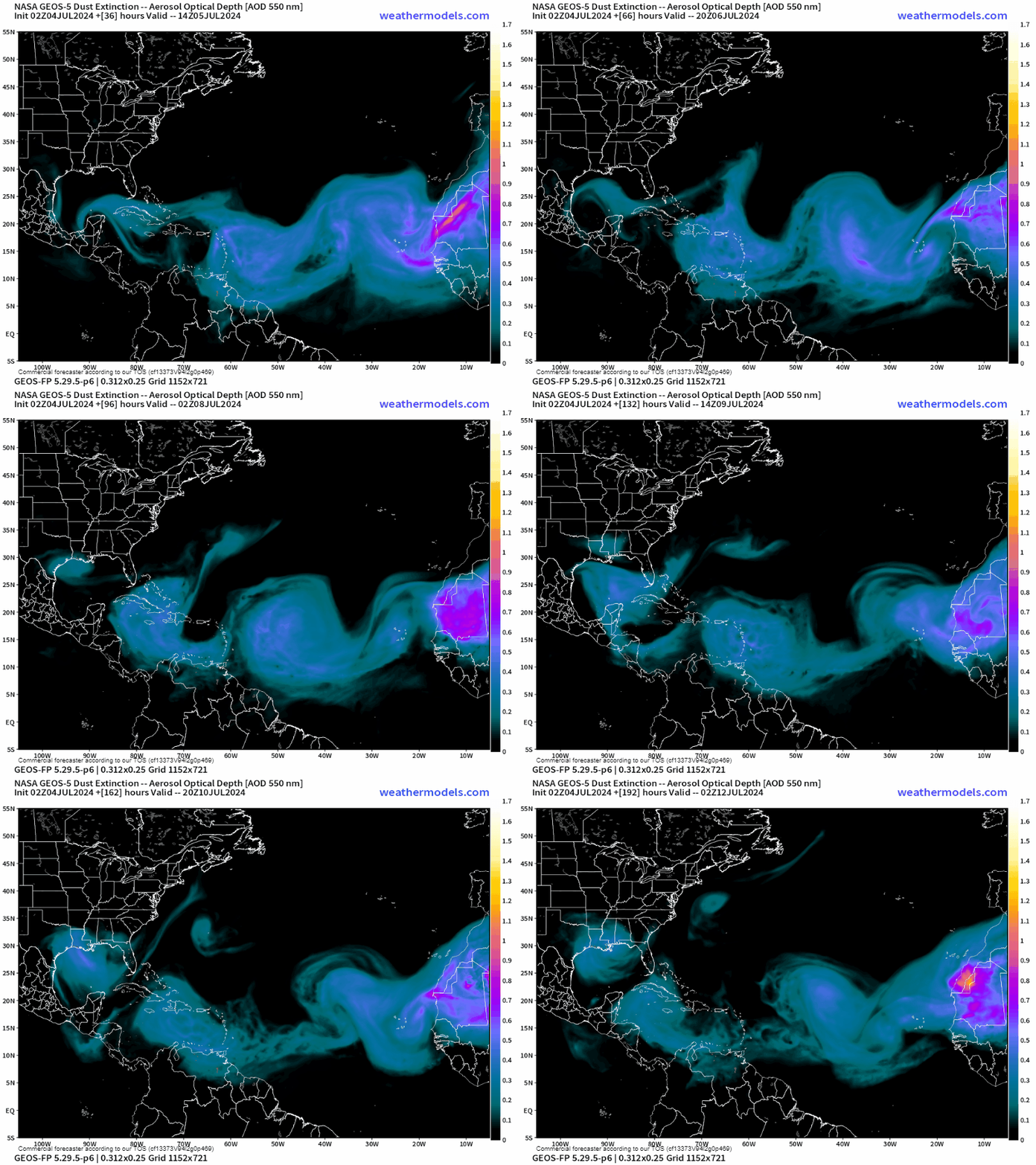
It’s peak dust season and a healthy push of dry, Saharan air is finally settling through the Atlantic.

Large scale conditions look less conducive across the tropical Atlantic next week so we should get at least a brief break from the record-breaking early-season activity.
The tropical disturbance we had been tracking behind Beryl (Invest 96L) is racing toward the Yucatán in Beryl’s footsteps but isn’t expected to develop.


Ty, Mr. Lowry 🌹