Ahead of Schedule: What Hurricane Season Activity So Far Means for What's Ahead
Spoiler Alert: Nothing. Check back in late August.
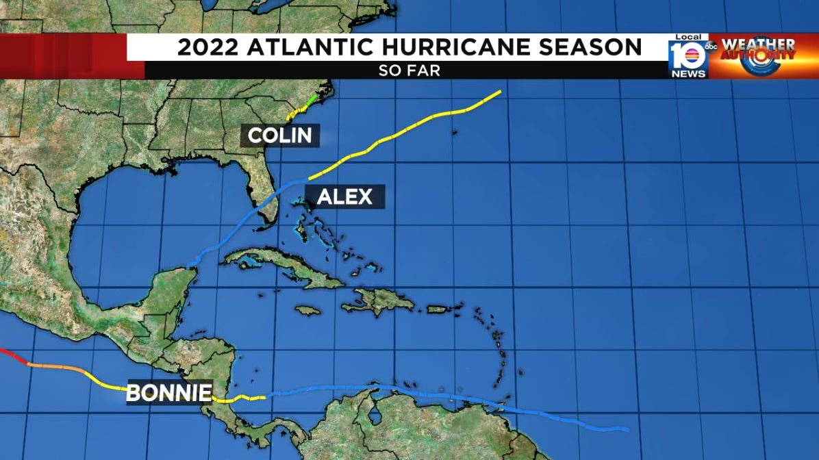
The Atlantic hurricane season is already through the “C” storm (Colin, which unraveled nearly as quickly as it formed over the Carolinas late last week), and we’re not even through the first full week of July. If that feels early for three named storms, that’s because it is. Since the satellite era began in the mid-1960s – since we’ve been able to “see” most storms churning over open waters – we typically don’t observe the “C” storm until early August. By other measures, though, the 2022 hurricane season so far looks more ordinary than extraordinary.
For starters, the first named storm of 2022 (Alex) didn’t form in the Atlantic until June 5th, the latest first storm since 2014. In fact, in each year between 2015 and 2021, the first storm formed before even the official hurricane season commenced on June 1. None of the three storms so far in 2022 became hurricanes and each generally had short Atlantic shelf lives – not unusual for early in the season, but also not remarkable.
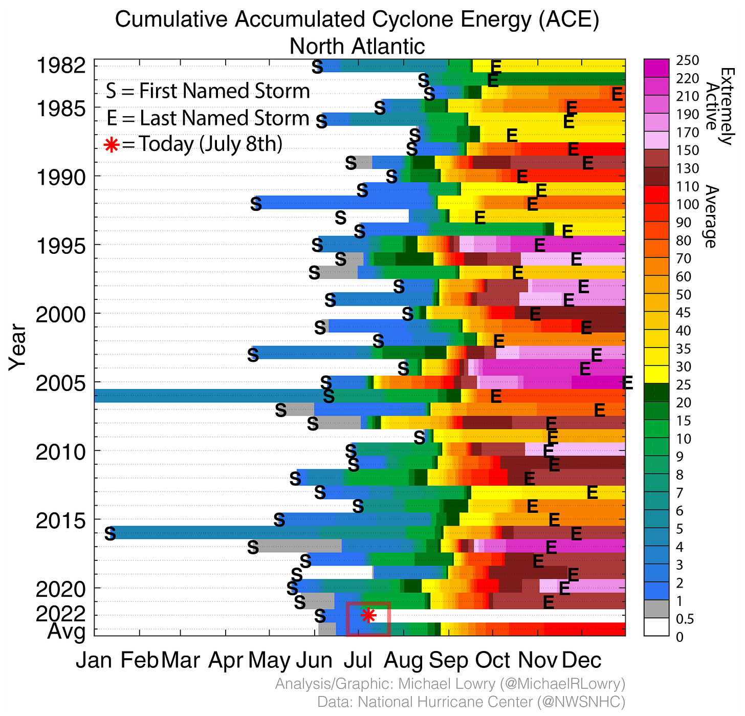
The go-to measuring stick for tropical activity – a gauge called Accumulated Cyclone Energy or ACE – looks pretty ho-hum as well through today. The ACE considers both strength and longevity of storms, so a single strong, long-lived storm can outweigh multiple weak, brief storms. You can think of the number of named storms as a quantity rating versus ACE as a quality rating. The ACE reading today stands at 2.8 compared to the 30-year average of 2.9 – unremarkable to say the least.
No matter how you slice it, there’s a natural tendency to wonder if the tropical activity so far can portend what’s ahead in hurricane season. If we’re ahead of schedule now, can we expect the trend to continue? If activity is less than stellar now, does it mean we’re in store for a mild season?
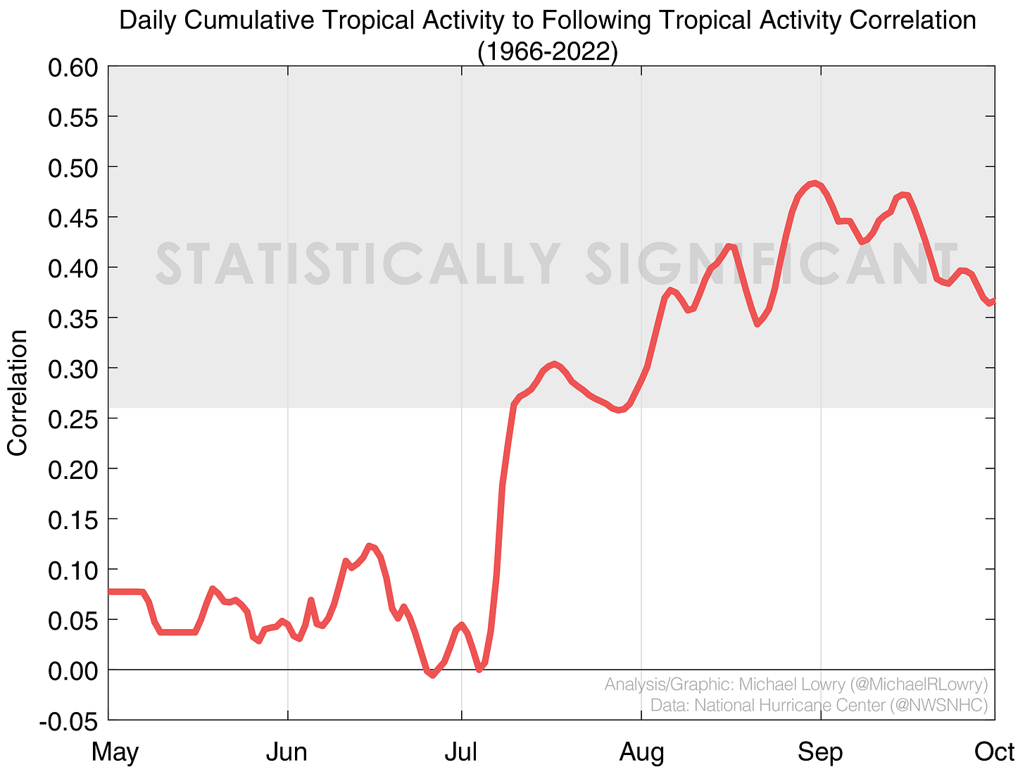
To answer these questions, we can examine past hurricane seasons to determine if there’s a relationship between the amount of tropical activity during the season to what happens later on. The plot below illustrates this relationship.
As it turns out, there’s no meaningful relationship between the two through about mid-July (below the shaded gray zone). In other words, up until now, whether it’s active, calm, or something in between, we can’t associate activity today to storminess (or lack thereof) tomorrow. By middle and late August, there is some relationship between tropical activity to-date and what’s ahead, but it isn’t especially strong.
The result isn’t terribly surprising since through today, on average, tropical activity accounts for only about three percent of total season activity. Put another way, 97 percent of hurricane season is in front of us. Whether it’s been active or not so far holds little weight relative to the bulk of activity in August, September, and early October. The bottom line: don’t try to read the tea leaves today and check back later in August.
If you’re interested in how the season is shaping up, your best bet is to consult the latest hurricane season forecasts from either Colorado State University (CSU) or NOAA. The group at CSU released their July update yesterday and continues to forecast an unusually active hurricane season, with 20 named storms, 10 hurricanes, and five Category 3 or stronger hurricanes. For context, the Atlantic averaged 14 named storms, seven hurricanes, and three Category 3 or stronger hurricanes from 1991 to 2020. If forecasts pan out, we have a lot to talk about in months ahead.
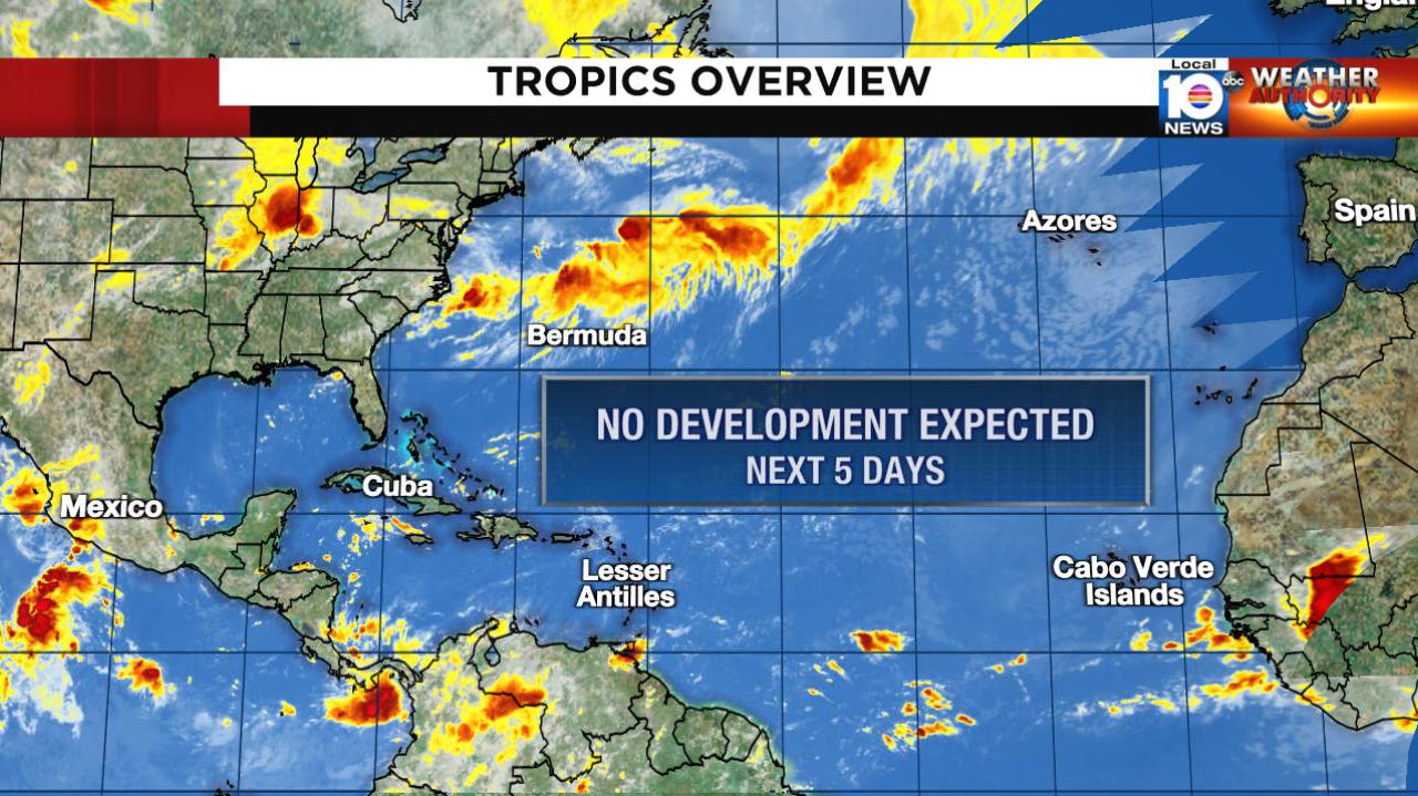
For now, the Atlantic is about as peaceful as you’ll find it in summer, and we don’t see any organized tropical activity at least through the weekend. Bonnie over the open eastern Pacific is winding down after its long, transoceanic journey. Another disturbance may develop in the eastern Pacific during the next few days but won’t pose any threat to land.


